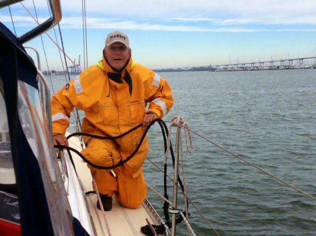
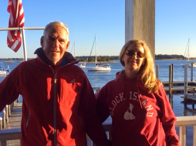
"There is nothing more pleasant than cruising on a boat with the whole family."
Letter from Empress Catherine the Great

Tuesday, November 18, 2014

November 15 to 17 -- Three Lay Days in Beaufort SC -- Zero Naut. Miles

Here is that Ladies Island Bridge, first from land, closed, and then from ILENE at the dock, open, with just a few of the waiting cars at the extreme left.

It was cold but the third day has been warm but first windy and then rainy. The wind pushed us hard on the dock, separated by our somewhat flattened fenders. Several boats that were anchored out dragged into the marshes.
Lene used the Downtown Marina's courtesy car for groceries and to obtain this Mr. Heater Buddy,
which burns propane, producing carbon monoxide and hence is not as safe as using the electricity driven heat exchanger, but used when we are not at a dock and carefully, for small periods of time while we are awake, it can take the chill off in the evening and early morning.

I washed the boat, cleaned the starboard rub rail with acetone and waxed it; not much for three days, I confess. I also plotted a whole bunch of alternative courses between here and St. Mary's, where we want to arrive a few days before Thanksgiving for the festival there. All the way from a single 125 mile overnight passage to as many as four intermediate stops, each such shorter hop or combinations of them by the inside and outside routes. It all depends on the winds, as always. Each such potential course except the inside ones, consist of three segments: to get out to the sea, in the sea and coming in from the sea.
Beaufort is a very historical town and the county seat and site of a US District Courthouse (federal court), as well as a tourist town with many shops, galleries and restaurants. I checked out the mostly used bookstore with a huge selection of books by Pat Conroy, and an antique shop with a nice selection of antique nautical charts. The restaurant we found and patronized this time is Low Country Produce, located in the tile walled former post office and town hall. It has good reasonably priced innovative cuisine and sells groceries as well. We bought a jar of their pickled Jerusalem artichokes after having been given a few with our dinner.
I visited the John Mark Verdier House,
right on the main street, Bay Street, which survived the war and several fires since 1804. It is the site of the historical society but they offer only guided tours of the house, which they do not conduct for only one person, so I saved $10 and contented myself with viewing the public rooms.
I had never thought that the Union army "occupied" the South during the war, but they did occupy Beaufort, because it was a harbor from which, through port Royal Sound (where a multi-ship naval battle was fought) they could operate the blockade of the Confederacy to choke off revenues from the sale of Sea Isle cotton, the finest grade, to England. The white confederate residents fled leaving their property (slaves) behind, so missionaries came in to help them, as well as merchants, newspaper publishers, photographers and carpetbaggers of all types. Many of the buildings on Bay Street survived to this day and a diorama was created of them and,from photographs, of the others.

Robert Smalls was a slave who had been stationed on a cargo ship, the "Planter". He put his wife and family aboard and brought the ship to the Union forces and surrendered. For this daring heroic act he was given command of a Union warship, later granted prize money with which he built a house here in town and was elected several times to the US House of Representatives.

But perhaps the best part of this town was just walking among the old homes and the magnificent live oak trees with Spanish moss that grace them.


This last one is Bythewood (two sylables not three), built in the 18th Century by the sea captain of that name and perhaps our favorite. The owner, Heather Perl, came along, took this picture and invited us for dinner. Maybe on the way back we can take her up on that.

We finally met up again with Dean and Susan of "Autumn Borne", who have appeared in this blog several times since we met them, coincidentally here in Beaufort, in the spring of 2012.


We also met their friends (our new friends), Benny and Lisa of "Rhiannon," a 42 foot Catalina. We six shared a pot luck dinner and played  and a game of cards.
Friday, November 14, 2014

November 13 and 14 -- Charleston to Tom Point Creek to Beaufort SC -- 60.6 Miles


Charleston is like New York in at least one way: both were started at the confluence of two rivers, and the point of juncture is a park and called The Battery.
It is surrounded by lovely stately old homes.  But you can't sail by close because a sand spit extends out from the point.

A pretty easy day of it, 9:45 to 3 pm, motoring all the way in the ICW, which was wide and deep. Cold but not unpleasantly. We made a connection with the boat next to us in the Charleston Marina, "Kachina", a Hans Christian 33, with the most beautifully treated teak.
It is sailed by John and Joanna currently from Colorado but originally from Canada and Martha's Vineyard, respectively. We exchanged cell numbers and stayed close to them all day. We had originally selected Steamboat Creek for the midway anchorage to Beaufort, but Lene read about Tom Point Creek after it was recommended by Jim of "Goldie,"
a home made, steel, blue schooner. So the Admiral changed our destination. The two creeks are only about a mile apart.
The only obstacle today was one low bridge that opens every half hour from 9 to 3:30, only about 4.5 miles from the marina. We left when we were ready and the marina had sent a man to help a boat come in, so he stayed and helped us get off. But it was too late for the 10 am opening so we went very slow for the first 4.5 miles and got there in time for the 10:30 opening and still had time to get through Elliot Cut before its very swift tidal flow turned against us at 11:15.  After anchoring,  I lowered the dink and used it as a platform to get some rust stains out and polished some stainless, before being chased inside by the cold. A cold front with stronger winds passed during the period midnight to 2AM, but our anchor held.

Where is Tom Point Creek, you asked? Oh, it flows into the Wadmalaw River. It runs between Stann and Little Britton Islands. Still no help? Well you won't find Tom Point Creek in Google, except for information on the tides there, but it is about 20 feet deep and just wide enough for a single column of boats to anchor, and swing with the tidal change; a strong tidal current runs through it, For the curious, look in Google Earth at 32 degrees, 38.75 minutes North; 80 degrees, 16.86 minutes West.  It is bordered by salt marshes on both sides
and the book said -- and correctly so -- that dolphins swim up the creek, playful looking but looking for food.


In the morning all six of us had mango pancakes before setting off at about 9:30.
Joanne and Jim

Jim and Susan
Both John and Jim are very handy, the former a carpenter and boat builder, the latter a mechanic who built Goldie and who has lived aboard for 40 years. Both are professional delivery captains so they know something about sailing, in fact, a lot!
When we pulled the hook I did the math: with the Ladies Island Bridge, near Beaufort, closed from 4 to 6 and it being dark by six, we needed speed to get to that Bridge, from which is less than 1/4 mile more to the Downtown Marina of Beaufort. We supplemented the engine's power with the small jib and trimmed it on every point of sail during the twisting ICW to gain an extra knot or two. We slowed down only in the three "Cuts" between different rivers. The cuts were short but reported to be shallow, though no problem for us today. A passing shrimp boat, its wings out, surrounded by its posse:
 We made the 3 pm opening, with the grace of the kindly bridge tender. The hundred cars and trucks lined up waiting until 3:06 when we passed, may not have thought of her so kindly, though. I think it was Lene's feminine voice that prevailed upon her to wait for us.

We plan to be on docks, here and in Hilton Head, for several days, using dock power to provide heat until the polar vortex goes away.


Thursday, November 13, 2014

November 10-12 -- Three Lay Days in Charleston -- Zero miles

A municipal manhole cover. Carol is Greek (or Latin?) for Charles and Polis, as in Annapolis or Metropolis, is city or town, hence Charleston, founded in 1670.

There are only three requirements if you want to cruise like we do, the other things are subsidiary. One is time. You need to be retired or independently wealthy or on a sabbatical or unemployed.  Second is money. Not a lot, but you need to buy a boat and maintain and provision it. And third, but no less important than the other two, is good health. On arrival here I thought we had run out of good luck with the third requirement. Lene was bent over with excruciating pain in her left knee. Every few steps was an attack of acute pain. We can't go on like this I thought. She can't climb over life lines and take big steps down from deck level to dock level or transfer between boat and dink.

I told her that we could haul the boat in a yard here in Charleston for the winter, fly home, get the medical problem fixed and come back here next spring and sail ILENE back to New York. The end of the adventure. But then I thought, before such a drastic decision let's get some medical advice. We consulted with our friend Bill, in Oriental, who is a retired Orthopedist. We took a cab to Roper Hospital where x-rays were taken by the ER doctor who gave us a referral for an ASAP visit with an orthopedist on their staff. The ER physician also gave Lene a soft splint, held in place by foam rubber and velcro, which essentially immobilized the knee, causing a very wobbly gait but the absence of the pain, and a prescription for anti inflammatory/pain killers. And these really helped a lot and Lene was walking, slowly but without pain, up to 3/4 of a mile each way. The orthopedist told her to "sail on," resting the knee when possible and using the pills and splint as needed. Her condition has a fancy name and is exacerbated by cold weather. Surgery, replacement and even cortisone can wait. Here is our sick bay, notice the flowers, and the gekko, to the right, below the clock, with short bits of weatherstripping hidden behind it so as not to mar the cherry wood. He will be a reminder of both our Carribean adventure and this trip.

Fortunately,we had spent a week here in the Spring of 2012 and seen most of the major sights, and can stop here again on the way home, because we did no sightseeing on this trip. We did laundry (it is free for boaters in this municipal marina, The Charleston Maritime Center, purchased a new Ipad to replace the one I ruined with salt water in the Chesapeake, and grocery shopped in Harris Teeters, a pretty good supermarket. We took a walk among the historic homes here


(notice my shorts; a warm day at last!) to
 a memorable lunch at Jestine's with great inexpensive southern cooking and named after a domestic servant who died in 1997 at age 112, the daughter of an ex slave and a Native American. Jestine worked for a southern family for many years and the restaurant is owned by a descendant of that family. The Reverend Brown of the nearby Methodist Church and the financial secretary of the church recommended the fried chicken which Lene enjoyed and I had, among other things, fried chicken livers, fried okra, corn bread with butter and honey and southern pecan pie.

And of course there is always boat work: ILENE had a bath, her water tanks filled, her fuel tanks poisoned to prevent the growth of microorganisms that clog the fuel lines, gluing back one of the buttons that hold plexiglass panels in place against the screens of the cafe doors with gorilla glue and the top of the percolator lid with JB Weld, a metal to metal glue that is remarkably strong.

But the two biggest problems required the help of Dr. Bill, who, I told him, enjoys fixing boats almost as much as fixing people's bones. As to the auto pilot, the most expensive component is the motor with linear drive -- the thinner rod to the left goes in and out of the thicker rod to the right, and pulls the rudder to steer the boat. The squeaking and beeping is a $ign of old age and thiS drive will have to be replaced $oon. Its kind of amazing that a guy who is 6' 3" could contort his body to reach this place to copy down the serial numbers. Replacing the unit will be harder, but once replaced this one will be rebuilt and used as a spare.

The other problem was the lack of charge into the starting battery. Its sole purpose is to power the starter motor which turns on  the engine. So it discharges only for less than a second each time, but it uses a huge amount of power when it does. And the problem was that it was not being charged by any of the solar panels, the engine or shore power. So the voltage had gradually reached the very low level of only 12 volts. Bill talked me through a series of tests, via phone, which showed that either ILENE does not have a needed "combiner" or that component is not working.  The short answer is that periodically, when we are (A) on shore power with the built in battery charger turned on, or (B) running the engine, we have to combine the starting battery with the "house bank" (which consists of 6 six volt golf cart batteries), so that the starting battery can get charged. This is easily done using a small red plastic key.  Last winter the old starting battery died because I did not know this and erroneously assumed that when I hooked the boat to shore power with the battery charger on, it was charging both batteries. So many lessons to be learned. Thanks again Bill.

Tuesday, November 11, 2014

November 9 and 10 -- Overnight from Wrightsville Beach to Charleston -- 162 Miles

To plan arrival times from overnights so as to coordinate with tides, marinas being open and daylight, one has to assume a speed. Divide the distance in nautical miles by speed in knots and you get hours. Several questions in the Coast Guard Captain's licence exam involve this fact and an assumed constant speed, which power boaters can more or less maintain. For overnight passages, we assume ILENE will make an average speed of 6.5 knots. We left at 9:30 am with a plan to arrive in mid morning the next day.

But sailboats have only moderate control over their speed, which is largely wind dependent. And it takes a minute or two of going the wrong way while putting up and lowering the mainsail, and relatively slower motoring speeds for the miles of the going out at the beginning and coming in at the end. And our course was lengthened when, due to the wind being directly behind us too slow, we took a wider turn around Frying Pan Shoals to avoid a dead run. That shoal extends quite a few miles out from the north side of the mouth of the Cape Fear River. Conversely, our course was shortened slightly when we cut the last buoy, R2, and passed near Rattlesnake Shoals off the entrance to Charleston. (That shoal is 16 feet below the surface so we could go directly over it, but why take even theoretical chances.) But the greatest variable is the wind. We had a few hours where the wind gave us less than four knots, and two hours in which we made a thrilling 8.5.

We had about three hours of very light rain in the late afternoon. One can't get rainbows without rain.


Some dolphins played with us at dusk.
Our dinner was a delicious and filling hot bowl of peppers, onions, sausages, pasta, red sauce and cheese that Lene had partially cooked before we left; we ate in the cockpit in the dark. Lene maintained the watch from 7 to midnight and I came on for the rest of the trip. It got cold during the wee hours but full foulies and gloves kept the chill out -- no pain. When Lene took over we were going only 3.5 knots on a very broad reach so I authorized the engine at 5 knots and we hauled the mainsail to midships to be a stabilizer. This was a mistake, in the sense that we wasted fuel and engine hours: sometime during Lene's watch the wind came back, and just aft of the starboard beam. So at midnight I eased the mainsheet out and we jumped to six knots. I shut down the engine and let out the genoa to play as well and our speed built to seven and eventually to variations over nine for several consecutive minutes. Eventually, we furled the genoa for the last three hours to delay our arrival. We had a beautiful sunset,

but the sunrise took place "off camera"  because heavy dark clouds blocked the eastern horizon during that event. The night time watches were quite boring due to the absence of even a single other boat out there to be seen, much less to worry about; we really had the ocean to ourselves.

The high speed portion was thrilling. ILENE seemed to be saying "I was born to go fast and I'm having fun out here!" Comparatively little heeling, and not big waves, just an exuberant dash through the open seas, out of sight of land with enough light, after the moon came up, to be able to see a bit. "Thanks, Dad", she seemed to be telling me.

In my last post I worried about the auto pilot but it performed very well during this passage. We expect minor variations in our heading among strong forces out there and auto steered admirably, though noisily, with a soft squeaking/beeping sound that I need to investigate.
This bridge is just a bit upstream from us.

I'm getting the spring lines in place for our arrival; end of the bridge, right.
Bottom line: we arrived in the Charleston Maritime Center at 10:30 am, 25.5 hours after we left, with an "average" speed of 6.35 knots over the assumed 162 nm.

Sunday, November 9, 2014

November 8 -- Swansboro to Wrightsville Beach -- 49 miles

Yes, a long day -- underway at 6:15 and put anchor down at 3:45 -- 9.5 hours of motoring in the ICW. Today and yesterday we traveled on sections of the ICW that I've never traversed before, having been outside at these latitudes on past trips. And I noticed how almost exclusively, and less so than in the spring of 2012, the ICW is in fact a one way street - southbound only - and seems devoid of commercial traffic. It is a road dedicated to snowbirds migrating south.

Our depth sounder is perhaps our most valuable piece of navigation equipment in the ditch and we watch it like hawks. When it starts to go from let's say 14 feet of water to 13.9. 13.8, etc, it means one of two things: either we have moved to a section of the ICW with shallower water, or we have started coming closer to one of the sides. We assume it is the later, try to guess which side we are too close to and go gently toward the other side, watching to see it the water deepens under us.

We noticed two potential mechanical problems that have to be thought through. One, the autopilot seems less responsive and more likely to roam a few degrees to either side instead of staying on the straight and narrow,Perhaps it is only a perceptual problem in that we notice the situation more when we are in a narrow path as compared to when there is nothing but horizon in front of us. Two, the voltage on the starting battery is getting low. Both batteries are charged together in the normal course of events, by the solar panel and by running the engine. The third method is by turning on the battery charger when we are attached to shore power. My current theory on this problem is that the battery charger is somehow decreasing rather than increasing the voltage of the starting battery. It seems to have done this last winter when I replaced the battery, and now again in Deatons, where again we had shore power. Yesterday I replaced the broken off lifting stem of the galley sink trap with a bolt and nut from ILENE's collection of them and cleaned out the filter leading to the fresh water pump, thereby restoring a healthy flow of hot and cold water.

Well today: The first thing occurred as we were getting underway in less than full light. About 30 small fishing boats, each with two warmly clad people were milling about. Lene had to pick our way through them while I secure the anchor.Then a siren sounded and they all took off at breakneck speed overtaking
us on both sides, motors roaring and wakes a making.Wild! Some sort of race or fishing contest perhaps.

We saw dolphins again, the third day in a row; they seem to love to play in the inlets and finally Lene got a shot of one, albeit not the greatest.

Why did our passage take so much time? Blame part of it on the bridges. There were four low ones on today's route, for which one has to hurry to be there on time and then to wait with other boats for their appointed opening times. Waiting, keeping a boat stationary in close proximity to others, can be quite a challenging task if there is strong wind and or tidal current. But today there was no wind. Actually we did get a knot from the Genoa for about an hour but after that the wind Gods took a break. By dumb luck we made the first bridge on time. The second required us to push ILENE's Yanmar diesel harder than I have ever pushed her --3000 rpms. In addition, we made it because the kindly bridge tender asked the waiting motor boats whether they would mind a five minute delay in the opening so the three sailboats could catch up. They graciously agreed. But the third and fourth bridges could not be made by speeding up so we had to make the appointed times by slowing down.

Wrightsboro is a college town for nearby UNC Wilmington, which city is far by boat but near by car. The anchorage is easily reached by small boats who take a left turn almost immediately after passing under the last bridge. But this route is not recommended for boats with deeper drafts like ILENE. We had to continue down the ICW for another 1.5 miles, then take the left, leading to Masonboro Inlet with its protective seawalls extending arms out to sea (through which we plan to depart tomorrow for an overnight jaunt to Charleston SC),
and another left along the inside of the barrier island and another mile and a half
to the sheltered anchorage area.

We lowered (and later raised and secured) the dink for a ride in to town, checked out the beach

and brought a few groceries. It is not supposed to be as cold tonight, or tomorrow, as it was last night and today. No, it is not shorts and tee shirts weather yet. And have I mentioned how much I have enjoyed and depended on Lene; without her company and help this trip would be no fun and very difficult.

After anchoring we learned that our friends, Dean and Susan on "Autumn Borne" pulled in here after us, at the end of an ocean sail from Beaufort. They have been chasing us since they left Catskill New York, We had a headstart. But while we are going outside tomorrow for 162 miles, overnight to Charlestown SC, they are going inside and visiting friends for a few days. So for now, we are still just two boats whose wakes have crossed.

Friday, November 7, 2014

November 7 -- Morehead City to Swansboro -- 20.4 miles

We headed off in the ICW through Bogue Sound and this is hard work because the sound is so wide and the deep channel so narrow. I ran us into the sand at one point but we dropped the sail and backed off. Yes, I tried to sail, using the small jib only, which gave us an extra knot or two, but the strong gusty wind blew us off the course auto pilot was trying to steer; and with trimming the sail came the inattention that led to the grounding.  So no more sailing today. 
We were underway from 9:30 to 1:30. Most of the way was a few degrees north or south of due west. Ilene called the Coast Guard who told us that the live shelling at Camp Lejeune would end at noon, hours before our arrival, so we could anchor at Mile Hammock Bay. But just a half mile after we passed Swansboro, “Pipe Dream,” which has overtaken us, was coming back the other way and told us that the live firing would continue until 5, too late for us to arrive there. So we too did a “U” turn and anchored in Swansboro.
The pencil is pointing to the white spot to the right of the town, where we are anchored. In the lower left, just below the line "X---X", is a magenta line labelled "St M 230" (Statute Mile 230 since Norfolk), running perpendicular to the double dash bordered magenta line indicating the route of the ICW, which shows how crooked it is. And below the knife blade in the lower right corner it says Bogue Inlet, through which, in the photo below, we saw out to the Atlantic for the first time since Cape May, NJ.
We also saw the dramatic effect of the swift running tide. It was ebbing  and as we came to the Inlet our speed picked up to 6.6 knots, only to drop to 4.2 knots as soon as we passed the inlet when the same outgoing tide was running against us.

Here in Swansboro we  are one of eight boats and are on 80 feet of chain in 17 feet of water. The big factor here is the tide which caused us to face the other way when it changed. We happened to anchor next to “Island Time” and used our dink for the first time on this cruise – I’ve been out a month today! The town is quant but we failed to find a postcard though we did find this Gekko,
made from the steel top of a 55 gallon drum, at a gallery.


This house was built in 1778.

   Here we're ashore, our heads framing ILENE.
Tomorrow is a long day to Wrightsville Beach, almost 47 miles. So its early to bed.

October 6 -- Oriental to Morehead City --19.5 Nautical Miles

We had to get our sea legs back. But while it was calm in Whittaker Creek, it was blowing hard, though probably not as hard as our new wind measuring instrument shows -- calibration needed -- once we left its shelter.  We could have beat the first five miles crossing the Neuse River, but after that is was mostly canal-like waterways with the wind strong in our faces from the southwest and we motored all the way and did not set a sail.  Approaching Morehead City/Beaufort a pod of perhaps 20 dolphins passed us, going upstream, in groups of two or three at a time, their black fins, and later their backs revealing them. Sorry I could not catch a picture; I was at the helm. This military assault landing vessel was going out Beaufort Inlet to the sea while we were approaching it from the north.
Our first stop was a fuel dock, which was tricky getting into, and back off from with all that wind, but we took on 45.8 gallons, our first refueling since Annapolis. I figure that since Yorktown, we have been burning .66 gallons per hour.
We had several choice anchorages picked out but with all this wind we took a spot on the dock of Sanitary Fish Market and Restaurant for $25 if you eat here.
We were joined for dinner there by Deb and Terry of "Island Time," a 42 foot Brewer cutter-rigged cruiser, the boat that is tied up behind us and enjoyed good conversation but sadly, very mediocre food.
They are from Midland Michigan and plan a five winter campaign to cover the Caribbean, all the way to Panama and the Central American coastal nations, leaving the boat for the summers. He was an engineer for a chemical company and she retired as a professor of biology.
           For tomorrow I planned two options. The first is to go out of Beaufort Inlet and back in at the Masonboro inlet near Wrightsville Beach. This is about 75 miles, but 69 of them a straight shot in the ocean, where we can go straight and fast. They predict 20 to 25 miles of wind from the NW, so it would be a speedy beam reach and close to shore so that the big seas will not have had a chance to build up and winds diminishing by five knots in the afternoon.  The alternative is a two day passage to Wrightsville Beach via the Intercoastal. The problem with this second alternative is the midpoint anchorage -- Mile Hammock Bay located in Camp Lejeune. Specifically, the Coast Guard is advising that the ICW will be closed tomorrow for military exercises involving firing live ammunition in the direction of Mile Hammock Bay. So the inside route may require us to spend another day here. A variation on plan B, mentioned by our new friends during dinner, would be to anchor at Swansboro, about ten miles short of Camp Lejeune with a rather longish run in the ICW the next day.  After dinner, while we walked four blocks to the postoffice and back Lene prevailed upon me to forego plan A for fear that even if we left at first light, we would have only 11.5 hours before it got dark, meaning that we would have to make 6.5 knots to get there before dark. Plan for the worst is her mantra. And Lene did not relish rising before daybreak and a rough passage and I like a happy crew. Lets check the weather again in the morning.