"There is nothing more pleasant than cruising on a boat with the whole family."
Letter from Empress Catherine the Great

Monday, February 9, 2015

Feb 7 -- Fast Ferry To The Dry Tortugas -- Zero miles (on ILENE)

The fast ferry, seen here at the destination, took us (and up to 198 other folks) the 61.9 nautical miles to this national park at an average speed of almost 25 knots. The passage outbound, starting with check in at 7:15 a.m. was pleasant, with a NE wind and waves on our starboard quarter. Approachiong the island requires a 360 degree circling of the island, counter clockwise. (You can see most of the cruising boats that came here on their own behind the ferry.) There is a faster way to get here than the ferry though:
We met a lovely couple, Suri and Carlos, from Miami They are power boaters and fishermen. They escaped Cuba (before they met) by getting  passes to visit Spain and then obtaining sponsorship into the US from relatives. My father did this in the 1930's, escaping from Hitler's Germany first to France and then obtaining sponsorship into the USA.

The ferry served a big wholesome (not gourmet) buffet breakfast on the way out and a lunch at mid-day, included in the price with coffee and water all day, use of the snorkel equipment, admission to the National Park and guided tours, all for $155 per person. Snorkeling was one of the featured activities and I dressed accordingly, but we did not enter the water for two reasons: (1) too much other stuff to do, such as Ranger Rick's  (his real name) informative talk, and
(2) the wind whipped up waves and created a wind chill.


These pilings which supported a former coal dock were the suggested snorkel place, but not with waves knocking you about.

The ride home was wild, going so fast over the now larger waves on our port bow. Many people got seasick because the huge ferry was leaping and lurching. We returned to shore at 5:15 after a rather full day.

Fort Jefferson fell victim to advances in naval weaponry, particularly rifled cannon, which permitted bigger shells to be thrown further, sort of like when a football pass is thrown with a good spiral.

Dr. Samuel Mudd set the leg of the assassin of President Lincoln. He was convicted of participating in the conspiracy and sentenced to life on this dreary hot dry fortified sandbar.
His sentence was later commuted by President Andrew Johnson in response to a petition by the soldiers, jailers and prisoners here after he saved lives during a yellow fever epidemic.

Fort Jefferson is claimed to be the largest masonry structure in the western hemisphere, made of sixteen million bricks: "the Gibraltar of the Gulf."
You can get a sense of its size by looking at the people in front. Its six sides with salients on each corner and its surrounding moat covers most of its sandbar, Garden Key. You would not want to climb the outer seawall, swim across the moat and attack to fort while being gunned down by grape shot from the salients at each end of the side.


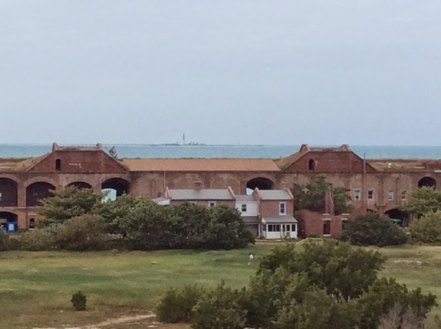
Salient with the light house and a 15 inch diameter cannon atop:


Actually there is a taller lighthouse 2.5 miles even further west, on Loggerhead key, seen dead center on the horizon, if you look closely.
Fort Jefferson was built and fortified for a negative reason: to prevent other nations from taking the place if it had not been strongly defended. It was strategically desirable because it commands a position at the far western end of the Keys around which shipping between the Gulf and the Atlantic has to pass and because a little known spot deep enough for anchoring battleships lies three miles north. Not a single shot was ever fired in war from Fort Jefferson.
Dry Tortugas National Park is also a bird sanctuary.

We saw huge frigate birds floating almost satationary on the updrafts that the fort's three story walls create. Next are the first thousand of the 50,000 sootie terns who are coming here from western Africa for the mating season and screeching above the formerly separate and adjacent -- and now recently connected -- Bush Key.
I'm hoping to replace my bird photographs with ones taken by an expert professional photographer with his strong telescopic lens, Richard King, of  richardkingphoto.com.


A fun full day. Lene was right; better by ferry.

Saturday, February 7, 2015

February 3 - 6 -- 3.5 Lay Days in Key West -- Zero Miles

I'm calling it 3.5 lay days because we got in so early on Feb. 3, shortly after 1 pm. We strolled Mallory Square and Duval Street -- the heart of the island's tourism. The cruise ships tie up at Mallory Square. The buskers perform there. The town is jammed with tourism. Countless bars (someone said 400), restaurants, shops (chi chi and otherwise), B and Bs, and boats selling trips to fish, sail, look through glass bottoms, dive, snorkel, or jet-ski etc. Most of the  B and Bs and restaurants are in former homes in residential neighborhoods. There are also many larger hotels, new and old.  This town is SO changed from my navy days here, the two months of August and September of 1965.  Possibly this had something to do with the season. Then it was hot -- the seaweed that washed ashore rotted on the beaches giving off  sulfurous fumes that peeled the paint off houses!

When a hurricane came through, my ex and I were ordered to evacuate the little cinder block house we inhabited and stay in the navy school, perhaps the sturdiest structure on the island. We parked our little red Triumph Spitfire on the navy base's baseball field, which was on high(er) ground. I went looking for the squat hot cinder block apartment where we lived but sometime in the last 50 years it had been replaced, with a larger more upscale structure.  It was right down the street from a large parcel of land that was all boarded up in 1965.

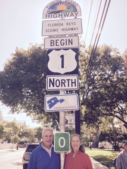
When next I visited this island, in the mid 80's the Bar Association Section meeting was held behind those boards -- in the newly renovated Marriott Casa Marina Hotel. The original Casa Marina had been built by Henry Flagler, at the end of Flagler Avenue. The road, Highway 1, which ends (or begins) here, was not a road 100 years ago, but a railroad. The Casa Marina is now a Waldorf Astoria Hotel after an additional renovation.
It was from the beach of the Casa Marina that I had my first sailing lesson, only five minutes long and not long enough: we capsized the Hobie cat several times, righted her, beached her on off-limits property of the Navy base and told the hotel to come and get it and us -- a better solution than going the other way -- to Cuba. And I learned through that experience that I needed lessons to become a sailor.

We were on a budget back in the mid 60's. Movies on the navy base and reading of the NY Times Sunday edition were our primary leisure activities plus swimming in the base pool and shopping at the PX.  The Jewish high holy days took place during our time here. In my Ensign's white uniform my ex and I attended the local synagogue, which has long since been replaced by a larger modern structure. The congregation raised funds by offering ritual honors to those who could afford to buy them. One man gave his honor "to the Navy boy".  Later, my ex said: "He's taken!" when the gentleman, a local merchant, tried to introduce me to his daughter. Another merchant invited us to the post-prayer feast at his home following services. There I ate my first gefilte fish, home made by his black maid. My father was right! I didn't know what I had been missing.

The island was at a nadir in the 60's which I imagined got worse when the navy shut its base and pulled up stakes here. Duval Street was undergoing a repaving job which lasted most of our two months. Sloppy Joe's, on Duval, Hemingway's favorite bar, was a stop for us then, no trouble finding a place at the bar.

But I have been told that it was the departure of the navy which created the start of the tourist boom here. One thing remains the same: the roar of navy jets taking off from the naval air base on adjacent Boca Chica Key, due east of here. LOUD! Another thing is new -- I don't recall it in the past: as in the Caribbean nations, chickens roam the streets, their crowing ringing out in the night. you might call them free range chickens.

OK, Roger; enough nostalgia!

We visited "The Little White House",  Harry Truman's favorite retreat during and following his term of office. We enjoyed an excellent informative tour by docent Rene. The navy came to Key West early in the 19th century, long before Florida was a state, and created a base to fight our enemy -- pirates!
The place had become a submarine base and when President Truman was ordered by his doctors to take his first vacation after many months in office
-- in a warm place -- Key West was chosen. The position of base commander being vacant, that officer's residence was used. The President loved it here and the navy improved, expanded and redecorated it for his future use. Other executives have used it too, most recently, Collin Powell, as Secretary of State, to work out the settlement of the Balkan War. The place was sold to a developer who wanted to develop Tank Island, across the harbor. He needed easements and the State said: "Sure, IF you fix up the Little White House and give it to the state as a tourist site."

We had a pretty good dinner on Lene's birthday at "Flaming Buoy".  The original proposed name was "Flaming Buoy and Hot Grill." Key West, like Provincetown, has a lively gay segment of its population.

We had breakfast at "Blue Heaven", highly rated and decent and a lunch in a very nice retro Chinese restaurant (when have you last seen Chow Mein or Chop Suey on a menu?) because we were cold walking home during the rare all-day rain. We do not eat deserts so we were not able to patronize a desert restaurant named "Better Than Sex."Its menu has suggestive double entendred names.

The rain came after the day I scrubbed ILENE's topsides. I used FRS to get the rust stains out near where the anchor rode has been shedding pieces of rust. It worked well.

We visited the two iconic sites of Key West:


We had a nice dinner aboard with Alice and Danny. Well, left over sausage, pepper and onion with pasta, red sauce and cheese, plus salad, wine and fresh fruit. No one went to bed hungry. Alice is a friend of Lene's from NY, now living in North Carolina and married to Danny. I had never met either of them before. They are here on a land vacation, found we were here via Facebook and we got connected. Lovely people and a nice evening.


Ernest Hemingway's house was a repeat tour for both Lene and me, though we had each visited it in the past with others. The crowd there reminded me of  the Sistine Chapel in July. Another excellent informative and entertaining docent with what might be called Key West attitude.
One of the 45 six toed cats that have
 the run on the place, on the marital bed.

His study in loft above the caraige house where he worked
from 6 a.m. each day and wrote most of his books


Papa Hemingway surrounded by his
 four wives, one of who bought this house for him.


And while the light house has been here since the mid 19th century, it was not on the tourist list until recently.  Unlike the lights of Scotland described in a book review in a recent post, this one was set way back from the sea, on high ground, and made of brick. It was decommissioned in the 1960's. The  picture of it is from the Hemingway House balcony. We climbed the 88 steps and saw the museum in the keepers' house.


We will be here in the Bight for a few more days.


Wednesday, February 4, 2015

February 1 - 3 -- Key West to Marquesa Keys, to Boca Grande and Back to Key West-- 29.9, 15.8, and 17.5 Miles, Respectively

Everyone says the Marquesa Keys are about 20 miles from Key West, but our route measured at 29.9. On the way, once out of the channel, we enjoyed about 25 knots of wind on our port quarter (20 knots of apparent wind) which filled our Genoa nicely. No need for the mainsail -- too much wind and plenty of time for the short passage. Part of the longer distance was going north on the east side of Fleming Key (a naval air reserve without a landing strip) and down south again on its west side, 1.8 miles each way, under power. 
Marquesas Keys looks a bit like a roundish South Pacific atoll (think Bikini before we atomized it), except it is mangroves instead of palms. It is large, four miles from NE to SW, and Mooney Harbor, in the middle, is too shallow for ILENE, though we did see two small power boats in there. This picture refused to rotate; North is the right side.


We had planned to anchor to the west side of Mooney Harbor Key, the tiny dot on the south side toward the west. The chart says it is only three feet deep on the approach from the south, but Alex had assured us, with a confirming visual from Google Earth, that there is a minimum of six feet of depth to the anchorage. But the 25 knots of wind was from the ESE, which kicked up five foot waves that left us no margin for error; they would have pounded us onto the coral on the way in if we were not perfect. I would love to try Alex's recommendation on a calm day when you can slowly hunt your way in -- and back out if there is a problem. So we continued a couple of miles west of the location then a couple of miles north and finally east and anchored at the spot indicated by the divider point at the top of the picture.

Going in, our Raymarine chart plotter was worthless. Its largest scale was six miles, showing not nearly enough detail to cut around the un-buoyed  shallow spots. So Lene manned the iPad, with its InavX  program which shows our location and a yellow line showing our course over the ground. "About ten degrees right, " she coached me, and we got in fine and anchored in 12 feet with 80 feet of snubbed chain and her phone's anchor alarm, just in case. Such anchor alarms are rather worthless in a crowded anchorage like in Marathon where we are only 15 yards from the boat behind us. By the time you hear the beep, it is too late to take corrective action. But we have miles of open water behind us here and if we started to drag we would have time to fix the problem. Our anchoring detail ran into a snag which we solved with many whacks of the boats hammers, first the rubber mallet and then the metal one. Last time we raised, at Marathon, I accidentally stepped on the "up" button causing the windlass to jam the anchor up into its housing. There was lots of room and time here for the whacking process which eventually freed the anchor.
The only other sailboat here was about a mile north of us, behind the most southern Island in the atoll's west wall. So we had "our" island all to ourselves. A tropical paradise except with this wind, though we are partially shielded from it b y the island, dinghy adventures were too fraught for us.
The waves here were less than at the unprotected mooring field at Key West.

Specifically, we were at N 24 32.566; W 82 09.946. This is the furthest that we will go and 1063 nautical miles from the Harlem. From now on we will b e heading home. By adding up the mileages of each of the legs from there to here I find that the actual miles traveled to this point are 1676.8 (1928.3 in land miles). Of the 117 days since and including October 8, we have moved the boat only 45 of them, only 38 percent of them, with almost two thirds of our days as lay days. Three of the passages involved one or more overnights, making for only 41 separate passages. I think we are taking it easy, trying to avoid problems with weather and enjoying ourselves.

About 10 miles off the south coast of Grenada in 2011 marks ILENE's southernmost boundary of travel so far. Eastport, Maine marks her furthest northern and eastern destination and we were now at the westernmost point of her range --so far.

Next morning, we had a problem. It was after a nice breakfast and we were cleaning the boat and not paying attention to the fact that the wind had changed direction. When the wind was from the east, we had miles of deep ocean behind us to the west. When they came from the north it was much less. The anchor alarm probably began to sound while the shop vacuum cleaner was roaring. We heard it and got the engine on, but in the course of getting up the anchor we drifted into water that was shallower than our draft. And the wind was pushing us further on. The engine could not get us off, even when we heeled the boat with the jib. We saw a fishing boat and called on VHF radio Channel 16. The  Coast Guard heard our call and responded. They switched us to channel 22A and asked us many questions including our Towboat US towing insurance number. They called Towboat US  "Ranger" for us with their more powerful VHF radio on a high antenna and it was dispatched to us from Key West. In the meantime I lowered the dink and put our port anchor with 20 feet of chain and about 80 of our 280 feet of line in it and motored away, paying out the line and dropped that anchor as a kedge, to try to prevent the waves from pushing us further into shallower water. Lene hailed some fishermen who tried to tow us off but their engine was not powerful enough. We waited with anxious thoughts. We heard a soft thumping when waves lifted us and put us back down on the sand. Not "pounding" but bad enough. When we on shore for the winter, the keel supports the weight of the boat. Four pairs of "jackstands", at the sides, stabilize the boat to prevent it from falling over, but the weight is on the keel. When afloat, all of the weight is supported by the water but here, when a wave lifted us a wee bit and dropped us down again, the thump was transmitted through the keel to the rest of the boat. Not a good thing. 
Chris, master of Towboat US "Ranger" arrived and passed us bridles to attach to each bow cleat to pull us off. He powered his engine but we were not moving -- our speed over ground was still "0.0 knots". I suggested putting up sails to heel the boat (and thus lift the keel,) and when Chris said OK we did so, but we were oriented facing the wind so they did not do much good until Chris twisted our orientation to catch some wind. Eventually we broke loose and I was hauling in the line of our kedge anchor but aftert a while it held fast to the bottom. When we wanted to drag it up, it would not budge in the direction we were going, holding us back. Chris said to cut the line. No way! Then he suggested tying a fender to the line and casting it off and promised to retrieve it for us later. We got all 280 feet of line out on deck with a fender tied along the way.  Chris left us not very far from where we had been, but in 13 feet of water, where we anchored with the starboard anchor, our normal one with all chain rode. He retrieved our port anchor, brought it back and gave me some very handy advice of how to get it reinstalled through its "bail" roller. He checked our rudder for damage and it turned freely. If we had not purchased unlimited towing insurance, this escapade would have cost us $1200. Chris was so helpful and polite. The antithesis of the Towboat US operator at Point Judith, RI, who claimed salvage ($27,000) for a tow in August 2010 -- and lost his case.  Power boaters need towing insurance because if their engines fail they need to be towed back to port. In this case, port was Key West, 29 miles away. But sailors can generally get back to port, we only need to be towed off the sand, mud or rock.


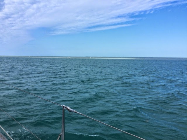
Well that experience soured us a bit on the Marquesas, and we started to head back to Key West, but the wind was light and from the west, and we were not going fast and would have arrived after dark and even though I have passed through the harbor coming and going, I really do not like night arrivals. On our way back, we were passing Boca Grande, and Lene said "Why not stay here for the night?" This island is surrounded by shoals but with a marked channel between them. The large green areas are shoals, less than one foot of water. So it looks like you are in the middle of the ocean.

The shoals do nothing to stop wind but eliminate all the waves which break up on them instead of us. North of us, the channel leads to water than only shallow draft boats can use, less than six feet.
The only problems noted in our cruising guides were a tidal current and sharks, but we did not plan to swim.  So we headed north to and into the channel and anchored right in the channel in 17 feet of water with 90 feet of snubbed chain out between R16 and G15, as shown on the chart.  (The distance from one horizontal line to the next is one mile.)  Around nine pm the tidal current started to run the other way and we swung on our anchor to face the other way. Normally, one should not anchor in a channel but here the book said this channel is so little used, especially at night, that it is all right. We could see no other boats. A nice calm night -- until about three a.m., when howling 20 plus knot winds shook the boat and woke me up. I turned on instruments and went to the cockpit and was not really well oriented yet when I looked at the depth meter and speedometer. we were moving at half a knot and the depth, which had been 17 feet the evening before was now 11 and falling to as little as 7.5. Oh no; Not again." I turned on the engine and tried, while the anchor was still down, to direct us toward where I hoped the deeper water was. The only landmark was the  G15 daymark buoy which I could see only by flashlight.
Eventually I turned the engine off and watched and realized that as the boat was moving around with the freedom that its anchor chain allowed, we were passing back and forth over that 7.5 foot spot, we were not dragging and we were not likely to do so with the winds which were now diminishing. By then I was bone chilled and went back to bed.
In the morning we motor-sailed back to Key West, with only the small jib.
We passed these two cruise boats on our way north into the bight where we tied up to a dock for a few days of touring here. ILENE needs a bath; and we do too. And it's Lene's birthday.

Sunday, February 1, 2015

January 30 -31 -- Marathon to Key West And First Lay Day There -- 45 Miles

After fueling (33.25 gallons at 2640 engine hours) we cast off at 8:30 and were on a mooring north of Key West by 4 pm.  What a wonderful day of sailing. The wind was from the north and created a nearly beam reach over our starboard side, without big waves -- because the Keys blocked them.

I was impatient to put up sails, as I always am, but the Admiral wanted to put things away, have breakfast, etc. And a good thing because when we turned into the wind to put up reefed main and genoa, we were passed by s/v "Fur Ellise", a Hunter 38.
ILENE being longer, and hence faster, we made friends via VHF radio without having actually met Kevin and Mary Ellise, when we soon passed them. Under sail, our speed increased from about five knots under motor to 7.5, peaks of 8.3, under sail. Later the wind got lighter, we shook out the reef but they augmented their speed with the engine and passed us. But we caught up again when the wind picked up before we both furled sails to head north, all around the west end of Key West, to the large spacious mooring field east of Fleming Key. There we took adjacent mooring balls. During all of this passing and re-passing they took the best pictures of ILENE, underway, with full sails, she has ever had. One of these will go up on the walls at the Harlem, where, until now, we have not had a good enough photo. Which one of these two do you think is better? The first shows non-optimal sail trim, with the main not having enough "belly" in her yet.

This mooring field seems secure. We have two lines through the mooring's eye, one to each side of the bow. But we are completely exposed to the northern wind which is kicking up waves around us. It is rolly.

As we approached Key West I noticed a large structure which seemed to be leaning over like the tower in Pisa, above the tree line.
When we got this close it was revealed as the stack of a cruise ship. And she came out through the channel as we came in, so we stayed out of the channel to give her room. I don't know when cruise ships started coming here but they were not here in August and September of 1965 when I was at the navy school here, learning to kill submarines.
Next day we dinked in to find the office where we paid our $18/day mooring fee and then to the dinghy dock. The office and dock are far apart and hard to find. We trekked over to the main Key West Bight where the marina in the heart of town is, to look over the slips and changed our reservation dates. There we met the folks of s/v "Into the Mystic" who we had last seen in Portsmouth VA. We also saw the schooners "Appledore" and "Hindoo", plying their excursion sail trade here. We had last seen them in 2013 in Camden, Maine and Provincetown, Mass, respectively, where they work in the summers. Lunch at Turtle Krall waterfront restaurant and a hike to the Publix preceded a taxi ride back to the dinghy dock with food. There we took wasted showers. Why wasted you might ask? Because the wind was "UP" on the way back to ILENE, kicking up waves that resulted in a pretty thorough salt water rinse.

A "discussion" took place, repeatedly, during most of the day, about whether or not to sail to the Dry Tortugas. We have given up on Cuba for this year. The new arrangement does not really relax the old rules except that the US government will not examine your paperwork very closely. In other words they invite visitors to lie. I could say that we were going for "educational" purposes, being a lifetime learner, or for "journalistic" purposes, because of the blog. But the regulations are clear that education applies to a matriculated student in an accredited school and journalism is much more formal than an amateur blog, however well written, if I do say so myself. So no Cuba this year, but what about the Tortugas?

Lene does not want to go for fear that we will face the continuation of strong wind in our face on the return passage. She also argues: "Why sail 120 miles for only a one day (two night) stay in windy conditions not ideal to the enjoyment of a tropical isle." And I have to count among my blessings the fact that my beloved is on this eight month sail with me; many wives just won't go. Don't push your luck Roger. So even though the forecast winds looked good (to me) for one day out, another day there, and the third day back, I finally figured out that Lene just didn't want to go. And a compromise miraculously appeared. Marquesa Key is only about 20 miles in the direction of the Tortugas. It is now our next destination and the furthest from home that we will go in our own boat during this trip. There is a high speed ferry which will take us to the Tortugas on a day trip. It departs at seven a.m. for the three hour trip and gets back to Key West at five p.m. Only $160 per person which includes breakfast, lunch, a guided tour of the fort and snorkeling. We are thinking to take this trip, though to me, it is just not the same as sailing there yourself. It is the same way that we visited Saba Rock in the Caribbean in 2012. So I'm feeling a bit like a mountain climber who intended to scale a peak "because it was there" but has to content himself with only reaching the last camp before the dash for the summit. Life is a series of compromises and I have a lot of blessings to be thankful for. But still....

A lot has changed on Key West since 1965, with the construction of huge malls with big box stores, but some lovely older housing remains.

NOTE: We will have no internet, or phone connection during the next few days.
Here are Kevin and Mary Ellise, after our mango sweet potato pancake breakfast; sorry, I couldn't get this picture to go in at the correct space.


Friday, January 30, 2015

January 26 -29 -- Four More Lay Days in Marathon -- Zero Miles

Here is a view, looking east toward the mooring field in Marathon from ILENE.
LOTS of masts. and more beyond them. A few of the boaters are at the marina's dock, a seawall.
And the marina's inner dinghy dock with lots of room. They have as much room again at the outer dinghy docks to the right at the rear end of the photo.  And they have "project rooms" where you can sew sails, varnish your oars, etc.


We had a very pleasant day with Bev, who was introduced to us by my friend, Hugh. She picked us up in her truck and drove us back to her beautiful home on Duck Key, about twelve nautical miles back east from here. Bev served us a lunch, let us do laundry and take showers, took me to Home Depot and Lene to Publix and then we had happy hour and dinner with her at the Sunset Grill, at the western end of Marathon, with great sunsets, before driving us back to our dink. It was a very full afternoon, on a day when the wind had moderated somewhat so we were not afraid to leave ILENE unattended. Bev lost her husband, suddenly, less than two years ago. They were boaters so she knows how to treat cruisers. She has five lovely grandkids in MA and in MO, where she will be moving back to soon. Bev is a pretty woman but sadly declined the offer to appear in this blog. Duck Key is an upscale residential community on an island south of Route 1, with mostly waterfront homes on the canals that run through the island. Shopping is a ten mile drive to Marathon. Sadly, we may never see you again Bev, but if you ever come to NYC and we are home, there is a berth for you.


These manatees come to the dock where there is a fresh water hose. But we are not supposed to feed them water because it encourages them to come in too close where they get hurt by propeller blades. You can see a white scar on momma's back (upper left). She is ten feet long! They are vegetarians and will not intentionally harm a human. Sort of a weird cross between a walrus' head, a whale's body and a beaver's tail.

While at Home Depot, with a lot of help from a very knowledegable staffer, I bought all of the parts (except nuts, bolts, washers and sealant -- which I had) to install the aft, 360 degree white running light atop a length of PVC pipe.
The problem was that the base of the light had only a threaded hole for a six mm bolt. I needed to create a stub to stick into the PVC. About two hours of work the next morning in the wind sheltered inner dinghy dock area, and it is done. Until now we had to hold the white light on the top of one of our heads, which gets tiring on the arms after a while. And while I was at it, after looking at MANY other dinks at the dock, I tied a thin short line around the base of the dink's red and green bow light, with the other end secured in the boat. So when, the section cup fails, as it will, the $35 light will fall into the boat rather than into the sea.

Then we met Alex, proprietor of SeaTek. He had come recommended by John and Marcia of s/v Remora. A very pleasant and efficient young man with a beard who lives aboard his boat, anchored here. He advised us to visit Marquesas Key on our way to the Tortugas, and stay in an unmarked place where the water is deep enough. He is also an intelligent and inexpensive marine electrician. He came to our boat, fixed a lot of things electrical and ordered the "combiner" we need to solve our battery charging problem which he will install when we stop here on our way north. I had caused one problem when I installed the batteries: I crossed two black cables causing the Link interface to confuse the two batteries. Another problem was a fuse that took ten seconds to replace. He pointed out a poor crimp which I fixed after he left. I took the aft part of the boat apart before he got here to save time and was very pleased with how much he got accomplished in one $70 hour.

An afternoon of shuffleboard followed by Lene watching her TV shows on the Marina's wifi while I visited the Marathon YC, where, as Harlem members we are welcome to dine. They have 300 members, mostly power boats, and only 20 slips -- no moorings. Most of the members keep their boats at back yard docks in the canals. A rather unforgettable, except for presentation, dinner at Marathon Steak and Lobster rounded out our visit here.

Wednesday, January 28, 2015

A Good Book for Sailors

I promised you no more book reviews in 2014; but the new year is in full swing.  This book was given to me at least several months before we left NY in early October by Judy, a dear friend of mine and Lene's, who sailed with us for a few days in the Turks and Caicos in early 2012. Her book group read it and liked it even though they are not sailors; sailors will appreciate it more.

It is about three generations of the Scottish Stevenson family. Robert Louis Stevenson would have been the fourth had he not forsaken engineering for literature to the great disappointment of his family and with a personal sense of shame. The three generations built most of the lighthouses of Scotland and supervised their operation.


Two threads are woven through the book. One is the biographical -- the marriages, births, deaths and personalities of the men, mostly the men, and their wives-- a personal story. The other and vastly larger part tells the story of how they built the lighthouses, against all sorts of obstacles.

Both parts were interesting, though the later was far more interesting to me. Much of the personal part relates to the efforts of fathers to induce their children to follow their footsteps into the family engineering business. Robert Louis's father was himself drawn to literature but was forced to abandon it to study engineering, which he then tried to force his son into.  The fathers drove themselves very hard and demanded as much from subordinates and their children. Except for the first generation, the men suffered from weak health, which was exacerbated by long days of strenuous physical activity in cold wet places.

There is a skeleton family tree which is incomplete, in the sense that the text names various members of the family who are described on the tree merely as part of, e.g.,  "two daughters."

More irritating to me, the sketch map of Scotland at the front shows the names of some of the cities, islands, firths and lighthouses, but is terribly incomplete. The lack of a proper map in a book that is about locations was the major obstacle to my enjoyment of the book. The author refers to so many places, possibly presuming that only persons who are quite familiar with Scottish geography would read her book. The Stevenson family also designed much of the "new city" of their home, Edinburgh. I tried to use Google Earth to figure out which roads were joined with others. Subsequent changes to the landscape are what I blame for my inability to complete that task. There are sixteen plates showing the most famous lights and portraits of the Stevensons, but none of Edinburgh. Bathurst is very able to draw pictures with words, but maps would be so much better.

Bathurst also mentions big events in Scottish history with which I had not even the vaguest idea. Jacobites were Scottish revolutionaries, and "The Clearances" was the process by which the landed gentry forced the "highland" Celtic peasants off the land to make more money from sheep. This contributed to the Scottish Potato Famine. Some of the "crofters" went to the "lowlands", areas in the southern and eastern parts of Scotland, others to America. But all this I learned from Google after Bathurst merely mentioned the terms.

Another minor defect in the book is the absence of any footnotes to support the statements made. I would like to know if a given statement about a person is the author's conclusion from one or more documented episodes, from her reading of his letters or journals, or based on a secondary source: either a biographer or a newspaper. I am used to David McCulloch and Dorris Kearnes Goodwin, who give you the source of every statement in their books. It is not that I want to read all of those footnotes, but one feels more comfortable knowing that they are there. Ms. Bathurst does include a bibliography and she seems quite knowledgeable and won my trust after a while.

Most of the chapter titles are the names of the most famous of the lighthouses, each more challenging to build than the last, by which successive generations of  Stevensons made their reputations. Bathurst makes the point that each lighthouse needs to be designed to fit the requirements of its site, not aesthetically (though that was true too) but from the viewpoint of the engineering involved, especially the base on which it was to be built. Earlier lighthouses had been knocked down by the waves.

There were also political battles to be won, by the Scottish Lighthouse Board against British control, and by the builders against the wreckers who made their living from salvage and accurately perceived that the lighthouses would diminish their livelihood. Religious people argued that God had put the shoals where he did, and if he had wanted to, he would have put lighthouses there too. How can one argue with such a person.

Bell Rock, the Stevensons' first, was built on a rock that was underwater at high tide. So work could only be done there, until the tower was partly built:  at high tide, in daylight, in the summer and in good weather. Not many hours of work per year.

The process of building the lights seemed to me like a scaling of Everest, where one has to establish a series of base camps leading to the final assault. In the case of lighthouses, these were to locate a quarry, create a remote land base where the materials could be assembled, acquire a ship to convey them to the rock, and then create: a landing place, a smaller temporary structure in which the workmen could live, the ring cut in the rock for a foundation, the foundation, the tower and finally the light at its top, before hiring and training the keepers.  And in some locations  during big storms, the waves threw tons of salt water over the top of and  into uncompleted lights and tore away blocks of granite weighing several tons.

The story also tells of the advances in lighting technology during the years, from a coal fire on a hilltop to candles with parabolic mirror reflectors behind them, to early glass lens concentrators, to Fresnel lenses.  And fuels advanced from whale oil to paraffin and even, after the Stevensons, electric bulbs, and the automation of the lights with consequent elimination of the keepers.

Bathurst includes other advances in safety at sea such as lifesaving organizations with boats, life vests, Plimsoll lines (to prevent overloading), licensing in an attempt to require competence and, in an epilogue after the Stevensons era, radio, GPS, and EPIRB. Bathurst notes the Volvo phenomenon -- as safety and navigation equipment improves, recreational boaters take greater chances, like Volvo drivers who drive faster because they are lulled into a false sense of safety by the safety built into their vehicles. A cautionary advice to all sailors.

My enjoyment of the book was enhanced by two others I have read. The first half of Robert Louis Stevensen's "Kidnapped" is in essence a counterclockwise circumnavigation of Scotland, punctuated by a shipwreck, which, took place on the Isle of Erran, near the site of Skerryvore, the largest, tallest Scottish light.
The wreck was before the light was built. I added the route of the hero of "Kidnapped" to the crude map in my book. The second was Joshua Slocum's Sailing Alone Around The World, reviewed in this blog, which included a gift of books from Robert Louis Stevenson's widow to Captain Slocum.

The first in the line of Stevensons began as a metal worker who invented polished curved mirrors to concentrate light. He built lighthouses to provide a market for his polished mirrors. He was self taught and valued education and the dynasty grew up coincident with the development of engineering as a profession. He considered himself inferior because of his lack of a classical education.
Here is Robert Louis, painted by his friend, John Singer Sargent, obtained in August 2015 at a show at the Met Museum of  Art.

Many people love lighthouses as works of beauty. Our Maine trip in 2013 has pictures of many of them. And one underestimates the value of lighthouses to navigation if one thinks them as useful only at night. As God led the Children of Israel through the desert for 40 years (Exodus 13) by manifesting himself as a pillar of clouds by day and a pillar of fire by night, lighthouses guide mariners by their light by night and their bulk by day.        A good read.

Monday, January 26, 2015

January 22- 26 -- Five Lay Days in Marathon -- Zero Miles

Mike and Bev are in the Marathon Community Theater -- operating since 1944!  Well, they have only been in it for seven years; he is an actor and she is lighting crew. We went to their production of "Harvey". Actually, they drove us there. They had to be there early which gave us time for pre-theater dinner at the nearby Cracked Conch Cafe. I pigged out on conch chowder, conch fingers and key lime pie -- and a local beer! If you are going to eat native, go all the way. (ful disclosure: the conch comes in from Turks and Caicos and most key limes are not grown in the Keys.)
Other friends drove us to the local Publix, a little over a mile away, at which we stocked up on everything except Boars Head cold cuts; they sell -- for $3 less per pound than anywhere else -- at the nearby liquor store/deli, where we stocked up. Cab ride back: $4.00
We volunteered to help kids make "projects" out of materials donated by Home Depot, as part of a Family Fun Day at the adjacent municipal park, but the event was cancelled due to adverse weather. It didn't actually rain but threatened and there was a strong wind. We had a mango pancake breakfast on ILENE with Marsha and John, of the Saga 43, "Remora".
Nice folks and we compared our boats; theirs is six years younger and some improvements were made but other good features had been discontinued. They are from Houston and had sailed across the Gulf.
Around noon, the wind came up very strong and our anchor dragged -- a very bad thing in this crowd. We would have gone aground or crashed into other boats (even floating at one knot, ten tons can do a lot of damage to both boats). Luckily we saw it, got the engine and windlass on and Lene steered, I picked up the anchor and we moved to a slightly better location where we dropped again, let out more scope and held while the boat hunted back and forth, getting close, fifty feet, from "Selkie",
an aluminum hull from Cork, Ireland. Selkie's captain came over in his dink and we invited his son and daughter, age six and ten (and their parents) over later, to play with our felines.
We were more lucky than a nearby boat, behind us -- facing the wrong way and heeled over -- that dragged into the sandy mud.
 Fortunately, they were afloat again the next morning. We would like to be on a mooring which is more secure against dragging, but no one is leaving until a weather window opens up for the Bahamas.
The daily radio net on VHF channel 68 creates a community among the boaters. It has a section called "Activities": movies,  theater, daily specials at restaurants, archery lessons, bible study, astronomy, meetings on human trafficking, passages to the Bahamas, etc. get announced. I asked whether anyone else sailing with cats wanted to  get together to share stories. But we had to leave our radio and did not get the replies, if any, which were to be shared on Channel 69 after the net. But next day s/v "Mardi Gras", from St. Louis, MO, with Barry and Linda aboard, hailed us while leaving Marathon by yelling, and gave us their phone number, so we could later exchange cat stories. Their stories were about Pearl's swim one night when she got distracted while chasing a moth, and the crazy obscure hidden places in Mardi Gras  in which Pearl was able to trap herself. Similar to our cats' adventures with variations. Their blog is sailmardigras.blogspot.com. We may see them in Key West or the Tortugas.
Our new pencil holder arrived and is installed. Lene hadn't liked the idea until now. I had thought this would be useful for several
years, to avoid having to open the hinged top of the desk and look under it for a pencil but didn't get one until now.
The movie "Red Dot On The Ocean" a documentary about Matt Rutherford, was shown on a sheet hung at the outdoor Tiki Lounge, next to the main marina building one evening. Matt, who had a troubled past with school, family, substances and the law, sailed an old Vega 27 -- a 27 foot boat -- around the Americas, departing from Little Creek Virginia and returning back there 309 days later, including west through the northwest passage above Canada to the Pacific and around Cape Horn -- (1) alone, (2) without stopping or going ashore and (3) on a short budget. He was met twice by other boats who brought him food and a replacement hand powered water maker. He had essentially no spare parts, sails, etc, and when he got back the boat was filthy and almost everything was broken, except his spirits. The film was highlighted by the presence of its director and producer,
Amy, from "Mary T", on a mooring. Needless to say this movie was appreciated by the audience, including us. Free admission! A real treat.
Technically, we are in Boot Key Harbor, formed by Marathon to the north (on which Route 1, the black line, runs), Boot Key to the South and Vaca Key to the east. We entered between the two red dots in the upper left (The upper one is a green buoy) and motored 1.2 miles east to between R"16" and R"18", shown just below the word "MARATHON."  From here it is a .6 mile dinghy ride, first continuing west and then north to the the land jutting south from Marathon by the buoy "5B". The greenish spot extending just below 5B called PA is a shoaly sea grass area, too shallow for even the dink. Thus, the harbor has room for expansion if people have the money to spend and the Corps of Engineers would permit this large squarish area, perhaps 200 yards on each side, to be dredged.
One morning we dinked through Sisters Creek which is the other entrance to the harbor, for dinghys and boats of up to four feet draft, to visit Sombrero Beach. The Creek is shown on the southern part of the chart and separates Boot key from Vaca Key. The water at the beach was warm enough for barefoot wading but  the air was cool enough for the sweatshirt. When I was in Key West for antisubmarine training in the fall of 1965, the type of seaweed that lines the shore here was made wet by daily rain and rotted in the intense heat, giving off a sulfurous gas that peeled the paint from people's houses! No such problem here.
The municipal marina is next to the city park where they have tennis courts and shuffleboard courts and equipment and probably lots of other things, available for rent, if you can call it that, because they are free.

Readers may recall my friend Hugh, from my navy days, who sailed with me with his grandson, Levi, in Boston Harbor in early August 2013 and who visited us with Levi in NY in 2014. Learning that we were to be in Marathon through this blog, he put me in touch with his Machetonim (Yiddish word to describe one's child's in-laws), Beverly, who lives here. We contacted her but our first proposed meeting had to be cancelled by us due to excessive wind making the dink ride uncomfortable, and to be here in case of dragging.
We have spent two, non-consecutive days aboard here due to high winds. In the later, our extra scope and the shifting direction of the wind put us in the channel and we were directed to move and did so, to a new spot about .2 miles further from the marina. Our plan calls for us to stay here a few more days.
When I drove to and from Key West in 1965, the keys were largely unpopulated, just a few bars and low budget motels is all I recall. The place has filled in with the rest of Florida.