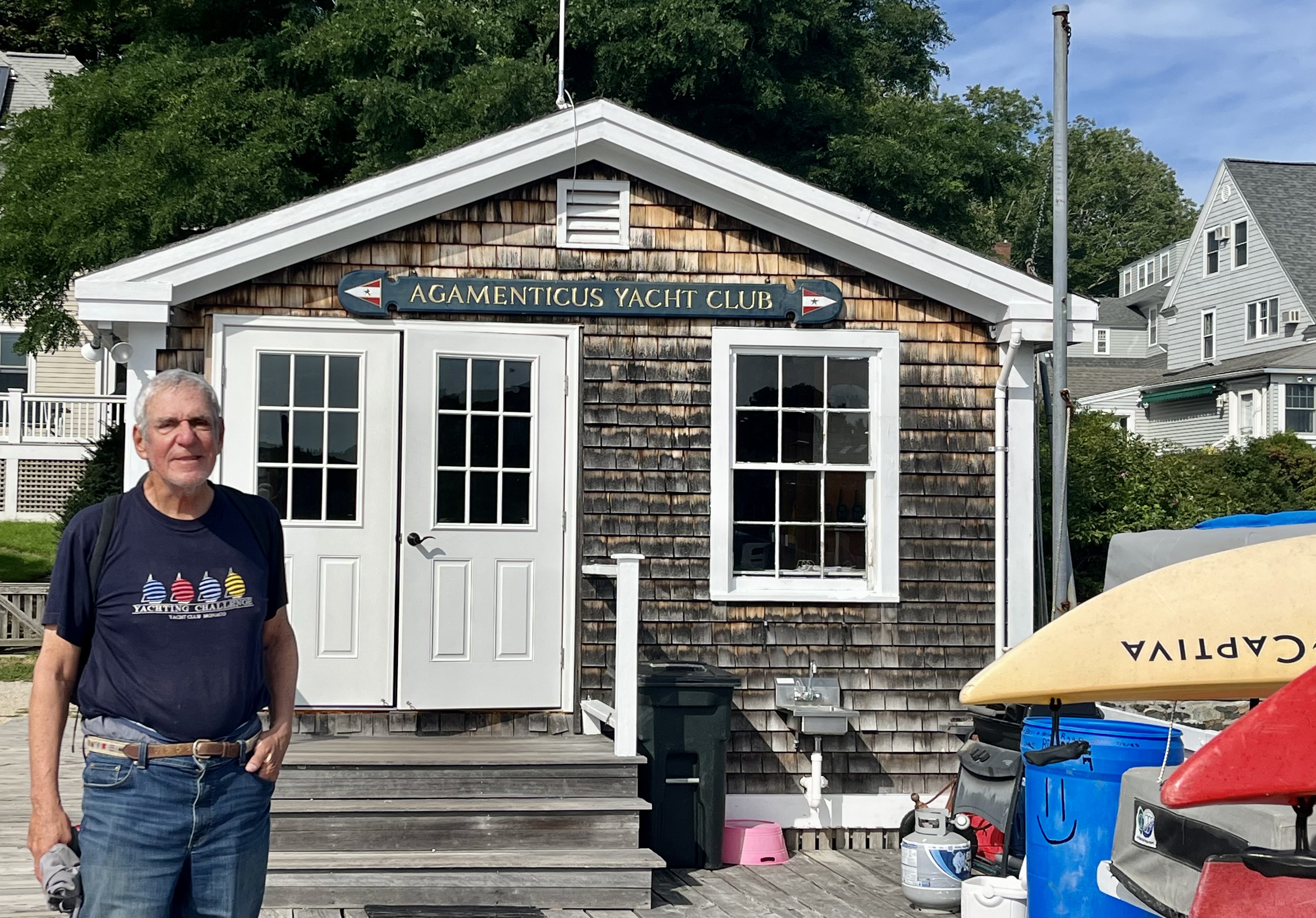
"There is nothing more pleasant than cruising on a boat with the whole family."
Letter from Empress Catherine the Great

Friday, September 1, 2023

August 31 — Day 53 — Salem to Nahant — 12 NM

 I had wanted to visit Nahant Harbor during our last visit to Massachusetts, but the wind was wrong that year. Nahant Harbor is a shallow bay, totally open to the waves created by the prevailing southwesterly winds. It is located on the south side of the Nahant Peninsula (perhaps formerly an island). The much larger and more open water north of that peninsula is called Nahant Bay. But today the winds were predicted to be from the north, so this destination seemed perfect. 

The only problem was it’s nearness to Salem — too short a ride. And we spent the morning leisurely doing paperwork during which the winds were strong. I had contemplated putting in a reef but by the time we left at 12:30, the wind had moderated. We sailed with main and jib, gently, for two hours at up to six knots. 

We are the blue dot on this satellite view. We came from Salem, shown at the top, and abound Marblehead. Boston is in the SW, from us.

The cruising guide said we should obtain the harbormaster’s permission before anchoring and to anchor outside the mooring fields. It was tough to reach the harbor master. The listed phone number was wrong. The municipal number had nine extensions, none being the harbor master. I pressed one and was switched to public works, who said the harbor master was not in her department but she knew his number and gave it to me. Permission was freely and cheerfully granted, with advice that the bottom had good holding, possibly too good with abandoned lobster traps and cables on the bottom. So I rigged a trip line from the crown of the anchor to a float on the surface. If it gets caught, the trip line will permit the anchor to be pulled up from a different angle. 

We elected the most eastern of the three coves, which had only one moored boat, one empty mooring and lots of room. We are in 13 feet of later at low, plus ten more feet at high, with 70 feet of snubbed chain. This was our second drop here. On the first, after we drifted back on the anchor, which did not drag, we were too close to the rocky shore.

There is a dock over by where most of the boats were but we did not go ashore.

We were close to Boston, with a nice sunset view. The chart shows that Logan Airport and Revere are between ILENE and the city, but they are low agains the skyline.


And like the carved stone lions Patience and Fortitude guard the New York Public library, our own brace of cats guard ILENE.

Thursday, August 31, 2023

August 30 — Day 52 — Rockport to Salem — 19NM

 We had made plans, a few weeks ago, to meet with Hugh and his wife Arlene in Salem this evening. I served with Hugh in 1967 on the USS Hammerberg; he replaced me as her Anti Submarine Warfare Officer and he got us reconnected via Facebook maybe 10-15 years ago. When we are in the greater Boston area, which apparently includes Salem, we try to get together. I had wanted to moor in next door Marblehead, which we visited quite a few years ago, but last time and this time as well, there was no available mooring except way far out at the Bay’s mouth. The person who could have rented us that mooring there told us “but you will be uncomfortable there”. What I remember about Marblehead, in addition to the elegant Boston YC, on whose mooring we stayed, were 1) the still standing home of Congressman Eldridge Gerry, whose salamander shaped congressional district gave rise to the word Gerrymander and 2) the painting “Spirit of ‘76” which hangs in its town hall. 

So if not Marblehead then Salem. This is our third visit and we have seen The House of the Seven Gables, and the Customs Court where Hawthorn worked (currently closed for renovation) and heard all we want to know about witches. But we almost had to cancel or adjourn due to forecast bad weather, I alerted Hugh to that possibility. But in the morning, while rain and fog remained in the forecast with scattered thunderstorms, the strong winds that had terrified Lene and the pussycats a few days ago were not in the forecast.

It was raining lightly when we got underway at 9:30, but the severe fog warning which was to last until 10:00 had lifted to a manageable level. The rain shortly developed into a downpour that lasted  half an hour, but without wind driving it, my follies kept me dry. Then no rain until another such fifteen minute downpour near the end. The route took us around Cape Ann. Essentially a) north out of Rockport, b) east across the north coast of Cape Ann, c) south through the sound between the Cape and Thatcher Island off its tip and along Cape Ann’s east coast to Gloucester, and d) west southwest across the big rock strewn Salem Sound to it far end, where, west to east, are the huge mooring fields of Beverly, Salem and Marblehead.


The Safe Harbor (brand) Marina’s mooring field has 250 moorings plus a large docking area.  One has to book a mooring through through Dockwa. It instructs you to call on Chanel 8 upon arrival, go to a particular day marker and wait for the launch to come out and lead you through the 249 other moorings to yours. Again we used the friendly launch service to go ashore where we did the laundry and wrote. The laundry room has seen a change for the worse in the name of technological progress since our last visit.  It is not payment by credit card of which I complain; that is progress as compared to being required to carry around rolls if quarters. But for us transient cruisers to do a load of laundry, Lene had to figure out how to download and use an app! Some IT guy thought that this was a good idea but he was wrong.

We walked to Finz, a modern, stylish, Asian themed, fish based restaurant overlong the water on Pickering Wharf. It was first built in 1762 and expanded, near the Customs house  and filled with warehouses for the loading and unloading of the clipper ships for trade with China. Now it is full of condos, shops and restaurants. A very pleasant reunion:


Wednesday, August 30, 2023

August 29 — Day 51 — York, Maine to Rockport, Massachussetts — 30 NM

 We left York at 9:30 with the tide still coming in the water was squirrely, though nothing like the St. John River and with the tide slowing our speed we had better control. Then a straight shot to the entrance of Rockport. Yes, we are back in Massachusetts! The course took us southward, straight through the Isles of Shoals, leaving Star Island to port and White Island to Starboard. We passed Gosport Harbor at about 10:30 and there was only one powerboat and one sail on the moorings. It was an unusual time of day for us to be there. We usually arrive late and leave early. I also looked for the guests, thronging on the lawns - with binoculars. Not today! Then a tiny bit of wind came up, very close to our nose, but I put up the main and cheated a bit and got another knot out of it.

Another mini fog bank at our arrival at 2pm. We were offered either side of the floating dock that extends out perpendicularly from, and end only about 30 feet from the Yacht Club’s front porch which overlooks the tight harbor. A mistake but no harm done: forgetting that we had put up our lines and fenders to starboard, Lene took us for a port side tie up. No harm, just another loop around and we were set. We are very close to “Motif 1” reportedly the most frequently painted and photographed structure in America. The barn red structure on the left.


In the old days I would have lowered the dink for the fifty foot trip to the club’s dock but the operator told us it would operate until seven o’clock and it was a no brainer. For six bucks in tips, round trip, I saved my back from the effort of lowering and raising the dink.

We noticed few changes in town since the last time we visited here a few years ago. I could not find the store that sold silk screened posters of seaside towns, and the antiquities gallery whose owner I would have enjoyed conversing with again (and several other galleries) were closed this weekday afternoon late in the season. The Rockport Art Association and Museum which displays Maine centered works by its members for sale — and several other galleries — provided my entertainment. Lene went the other way, on Bearskin Road and bought a hat snd sweets. 

After showering with the luxury of lots of the Club’s hot water we returned to ILENE, and had the Mate’s excellent boat cooked cuisine for dinner. Lene tripped aboard and iced, compressed and elevated her sprained ankle. Maybe it is only a strain. We played cards and though Lene is excellent and I have no card sense, Lady Luck was in my corner and I won. Or maybe she was distracted by her ankle. She is such a huge help to me in our voyaging, though I do most all the work except cooking, her star bit is bringing ILENE to docks and moorings while I grapple for them and tie up the boat. Heavy rain during our sleep.

AUGUST 28 — Day 50 — Cape Poirpoise to York — 19 NM

 York is yet another new Harbor for us. The Cruising Guide praises its safety — once in — and its scenic and historic values, but scares off people, including me until this cruise, with the dangers of a ninety degree sharp bend being difficult in the river’s strong flood and ebb currents. The young friendly Harbor Master, Forrest, told us that as experienced sailors we should have no problem except during the two hour period of max flow, which the tide tables show was from 11am to 1 pm today. Having gone over the St John River’s Reversing Falls, with its ten minute window, this four hour window looked easy. We left at 7:05 am giving us four hours to traverse the 19 miles before eleven. 

The many lobster boats who put out to sea from Cape Porpoise before us —the earliest at 5 am — were very respectful; they did  not rev up their engines, with consequent big wakes, until after they had passed us. Thank you gentlemen!


No wind at all until we were two miles from the beginning of the entrance to the York, so it was an all diesel day. When those big wind storms blow in, as one did a few days ago, they take all the wind with them when they leave. Sunny with visibility to the horizon. 


We passed Cape Nedick, a peninsular knob of land sticking out into the Atlantic which appears totally developed. 


It has its own lighthouse.

When we got about a mile north of the buoy that marked the entrance to the York River, we saw a wall of fog rolling in from the south. We can navigate in fog; the FAA calls it “Instrument Flight Rules”. We see our boat’s position, the buoys and the land — all on the chart plotter. Yet you want to confirm the electronics by looking up from the screen for visual sighting of the actual buoys to confirm the virtual. We had 300 feet of visibility.  We made it in without problems as the fog lifted, as mysteriously as it had come, and took mooring number 2 as directed. 

We took a long walk: the fishermen’s trail, crossed the smallest suspension bridge in America,


took the trail through a forest park,

on to town and after tea, back to the harbor and the beach

Before returning to our dink at the dock that the local YC had allowed us to tie up.

That’s a name I had to look up; it is the name of the highest mountain in this area. The clubhouse is twice as long as it is wide, and specializes in teaching and kayaking. We had  no internet or cellular here on our mooring.

There was no shortage of things to do here. But with only one day in each port I did not plan well enough in advance, to maximize our experience in each port. The library, the museums, they remain for future visits. And for the second night the dockside dining was disappointing; Lene is a better cook than these folks.

The current past our mooring was so strong for the hours of max flood that they dragged our mooring ball completely underwater.


Tuesday, August 29, 2023

August 27 — Day 49 — Cliff Island to Cape Porpoise — 27 NM

We normally leave Casco Bay in Maine for Massachusetts with a stop in either Isles of Shoals or Portsmouth NH. But those are fifty mile passages and shorter hops are preferable when possible. And Lene has come to like going to new places, which Cape Porpoise was for her.

Underway from 7:30 to 12:30, with rather straight shots from Cliff Island to the turn at Cape Elizabeth,  


And then again from there to the entrance at Cape Porpoise.


We had a problem at first, but one that Lene easily solved. The chart plotter showed ILENE, her course and speed and the pink line, being the track we had made on our way in — so we could follow the breadcrumbs out. But the buoys were gone and the land masses such as islands were represented only by crude rectangles or triangles. I was the culprit! In switching from “North Up” to “Course Up”, like the GPS is on your car, Mr. “All Thumbs” pressed a button to use the software brand we do not have, rather than the one we do have. 
We put up the main and Genoa on port tack, though the wind was rather light. When it came directly behind us we put on the preventer and drove “wing on wing” for an hour while our tide assisted speed over ground fell gradually from five knots to three. Then the fun ended, we furled and Yanmar got a chance to work again. We passed Cape Neddick, a rocky knob of a peninsula sticking out into the Atlantic which is now fully or overly developed waterfront real estate.
Cape Neddick even has its own lighthouse. 

I had been in Cape Porpoise before, but for a different purpose and I had a completely erroneous negative image of the place. Last time I was with Jim and KC. We were heading from Casco Bay, Portland specifically, to Isles of Shoals. But it got stormy and we were beating into strong winds, with an adverse tide and going very slowly uncomfortable and might not make it into Gosport Harbor before dark. Was there an alternative, a “port in the storm”? Well yes - Cape Porpoise. It is well marked with buoys and the guide book said we might be able to find room to anchor in the dredged deep-enough area outside the fleet of moored lobster boats. We got in at high tide and anchored. At high tide the land around the cove is at or below sea level with the grasses rising above the land. Not much protection from the wind but great protection from the ocean waves that roared by outside.  The Guide mentioned some sort of restaurant a the lobster dock but it was a dark and stormy night, we had food, were tired and did not go ashore.  I imagined, in my prejudice a not-much place frequented by lobstermen who lived in shacks nearby.
I was completely wrong. Cape Porpoise is a very upscale suburb of nearby Kennebunkport. It is
 filled with big lovely homes, several fine restaurants (though the one we selected was disappointing— well, after eating a boiled lobster dinner at Lunt’s Deli, Frenchboro, all others pale in comparison). There is a gourmet deli, a good market, etc.  We met a lovely couple while carrying our groceries home. They are retired and have a pad in Boston where they stay two nights a week. They gave us a ride back to our dinghy. Thanks!
ILENE is the boat with the tall mast at the left, seaward of half of the moored lobster boats, on 70 feet of snubbed chain in 23 feet a high. The Atlantic is in the background. A calm, quiet night.

Sunday, August 27, 2023

August 26 — Day 48 — Robinhood Cove to Cliff Island — 23 NM

 It was foggy at dawn but when it cleared it, I lowered the dink and we went ashore to pick up Lene’s package, take showers and make the traditional deposit and withdrawal — a bag of trash in the dumpster and water into our gallon bottles. There is a restaurant, but we had dined aboard, and a cost “Library” with internet that we could have used. But we remained aboard. We were told that a whale was living in the Cove, but we did not see him (or her). And then we were off! In light winds but with favorable tide. The seas had moderated but after the storm, big rollers remained. Rolling up the Sheepscot River they slowed our exit.


We passed Five Islands where we have been before and had lobsters. Rounding Cape Smell, the eastern edge of Casco Bay, we crossed most of  it. Here we saw that we had only about eleven miles to go and the weatherman revised his prediction of 2 pm rain —  not coming until evening, so we took it slow, under sail in the light wind.

We took a route that managed to go almost all the way across Casco Bay without having to dodge rocks, islands and reefs. We passed south of this mess called Bald Head Ledge: 


Cliff Island is adjacent west of Jewell Island where we have been so many times, including on this cruise. The Cruising Guide gave Cliff a good review. It is “H” shaped, creating coves both north and south of the horizontal. So if north winds are expected one can shelter south of the horizontal and vice versa.  But the only winds expected that night were, as the meteorologists say, “light and variable”. Thus, we figured that the ocean rollers, coming from the SSW  were the  greater problem, not the wind, and elected the northern cove. Yes there are a few charted, but not buoyed shallow spots, but we had no problem dodging them. I had looked at the satellite view of the island on the map application to confirm that our target spot was not filled with moored boats. On arrival, however, we saw a dozen moorings, all but two empty, and took one. One boat was a day sailing powerboat which left well before dark and the other was a sailboat, without a crew or dinghy present. In other words we had the place to ourselves. In the morning we noted that another sailboat had come in during the night. 

There is a market of the west side of the west vertical of  the “H”. It could be reached by dinking to the beach shore and walking across the island. We did not need provisions that badly so we remained aboard. The only problem, and it moderated greatly at bed time, was that the rollers coming from the SSW, managed to change direction and make our anchorage rolly, with what wind there was holding our beam to the waves. The Cruising Guide had not mentioned this wrinkle. The sound of surf crashing about us was our bedtime music. Good old Jewell Island would have provided a calmer night.

August 25 — Day 47 — Round Pond to Robinhood Cove — 21 NM


 Robin Hood Cove is in the Sheepscot River. Lene always thanks me for getting us to our destination safely. Today we got here, but not safely. We should not have made this passage today; the winds were too strong (“small craft advisory”). We did manage to get here. We left early to
 avoid the strong winds, Ha Ha, but at one point we were beating at five knots with  30 knots apparent wind. We used the reefed main without a headsail. We went south out of Muscongus Bay, west and finally a very broad reach heading up the Sheepscot River. During the last part I shut off the diesel and we were doing eight knots. There were seas up to eight feet high on on all three legs, and dodging lobster pots needs a firmer hand on the wheel than auto can provide with its “plus or minus ten” buttons. Until the third leg, the bow mounted high up on waves and then occasionally crashed down through the crest of the next wave with a resounding bang that terrorized our kitties. Because of rain, I directed Lene to stay below.  My foulies, the above was the “before” shot, were secured over the tops of my sea boots. But by the end, the foulies were waterlogged but drying. Lene told me after we got our mooring that she cried and I apologized for my mistake subjecting her to such fear. The last time she cried was in the Chesapeake in 2015.  We may stay here tomorrow. At one point when heading west, we considered taking  a mooring in Linekin Bay, which would have cut short the passage, but a package had been shipped to Lene here in Robinhood. 

My first and only prior time in Robinhood was with Roy, of the Harlem, as part of his crew to help him pick up his new boat here and drive it home. This was in the spring of 2021.

Tomorrow we are scheduled to go to Cliff Island in Casco Bay, located next to Jewel Island, but maybe we will take a lay day here, due to weather. We arrived at lunch time and I got dried off and into bed to warm up. Soup, coffee, etc.