"There is nothing more pleasant than cruising on a boat with the whole family."
Letter from Empress Catherine the Great

Saturday, April 21, 2012

Our Last Two Exumas


The Exuma chain within the central Bahamas consists of several hundred separate islands, of which we have ended up visiting only ten. Our last two were Warderick Wells and Highbourne Cay, a study in opposites.  Having become more comfortable with sailing on the skinny (shallow) water of the bank, we jumped to each of them on that side. The trip to Warderick Wells was mostly motoring for its 18 miles due to light winds.
Warderick Wells is at the heart of a huge Bahamian National Land and Sea Park: NO fishing, conching, lobstering or shelling; the sign says: Take only photos and memories; leave only footprints.
Moorings are $20 per night for a boat our size, and wifi, is an additional $10 and limited to 100 megabytes. But if, having bought the wifi, you can’t get or keep the signal,  you are out of luck. Reservations are taken the day before during the Park Ranger’s morning discussion on VHF channel 9 at 9 am. The Ranger, Darcy, first asks for boats which are leaving to call in. She wishes each a safe passage and adds their mooring number to her inventory of available ones. Next she reads off her list of boats that made reservations the day before. Then she asks for any boat not on that list, who wants a reservation for tonight or tomorrow to state their name, length and draft. She then tells everyone to hold on for a few minutes while she figures out which boats get plugged into which holes.  Her system of priorities in not known to me. And finally she tells each boat which field, and mooring number they have been assigned, and how to get to it. Most everyone wants to be in the North mooring field. It is a single line of moorings in the center of a long “S” shaped channel of dark blue (deep enough) which is only wide enough for one boat to swing on its mooring
and is closer to the Park Ranger’s office where you go to pay and to buy souvenirs. There is no food sold and no place to drop off garbage. We were assigned to the South or Emerald Rock


mooring field, which is more than one mile away by dink, including a shallow spot where your propeller will either hit sand or rock if you go at low tide. I hit both, one going and one coming back, without significant harm. But it was a good mooring with seven feet of water at low tide and very well protected by the island from the easterly winds that battered the east side of the island. Above is Lene looking out at the fleet, include ILENE, center, with Emerald Rock to the right. The rock, as are many in the Exumas, is undercut at water level on all sides:

We stayed in the park for three nights because Chris Parker, the weather guru, whose daily (except Sunday) broadcasts we listen to at 6:30 am on SSB channel 4045, accurately predicted very strong winds for those days. Chris begins with a request for any emergencies, moves on to give a general discussion of troughs, ridges and fronts that cause the weather and then gives a broadcast for each part of the Bahamas and portion of the US coast from Key West to Norfolk, and finally answers questions from boaters who subscribe to his service who tell him that they are planning on going from A to B and ask which of the next few days will make for the best passage. He is a treasure to all the boaters of the region. We started listening to him at 8 am a few months ago, when he does the same thing for the Caribbean on a different channel.
What is there to do there besides rest and relax? There was a BYOB party on the beach near the office one night. The park provides a big cooler of ice. 
Everyone else, about 20 people that night, bring beverages and a snack to share. It was sort of like the George Town bonfire, but without the fire -- and without the sand flies. I met a young couple from British Columbia. Graduating from college in this labor market, they decided to sail for a few years until the economy picks up. Many of the folks were southerners and I pointed out that the couple from New Zealand were from the furthest south of all of us, 
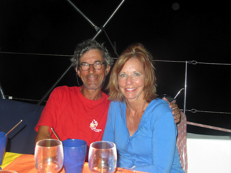
and that I was a Yankee. Ilene elected to stay aboard for this party, fearful of getting wet from spray during the dinghy ride in the wind.  I forgot the corkscrew and one of the good ole southern boys whose boat was in the nearby northern mooring field went back to his boat and brought his for me to use.
The other thing to do was hike. We took two of them on different days and though not long in mileage, they were rugged for the climbing over rocks that the trails consisted of. One hike was to BooBoo Hill, the island’s highest, 57 feet above sea level, whose name has to do with ghost story legends. Here is the view east with my shirt being rippled by the wind. Next is the east coast looking south.


The trail was well marked and crossed a flat area which was partly underwater when we came back, making a slightly longer trip. The rangers office is the house in the background. This area was a nursery for the three varieties of mangroves, whose differences were explained by intelligent signage. 


Very near the top of the hill were the blow holes: the waves crashing on the coast below the cliffs

 had bored holes to the top of the cliffs. When waves rushed in, a lot of air and sea mist gets caught and blown up through these holes.

Our second hike was to the south where an old plantation and a wall across the island lie in ruins 

and to the north over hills covered with eroded rocks, past Termite Beach to Emerald Beach. 


The flat plates of rugged rock are not entirely stable and one gets the sound of walking in New York City on a loose manhole cover.

The voyage from Warderick Wells to Highbourne Cay was 32 miles of easy sailing, on a starboard reach with the wind mostly at or aft of the beam. We were doing seven knots with double reefed main and small jib and with small waves. The marina’s entry is marked through the reefs with two ranges: line yourself up with the first pair of landmarks and follow that path in until the next two landmarks, on your port side, are lined up and then follow them in. The Marina was big, modern, well run and expensive, but permitted us to unload our six bags of smelly garbage and sold us internet with sufficient megabytes, and it worked -- with a strong signal.  Water, made on the island by reverse osmosis (desalinization) would have cost fifty cents per gallon. No thanks! And the same to your electricity.  We did dine at their lovely restaurant with a great view, or at least I did. Lene did not like the Bahamian Buffet menu of not so hot and not the best Manhattan style conch chowder, fried chicken, ribs, three starches, cole slaw and two cakes—one of which had enough rum in it to get a sailor drunk if he or she ate two pieces. All you can eat, for $35. The food was good, but nothing compared to the barbecue cooked by the Harlem Yacht Club’s Chef, Rutillio, that we are longing for.
We were assigned the slip next to “Retired Sailor III” out of British Columbia a custom built “Nordhaven style” 74 foot trawler. Our cats explored the docks, the stone hills behind them and our neighbors’ boats, making friends for us. They were “out” all night, but they know their way back and who feeds them. The current edition of a glossy magazine called Southern Boating was being distributed for free at the Marina. The lead article was a puff piece about the marina, coupled with the 25th annual swimsuit issue, a puff piece on bikinis modeled by women with no puffiness about them, whatsoever.  The article about the marina illustrated the friendliness of the staff by reference to a conversation between the mate of Retired Sailor and the dock hand who took her dock lines to tie up the boat. Mr. Retied Sailor told me that he was telling all his friends that his wife was featured in the swimsuit issue.
Posted from Bimini.

Outside and Inside to Big Major's Spoot and Staniel Key

Hauling in the two anchors of the Bahamian moor at Little Farmers Cay took more time than I had expected. The windlass’ manual said I could turn the top of the drum with a winch handle to disengage the "gypsy" (lower part which has teeth that engage the chain) from the upper part, which is smooth, and can be used as a winch to pull up the rope line holding the second, port anchor. But this disengagement process did not work for us. So after pulling in all of the 80 feet of line I could, by hand,  (not much) and cleating it down, let out another 20 feet of chain for the starboard anchor, wrapped the port anchor line around the drum and pressed the “up” button, pulling in twenty feet of both line and chain at once. Then, cleating down the line again, and letting the chain out the twenty feet again, I repeated, using the windlass to pull on both. After several more 20 feet lengths, the port anchor broke free from its hold on the bottom and I could pull it up by hand and secure the anchor and the line and then haul up the starboard, all chain, anchor the normal way.
We exited from Farmers to the ocean through the cut by which we had entered and set sail.  But we left at the slack at high tide, and in looking at the chart, there was a warning against entering the Big Rock Cut at Staniel Cay, our destination, while the tide is ebbing out to the east while the wind is blowing in from the east. And that is where the wind was and the three hour sail would put us at the cut at just about the maximum flow of the ebb. What to do? The chart told us of another cut, Dotham Cut, about an hour nearer to us (which we could thus enter an hour before maximum ebb) and which was also wider. It was just north of Wild Horses Rocks, at the north end of Great Iguana Cay.
We entered here, with motor and reefed sails pushing us against the tide. It was slow going for about 200 yards (it seemed like a longer stretch), like sailing through a washing machine with waves breaking behind us and very confused seas. The stern of our boat is open at the swim platform, a little more than a foot above sea level and water entered the cockpit from astern, wetting our feet and then drained right back out again. Once through the cut things calmed down and we sailed a big ten mile “C” shaped course around some shallow sandbars and Harvey Cay. Thus the day’s passage was “outside and inside”.  Our trip on the Caicos Bank had prepared us well for such inside bank sailing. We anchored on the west side of Big Major’s Spot, an island just west of Staniel Cay. Many boats were anchored there, close to each other and to the beach, in six to eight feet of water. We stayed quite a ways out amongst megayachts in 16 feet of water, with 100 feet of chain out, and lots of room between boats. This sign says “Welcome to Staniel Cay” and Big Major’s Spot is the green bar to the right, in the back, and we are behind it, near the point, sheltered from prevailing east winds.
 Our first adventure here was to Thunderball Grotto, named after the James Bond Movie. It looks like any other small island, but at low tide one can swim under its opening, blocked by the dink where we moored our dink in this photo taken at high tide,
and snorkeled into the hollow. There is perhaps 15 feet of water inside, and many tropical fish, and the ceiling is high, perhaps 20 feet, with three holes in the rock, each perhaps 5 feet across, through which shafts of sunlight shone, illuminating the water. I took in a disposable underwater camera that Judy had given us in Providenciales but after taking some photos I put it in my pocket and it seems to have fallen out and alas is lost.
Swimming back out, to our dink, we spotted “Corsaire”, which we had last seen exiting George Town, and hailed them and were invited aboard for a drink. Mac and Dana are extremely good hosts.

 She was a top model in her native Czechoslovakia (her website; pitchondesign@hotmail.com) and he was born in the US of one Czech parent. Corsaire is a new boat for them and they have not yet changed its name to “Czech Mate.” She is a photographer who loves to cook and is aggressive about inviting guests aboard. He helped design the programming and charts that are used in all of our car GPS systems. They live south of San Francisco but keep their boat on the east coast. They have sailed these waters for many years and gave us lots of good "local knowledge".  We had two dinners aboard Corsaire. The first was fresh fish fried in panko and the second a cerviched conch salad. Through Mac and Dana, we met Herman, sailing a 40 foot cat ketch “White Wings.” Herman was waiting for parts for his steering system and Mac for parts for his water maker. We had them all over for a breakfast but with no mangos, we used sautéed apples with cinnamon and diced canned pineapple in the batter for the fruit component. Don’t knock it till you’ve tried it!
Taking advantage of a very calm day I donned a weighted belt to counteract my natural buoyancy, mask and fins and dove under the boat to inspect for damage when we hit that rock. Good news: the scrape in the lead of the keel is about 5" by 1" by 1/16" --cosmetic.


One morning we dinked over to the beach at Big Major’s Spot to visit its most famous inhabitants.
They swim out for food and we gave them some bread, trying to make sure that they did not board the dink. While there we met a dink with eight people aboard. Their boat is named "Mawari". Their youngest of six, Miles, one year old, was born during their year aboard in Israel!
We also saw “Ptarmigan”, a catamaran sailed by Andy and Barbara of London, who we had met at the Tea at George Town.

Mac had invited us and we invited the Ptarmigans on a dinghy exploration about six miles north through Pipe Creek, a body of water too shallow for us to sail through, but quite deep enough for dinks, bordered by several cays to the east and Pipe Cay to the west.
We stopped at Compass Cay marina and explored that island, including its “low tide airstrip” – too wet to land an airplane at high tide – and its beautiful east facing beach.

And we stopped again for lunch on the way back at Sampson Bay Marina, and then on a beach deserted except for us, for a swim.


Our only disappointments were on Staniel Cay itself. Dana showed us where to buy fish off the boat at Government dock, whose underwater residents eat fish heads.


And we bought about six gallons of gas to replace the gas sold to JR on Little Farmers Cay and the fuel used on our explorations, and to top off. And we finally had gone through a liter of the lubricating oil mixed at two percent with the fuel. But produce in both the pink store and the blue store, was almost non-existent, very high priced, and moldy when we get it home and looked at it. What do the natives eat beside fish?  It’s not a healthy diet. And the Yacht Club’s restaurant has wifi, but not for our computer for long enough to do any good. A few seconds at a time won’t cut it. Finally, we waited for an hour for lunch (it’s true that they had a crowd) and then paid for our drinks, left and dined aboard. The Staniel Cay/Big Major’s Spot area is beloved by many sailors and now, despite these few irritations, we are among them.
Posted from Nassau, Bahamas

Tuesday, April 17, 2012

Black Cay and Little Farmers Cay

Departing George Town we saw a big navy blue sloop going our way and hailed them on the VHF. Corsaire is a 50 foot Beneteau with a draft ten inches deeper than ours. We were both headed north but toward different destinations, but both intended to go later to Staniel Cay. 
We both passed out through Conch Cay Cut from the shallow harbor out to the deep (NE) side of the island chain and had a great sail past several of the chain of cays for 19.4 miles. We had set the small jib in the harbor to aid the engine but out in the deep water we saw that we could carry the genoa so we let it fly, rolling up the jib behind it. We later let the boom out to leeward as far as it could go, and hoisted the reefed main, without turning into the wind, and then trimmed it in. With the wind  from the southwest and our course northwest it was a beam reach and brisk enough to move the boat at speed and without significant waves, because the wind was off-shore and did not have room to build the waves up in the space between the islands and our boat, less than a mile from shore. We entered the SW (bank or shallow) side of the island chain through Glass Cay Cut and anchored behind Black Cay as planned.
We were the only boat there. 
I had planned to visit the town of Rolleville on Great Exuma the next day. The Rolle family was and is big in the Exumas, with a town, a village and a cay named after them as well as about four businesses in George Town. But the anchorage was rolly (the cruising guide uses the phrase “subject to surge”). So we left the next morning for the ocean, via the same cut, and sailed  the 25 miles to Little Farmers Cay which we approached from the ocean through Farmers Cay Cut. The sailing was much like the day before but the wind was a bit forward of the beam and stronger; having flown the Genoa, we were overpowered so we partially furled it and reduced speed a few tenths below eight knots. The cruising guide says that at Little Farmers Cay anchoring is poor but that moorings may be taken, and to call Ocean Cabin on the VHF. No problem, was the reply, aim for the white house on the hill once in the cut. Here is the white house.


 And here is the view from the white house, out through the cut:

We took a mooring, off White Land Beach, just below the white house, where we were protected from the westerly winds. There we met Ken and Linda, sailing Adele Mary, named after his two grandmothers, a beautiful Shannon 39 . ILENE left, Adele Mary, right, Big Farmers Cay in background:


He is from Vail and manages a portfolio of commercial real estate and she retired from an IT job for the railroads.
We invited them to a shared dinner aboard ILENE that evening and then took a walk on the island, meeting JR, carver of wooden statues from sweet tamarind limbs.
We bought the owl on whose bottom JR is carving his initials. We did not haggle but he offered us a 20% discount “because it’s Easter”. JR is big on the healing properties of the bark, leaves and fruits of the trees that grow on his property. He told us about his island. He gave us a tour of his home, his shop and the southern part of the island. He asked if he could buy a gallon of gasoline for $10 (fuel of any kind is a lot more expensive here than in the states) to operate his generator to make electricity (it had been several days since the electricity on the island was working.  One NEEDS a generator) so the fish in his freezer would not spoil. We agreed and in  fact poured more than a gallon of gas from our dinghy tank to his.  The cruising guide said the cost of moorings was $10 so we asked JR to pay Terry, the proprietor of Ocean Cabin restaurant and provider of moorings, the $10 for us and he paid this sum to Terry’s daughter.
Dinner aboard ILENE was a big hit with good food, wine, conversation and a show of lightning from all around us which lit up pieces of the sky from below the horizon and without the thunder signifying proximity. When we heard faint thunder at last, it was time for the party to end.
            We went to sleep at about 11 but were awakened by a terrible crash at about 1:30. By the time we were up in the cockpit with the engine and instruments on, we were far from where we had been, and where the other moored boats were. It was raining hard with a lot of wind. We had not hit or been hit by another boat; we had hit a rock. We backed out into deeper water, dropped the anchor, watched it set, and I stayed in the cockpit to see if the distance from our boat to the cursor of the chart plotter, set on a landmark 0.250 miles away, changed out of its range of .248 to .252 miles. One thousandth of a nautical mile is six feet. We were secure again, and far enough away from the land in front of us, the shoal behind us, and the other boats nearby still on moorings. Ilene was quite scared. I was too focused on trying to do what had to be done to get scared about what might happen if those things did  not work.  I called Terry of Ocean Cabin on VHF in the morning to tell him that his mooring had broken and that part of it was still attached to ILENE and he could come and get it. I had pulled it aboard so it would not get tangled with our propeller while we were backing.We both saw that the weakest link in his rusty old chain had simply rusted through. I later learned that a sort of rough justice had accidentally been done. I had not known that the mooring price had been raised from $10 per night to $20. So in fact I paid for only half a night’s rental, and we were on the mooring only half a night.
          Next day at about 1 pm the wind had shifted to the east. Now we had swung closer to shore and the depth alarm, set to go off at seven feet, made its horrid squeal. We were in just over six feet of water with our 5’ 8” draft. A group of snorkelers came by to tell us that our anchor had gotten wrapped around a coral and was wrecking it. They were satisfied with our answer that in the middle of the night, we had a legitimate emergency concern other than the environment. They helped us get our chain in without further damage to the coral and we moved to a spot in a channel further north along the same eastern side of Little Farmers Cay, but better protected from the strong easterly winds, by the south end of ocean facing Great Guana Cay.  There were moorings here too, and moorings are generally considered more secure than an anchor, but this had proved not true at Little Farmers Cay. So we put in a Bahamian moor (the people on the islands call it a "merenge" because the boat's stern twitches back and forth): one anchor is set out the normal way and the other, also from the bow, at an angle of about 150 degrees from the first anchor. This way, when the current rushes from SE to NW, one anchor is holding and when the tide turns and the water rushes the other way, the other anchor holds. The result is that the boat’s bow does not move very much. ILENE is in the darker blue, (deeper) water and you can see an ocean roller roaring in through the cut at the left.


On our third and last day, the afternoon of Easter Sunday, I took in the dink and walked the island.
Its Yacht Club in the NE was closed.


Most of the names in the Cemetery are Nixon or Brown.


Its airport runway is level along the NW coast; a seven seater had recently landed, I was proudly told.


The Baptist (only) Church and elementary school.


What caused these eroded waterside rock formations, so typical of the Exumas? Salt water.
I met two gentlemen, Messrs. Rolle and Wilson, sitting on an Easter Sunday afternoon. 

They, as had JR, the carver, were kind enough to answer many questions. If anything said in this posting is incorrect, please blame my hearing or memory, not their accounts.
It seems that everyone on the island is either (1) a descendant of one woman who, one at a time, had two husbands: Mr. Nixon and Mr. Brown, or (2) related by marriage to such a descendant. The island is owned and run by the family.  If an outsider like me wanted to live there, a family member would lease me land for 99 years, a family member would contract to build a house for me and I would be welcomed in such manner as the only non-family member. On neighboring Big Farmers Cay, there are several large vacation homes owned by people from Canada or the US, but not on Little Farmers Cay.
There are 65 residents about 18 of whom are in the elementary school. Those of high school age are sent off the island to school. Those who return are provided with a piece of land and the foundation of a house but it is up to the new family to finish the construction. This house has seen better days.
There is one policeman and one police car and quite a few feet of paved road per capita. The garbage is picked up and brought to the dump.  


 Cotton was once grown on the island and a few bushes of wild cotton are still in evidence.


 Little Harbor, with the government dock, where you can come ashore without getting your feet wet.


We had a delicious and inexpensive dinner of cracked conch (sort of like fried calamari) and lobster tail at Ocean Cabin restaurant.


 Little Farmers Cay was an interesting island of family unity and unlike Black Cay, a place of unexpected, undesirable and excessive night time excitement.

Posted from Highborne Cay.

Monday, April 16, 2012

Eight Nights at George Town


We arrived in George Town on March 28 and left after eight nights, on April 5. G Town is the capital of the Exumas. For the first half of our stay we anchored in Elizabeth Harbor, on its side further from town, where we were sheltered by Stocking Island from the strong easterlies, off what is known as Sand Dollar Beach. We saw, upon arrival in strong winds, that almost everyone else was anchored on that side, about a mile from town, and we followed the wisdom of the crowd. Elizabeth Harbor could have been called Stocking Island Sound, just as Long Island Sound is the body that separates Long Island from the mainland. Stocking Island is about five miles long and lies parallel to the coast of mainland Great Exuma, making Elizabeth harbor about five miles by one mile. But there are many large impassable shoals in it and it never gets more than twenty feet deep. But there is lots of room for big scope on one’s anchor and lots of room between boats. View from Stocking Island with anchorage in foreground and G Town behind.


Downtown is a group of businesses that line both sides of a street about half a mile long including two banks, Immigration, two food markets, several souvenir shops a government center including the Post Office, a small Yacht Club, Customs, two small hotels, three places that sell electronics stuff or services, a Bahamas Telephone Co. (Batelco) office which was closed for renovations, a laundry/laundromat, several bars and snack bars, a gas station, two places that sell boating supplies, etc. Some are in modern two story buildings while others are in well, shacks. The road is one way through town and crosses a stone bridge over the inlet to Lake Victoria, which is about .1 by .2 miles and which has the dinghy dock that provides access to town from the water. View from the bridge of Lake Victoria including dinghy dock and sign on path from dock to town:


On the outside of the bridge is Kidd’s Cove,
a small cove near which we anchored for the second half of our stay, after we got our lap top charger cord, when we had more “town” things to do, i.e., the internet, laundry, ice, groceries, jerry cans of diesel, propane, souvenirs, etc.

  Our first stop ashore was at the bank to get ATM dollars, and then spending some of them to wire money from that bank to the bank of the vendor in Nassau of the lap top charger cord, which would not accept Amex or any other credit card; welcome back to the mid 20th century! 
Then to Customs and, at the other end of town, Immigration. I had been worried about being asked questions about where we had stopped during the six days and 250 miles between Provo and G Town.  But the earnest and polite young man behind the counter was only interested in my filling out his three forms (two more forms at Immigration) fully and accurately, in triplicate or duplicate, inserting the carbon papers correctly between the forms, and, oh yes, collecting the $300 fee, and filling out his three other forms that were given to us as receipts. The good news is that we do not need to check out from the Bahamas, but instead, can conveniently mail the permit back to Nassau from Florida.
There are a lot of boats in G Town, as many as 450, we were told, though less when we were there, past the peak in their season. Many come from the US and Canada and go no further, spending months here in the harbor, away from the cold north. We missed the event of the season, the National Family Island Regatta, in which the Bahamians race their traditional wooden sloops in the harbor and many parties are held. Here is the viewing bleachers and committee stand.

They have a daily morning weather report and net on the VHF radio. When arrivals were solicited by the controller, we announced ourselves and I asked if anyone had a chart book for the Exumas and offered to trade for charts of points further south.  I had used a series of sketch chartlets in our cruising guide to familiarize myself with the route into the southern end of the harbor through the shoals and then used the chart plotter to get us through, but a real chart is best. Boomerang, a 34’ Hunter with Mitch and Jessica from Vermont answered, and we switched to another channel, set up a meeting and spent several pleasurable and productive hours on their boat that afternoon while repairs to their dinghy were drying. We parted with their Exumas (central Bahamas) chart book and $100 and they kept our three chart books for the Dominican Republic to the Spanish Virgins, to the Windward Islands and to the Leeward Islands (Anguila to Grenada). They also told Lene about iNavX which provides charts of the whole US east coast on the iPad and uses its GPS feature and a navigation program to permit navigation and a cool anchor alarm that can ring in your bed, where you will hear it,  rather than out in the cockpit. A good backup which Ilene bought and Jessica trained me how to use.
Highlights of our stay:
A Cruiser Appreciation Tea at the Palm Bay resort about two miles away, that we visited by dink, sponsored by the Ministry of Tourism. The Tea was announced on the Net. They provided a “Rake and Scrape” band to entertain with standard calypso music. Rake and scrape apparently means that in addition to a guitar and several hand beaten drums there is a player who scrapes a screw driver blade along the teeth of a hand held rip saw.
They also presented a fashion show.
And many delicious native foods and a chance to meet other cruisers.  And the price was right too: Free!
Another day, a “Bonfire on Sand Dollar Beach” was announced on the morning Net. Several calls got us the particular spot on the beach, the time, and what foods/drinks to bring. It was very close to where we were anchored. About 30 folks showed up. We brought manchego y  membrillo, but not having manchego cheese on which to base the guava paste, we used what the store labeled as provolone, as a substitute hard-salty cheese. But it was not a successful dish, though the pieces were all eaten, because the alleged provolone had the flavor and consistency of muenster. And, despite bug spray, the sand flies were vicious and we retreated from the beach after about 40 minutes. The morning after the fire:


We visited the heart of the cruiser community at volley ball beach, about a mile away on Stocking island. We did not partake of the roast pig at the Chat and Chill,

the landmark eatery on that beach, largely because we forgot to bring money.

Lene met folks who operate a luncheonette and motel in the touristy lake section of Michigan in the summer. I got into a volley ball game.
We walked across Stocking Island to see the other side – it is high and narrow. And we saw the lovely eroded rocks of this place, the type of rocks that the Japanese love to install in their contemplative gardens.
On the mainland, we had two great lunches at Peace and Plenty, a nice restaurant in a hotel and got some souvenirs.
I almost led a Passover Seder for a black congregation. While dropping off our propane canister to be refilled, Naamen Forbes, the enterprising and polite propreiter of that and other businesses informed me that a rabbi had arranged with his minister to lead a model Passover Seder for his black congregation, but had fallen ill. I volunteered to do it and for a few hours was thinking how I would do this. Their religion forbids alcohol. No problem; “the fruit of the vine” which we bless includes unfermented grape juice. I have no matzoh, kosher for Passover or otherwise. No problem; we can use those small round Carr’s crackers as a symbolic representation of a matzoh. I also have no Hagaddah, the book with the service written in it aboard. No problem, after more than sixty of these seders, I know it well enough to give them the important elements without the book. But I’m a layman, not a Rabbi. No problem, this particular ceremony is normally performed at home without clergy.  I was all wrapped up in planning this until I checked back a couple of hours later. Naamen’s minister concluded that having called the program off, it was too difficult to get it back on the tracks that night, which was our last in G Town.
We fixed a few things for the boat. The flag halyard for flying the Bahamian courtesy flag came off, permitting Lene to haul me up to the lower spreader to reinsert its line in its block there. I replaced both screens in the port café door, that the cats had clawed through, but this was disappointing because they have clawed through one of the new ones already. A tear in the sheet we use as a slipcover on the starboard settee was repaired with adhesive thin sail tape on the back side, reinforced with stitching. Not much work done; I'm getting lazy. We planned routes and distances for about a half a dozen cool spots up the Exuma chain, which will be the subject of the next posting.
Here is a Still Life with Fruit and Cat, with lighting that came out in the Dutch Masters style, I rather think:
Posted at