"There is nothing more pleasant than cruising on a boat with the whole family."
Letter from Empress Catherine the Great

Saturday, August 31, 2019

August 28-29 -- Battleship Cove, Fall River, Mass

Yes, Massachusetts, not Rhode Island! But Fall River can be approached by water only through Narragansett Bay, so it's alright. It was only five miles and with virtually no wind we did not raise any sails on the still waters -- nor hoist the dink. We passed Borden Light and under the I-195 Bridge (you can see the battleship behind the can).

The moment of truth, though the bridge was twice as high as ILENE's mast. Then we cut under the bow of the Battleship USS Massachusetts, BB-59, which separates the eponymous Cove from the Taunton River and took a mooring almost under the I-195 bridge and in the shadow of four retired naval vessels. Being so close to the huge warships was a unique sensation, comparing tiny peaceable ILENE to the ferocious killing machines. Lene in the dink is my chauffeur.
Borden light by my shoulder

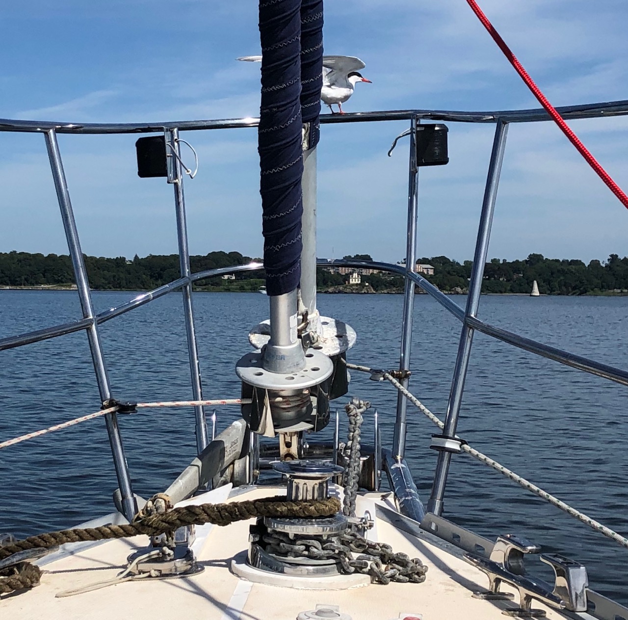
That's a pigeon, not a dove.


Both ILENEs

The mighty Battleship is the queen bee. They don't make them anymore, - haven't for 75 years. The other three major ships include the Destroyer Joseph P. Kennedy Jr. DD-850; like I said, this is Massachusetts after all. Kennedy is about one third again larger than my Destroyer Escort, Hammerberg. The Kennedy had its Viet Nam Era configuration with ASROC and DASH: weapon systems that were supposed to deliver homing torpedoes by rocket and by drone, respectively, to kill the enemy submarine before it could kill us.. Hammerberg had DASH and the system never really worked. it was an engineer's dream but the multiple ways that small errors crept into the process through so many human intervention points, meant that it was ineffective.
The Cove's flotilla also included the submarine USS Lionfish, and the former Russian guided missile launching frigate Hiddensee, half the size of the Kennedy, but not open for touring. There are also, on land, two full sized WWII PT boats, one of those landing craft from which our GIs staggered out onto the beaches of  Normandy under NAZI gunfire, a great Antifa action, and several military aircraft, both fixed wing and helicopters. In short a very broad expanse of military equipment and history.
The Massachusetts bristles with guns with three triple barrelled sixteen inch diameter cannons. Each of the nine 16 inch guns could propel a one thousand pound explosive shell 25 miles! So such "battlewagons" were used for shore bombardment in WWII and again, up to 20 miles inland,  through Viet Nam.
The Massachusetts has so much interior space, with high ceilinged decks, that much of it has been given over to displays of almost anything nautical or military. A full room of documents and articles celebrating a decorated Cruiser, a collection of hand made dioramas, of PT boat history, and even the Boy Scouts. One of the founding purposes of the Boy Scouts was to acclimate young men to military life. It worked that way on me though I also derived many of my few good qualities from scouting. We saw several groups of uniformed High School students who were in the Marine Corps ROTC program touring the Cove.
I spent about nine hours over our two days here in the ships and museum but did not have the physical strength to see all that was on display.
You will recall in May I posted about a visit to a Destroyer Escort docked in the Hudson in Albany.  That ship, also of WWII vintage, was so much better explained with live volunteer docents who loved their ship, kept her in top condition and knew so much about her.  Fall River has much more raw material to work with but has so far done much less to bring it to life.There are no docents and signage is weak. Movies in key locations are not really about the ships and hard to hear or see. Fixing this would take a great deal of money and volunteer effort, but much more can be done than just letting folks wander about.
The museum is two blocks away and covers too much with not a lot of depth. One thing I learned about was the role of the Azores as an allied base in WWII and the high level political maneuverings needed to accomplish this. These are Portuguese islands and the Portuguese influence in these parts, mentioned previously during this cruise, is evident in Fall River. The other thing I learned in the museum was about was the Fall River Line, a business of side wheel steam driven paddle boats that transported large numbers of passengers, in style, between docks in New York's East River (via Long Island Sound) and Fall River, with connections by railroad between Fall River and Boston. For many decades they ran daily in all seasons, and all weather, including fog, until the failure of the business in the depression of the 1930's. It was an overnight passage and the business people awoke refreshed and ready for business.
This exhibit brought back to my memory what must have been one of my first water passages: with an aged aunt I traveled by boat from New York City to Bridgeport Connecticut. It must have been around 1950, so my experience took place after the demise of the Fall River Line, but it was a thrill to a young kid.
Our last night we attended a rock concert in "The Narrows Center" which is the third floor of an old factory building. The artist was Danielle Nicole with three musicians in her group. I was told she was a blues singer but I think I heard rock. She has a song nominated for a Grammy. I had never heard of her before. The concert was after dinner in the Cove Marina and Restaurant, to which we had traveled by dink. Very modern but good food.
We tarried the next morning with hair and nails appointments for Lene, groceries and a breakfast at AlMac diner. Breakfast was the final straw in Block Island being crossed off our itinerary this year. Well at this point, 2/3 of the way through the planned cruise, my mate usually gets itchy for home and 2019 is no exception. Not that we have any appointments for which we have to get home early. But Almac served fried Portuguese bread, that sweet delicious bread, and told us that we could get more during our walk back to the dink, at Cinderella Bakery. We did. And part of the reason for sailing to Block Island's Great Salt Pond is to score such bread from Aldo, who scurries about the harbor in his boat yelling "Andiamo!!!" and selling to those who becon him over. Block has many other attractions, but we've got our Portuguese bread fix for 2019.

Thursday, August 29, 2019

August 27 -- To The Kickamuit River Anchorage

We set out for the Kickamuit River from Potter Cove at three p.m. for the ten mile sail, trying to arrive near slack at high water at five p.m. -- and the plan worked. We used the main and small jib. with gentle wind and only ten miles to go. This was our second passage on which we did not raise the dink. The first part was eastward and the rising tide pushed us north so that we had to go close hauled to get south enough to clear the shallow water south of Hog Island. Then we turned to port and came on a broad reach to the north with the same rising tide helping us along.

We got to wing on wing passing under the Mount Hope Bridge. It attaches Aquidneck Island (which has Newport on its southern west coast) to the mainland near Bristol.
Charts can be scary. This one, showing "Bristol Narrows", at the mouth of the Kickamuit, looks impossibly narrow, with the buoys so close together as to be impossible. The dime shows the scale.
But our chart plotter permits an enlarged view, which makes it rather simple when there is no strong current running in or out. The pink lines are our track, in and out, Green "1"is  off the entrance in the south  and Green "7" after three reds. The chart plotter shows us passing on the wrong side of some buoys but that is because the buoys move a bit on their mooring chains; we use the visual -- the  actual -- and keep inside the channel rather than the charted view shown by the chart plotter.


Here is a view looking out. 

The water does get very shallow nearby as evidenced by this fisherman standing in the water. Lene took the helm on the way out and was rather proud of herself, which makes me proud and happy too.
The River, flowing from the north, forms a large, lake-like harbor before exiting through The Narrows. Sort of like the Harbor of New York City, on a much smaller scale. The deep water is about 1/3 mile wide and twice as long as seen on the chart above. The portions of the shoreline that are not marshy are lined with summer homes. We took a dink ride around most of the "lake," but at 10 a.m. on a weekday, we say only four people and two dogs. A very quiet place. As near as I could tell there are no commercial enterprises, boating related or otherwise, near the coastline, but it is very close, by land, to Bristol.

We spent a quiet evening on 50 feet of snubbed chain in 15 feet of water neared the eastern shore. Here is a beautiful mirror sunrise:
A good place to get away from it all, or to weather a hurricane. The one active now, we pray, will not be coming near Rhode Island.

August 26 -- To Potter Cove on Prudence Island

The Cove is shown in the SW corner of the chart in the last post, the one about Bristol. We sailed the 3.5 miles under genoa alone on two very broad reaches in about an hour with only one gybe. We were on port tack heading south out of Bristol and starboard going west to the Cove.  The cruising guide warns that there is a $100 fine for using a mooring without authorization, a markedly unfriendly attitude compared to most places. There are about 40 moorings, only two of which was occupied and sufficient room for us and many others to anchor. In the morning the Cove was glassy, north, south, east and west.


The first four picks are from ILENE, with the fourth showing the beachy spit that protects the cove, except from Southeasterlies. And the last of the five shows our dink at the dock with ILENE in the background.  A big place. But the dock has a sign threatening fines if you stay more than 10 minutes. I don't recall there being such an unwelcoming attitude when the Harlem put in here 20 years ago. Lene went back to ILENE for some "alone time" while I walked about 2.5 miles south, exploring the island.
My first time here was on the USS Hammerberg; we loaded ammo from the munitions depot at the island's southern tip after a long period in the shipyard. We were on the long pier and each man carried one three inch diameter shell from the depot to our magazines. (The depot is now a nature sanctuary as is much of the island.) From the loading process Hammerberg set directly out to sea -- into a hurricane -- before we had gotten our sea legs. So I cannot say that I have "never" suffered a bout of "mal de mar".
I saw three deer -- big females -- who saw me and crashed off into the woods. I heard birds singing. I was passed by four trucks before I reached the town. The two lane road has a name but no road signs tell that name and it is not paved, but well graded. Various named trails led off from the main road, but to where? So I did not explore them.
Wildflowers abound at its sides. The island's population is less than 100 in winter, several times that in summer. No real stores so one has to bring one's own.


The folks here are into fishing. Here clamming:
The island is about six miles long and looks to be between 1.1 miles wide in the fat southern part to only .25 miles wide at its throat, the isthmus connecting the north and south. But in fact this isthmus is cut by salt marshes from both sides, and has only a hundred yards of  solid land.
One reality I had never thought of before my little walk was how central Prudence Island is to Narragansett Bay. You can see so many of the places we have been or will be, including Bristol, Providence and Quonset Point from across the salt marshes.

Folks here are really into their island:

Sunday, August 25, 2019

August 22 - 25 -- To And In Bristol

Two hours for the ten miles here from Edgewood, motoring without sails directly into light southerly winds most of the way. Lene had an appointment with a hair salon and we got there in time. Passed this light off Conimicut Point, by green can "15".
We shortened the trip by staying outside the channel for a good part of the way, on hypotenuses. The channel is about 50 feet deep and we don't need that much.
I think this was my fourth visit here and the first where we moored our boat on the west side of the harbor, near the town, at the Bristol Maritime Center, the crenelated castle. On all previous visits we took a mooring at the Yacht Club on the other side of the harbor, far from town. The Maritime Center provides nothing except the mooring itself, for $40 per night, But we used the nearby free dinghy dock,  rest rooms, showers ($1.00 for three minutes) and laundry machines ($5.00 per load). There was a big Herreshoff regatta so that the Maritime Center no longer had available moorings for out third and fourth nights -- so we anchored just outside their field in 20 feet of water (which we could have done the first two nights as well though a longer dinghy ride in the surf --see below-- would not have been fun). I worried a bit during our time on anchor that if the wind shifted to come from the south, we would be too close to the moorings but the forecast held throughout for winds from the north. And our last two nights it got cold, low 50's, so we closed hatches and ports, hung a bath towel ofer the closed screen cafe doors to the cabin and used an extra blanket.
This was our first Bristol visit since Redlefsens restaurant went out of business. The new restaurant in its place, Portside, was not bad, but let's just say it is no Redlefsens. We had two dinners, a lunch and a memorable breakfast in different places in town. The breakfast, in a hole in the wall Sunset Cafe, included delicious, spicy, crispy strips of fried  "choriso hash" and huge buttery home baked biscuits. We would have eaten there again on our last day but they were closed. We never spent as much time in Bristol before, including the summer when we we lucked into the enormous Fourth of July parade, going strong for almost 200 years, during which former Harlemites Hadley and Susan had graciously hosted us! This time we took more time and learned more about the area by foot and by bike.
The highlight, though, was a visit by Harlemites Rhoda and Lloyd
who drove up, stayed in a hotel and celebrated their 48th wedding anniversary with us. Their son, Jonathon, learned the name of a restaurant at which we dined together, Bar 31, and ordered a bottle of Prosecco and cheese cake for the celebration! We had invited any and all Harlemites to join us in Rhode Island -- by land or by sea.  We  toured the area by car, including the Yacht Club (which is operating out of a tent this year while the clubhouse is being repaired after a fire) and lovely Colt State Park, both located on Poppasquash Point which forms the west side of the harbor. Our friends also took us shopping. Plans to have wine etc. aboard before dinner the first night were thwarted by very strong winds from the south. We were lucky to make it in to the sheltered dinghy dock amidst the large waves the fetch kicked up only slightly wet from spray; by the time of our ride back ILENE after dinner the seas had laid down.
One day was devoted to museums. First and foremost, the Herreshoff, celebrating the family and its business of designing and building sail and power boats for yachtsmen and the military from 1863 to 1945, including seven consecutive winning Americas Cup boats (eight races) and an early catamaran. They have about fifteen nicely restored boats available in a large building, three of which can be explored if you take off your shoes, several steam engines, many hand carved models used as models, and rooms showing how curves were traced, masts built and sails made.

After lunch: Linden Place, built by Mr. DeWolff in 1810, who, like the occupier of the White House, absconded with his family leaving the people to whom he owed money for its building it in the lurch. Several additions and improvements were made during the years. The Place was acquired by DeWolff's son in law, Mr. Colt, in 1865. Four Presidents stayed there and Thomas Jefferson wrote a letter praising one owner for his speech supporting religious liberty. Ethel Barrymore married into the family and her time is celebrated by the Place now. Lots of art and furnishings. Mr. Colt  made most of his money in rubber. One owner built a separate ballroom on the grounds which is now actively used by the wedding-industrial complex - brick on right.

This is the back yard. Colt also built a beautiful marble school next door. And he donated the large park on Poppasquash Point which is named after him.
Finally we visited the small Bristol Art Museum, featuring drawings in colored pencil.


Another elegant house on Hope Street (Route 114), the main drag.


We had a day sail with Lloyd and Rhoda, shown in the faint thin pink line of our track in the next photo. It was 15.9 miles according to the computer and included a clockwise circumnavigation of Hog Island, which shelters the south side of Bristol Harbor and up into the Providence River to off Rocky Point in the NW. Our boat is shown in white on her anchor in the harbor, upper center.

 Our day sail coincided with the Herreshoff Regatta, in the SW corner, which we kept well clear of.


For a while we kept up with this 94 foot beauty, "Eros", while pointing higher than her but going slower, with only our main and small jib.


Lloyd is not as experienced a sailor as Rhoda but he had the helm quite a while, and enjoyed and learned from it.


Everyone had a pretty good time.
Our last night in Bristol occurred gradually. Our next stop is Potter Cove on Prudence Island but it was Sunday and the Cove was likely full of weekenders so the fog which delayed our departure was not a problem. But then the wind was strong enough to persuade Lene to ask me to delay another night. We did not leave the boat and I did a few chores including tightening the shrouds "one Turn" as advised by our rigger back at City Island. We also made progress in the taming our mini-lion, Cruiser, as evidenced by his relaxed pose.
And with only an hour's sail to our next destination, we did not have to raise anchor early the next day.  We rented bikes for four hours and rode ten of the fifteen miles of the bike trail up the east side of the Providence River. The trail was the trackbed of the former Providence to Bristol Railway, which was closed for passengers following the devastation of the 1938 hurricane and to freight in the 1970's. It is fully paved and well maintained. On our way we passed through the towns of Warren and Barrington on the banks of rivers with the same names. These towns have marine facilities, but not for ILENE, so bike was the only way we visited. Warren was where the University of Rhode Island, now called Brown, was first started.


We stopped for lunch at the Wharf Tavern in Warren -- high grades for modern ambiance and view, good enough for food.  Twenty miles seems ambitious but the bikes had motors and batteries capable of driving them at twenty mph. I thought it was cheating but we only cheated ourselves out of exercise for those parts of the ride when we used the electricity. Such bikes could be useful for folks who do not have cars. This is the Tavern's picture window, not a painting.

Thursday, August 22, 2019

August 19 - 21 -- Passage To And Two Laydays In Edgewood/Pawtuxet

Providence was the only big city on our itinerary,  the furthest from home, 125 nautical miles by crow flight and 222 under ILENE's keel. It was also the northernmost point of this cruise which is the shortest cruise in time and distrance since 2010-11. And the ports in RI being near each other, and with lay days in most ports, there is far less sailing than ever before. But I am handling it quite well, thank you; indeed enjoying it.
My tide table said that slack water in East Providence was at 11:20 AM, but either it or my reading of it was erroneous. I'm always up early, reading or writing and at 7:15 Lene came up and said "It's slack now!" I looked and she was right. We got underway at 7:20. Slack time does not last very long, though the water at each side of it moves slowly. In any event, I cast off all lines, and the boat sat stationary until I pushed its stern off from the dock while jumping on with Lene backing us out. Easy!
The Liberty Passion
 has an interesting stern toward starboard which includes a long driveway that articulates our and is suspended permitting trucks to drive aboard.

The perceived problem with our destination, the Edgewood YC, is that the chart shows it is located in very shallow water with a channel from the main channel to get in.
We had been told not to worry by the YC staff, but I wanted to delay our arrival until nine a.m. when the launch
operator would be on duty and could help us if we needed help. So we covered the four miles from E. Providence very slowly, at two knots, with the engine just above idle speed and I held my breath when we turned to starboard, leaving the 40 - 50 foot deep dredged white channel, needed for ships like Liberty Passion, to head NE for the Club's mooring field. (near bottom of the chart, red line)
The charts, both paper and electronic, show that at low water there is only five feet at our mooring, (N 41; 46.60  W 071; 23.08), such that the lowest ten inches of our keel would be stuck in the mud -- or rocks. But we were fine here for three days (six low tides) and we even motored  to the Club's dock to fill ILENE's water tanks at high tide one day, without a depth problem. I do not think it is dredging that created the greater depth.
Edgewood and nearby Pawtuxet are both legally recognized subdivisions of the larger area of Cranston, Rhode Island. We walked in to Pawtuxet, about a mile downstream, actually we walked back, because when Lene asked a lady for directions, she gave us a ride.
(I get angry at Lene when she asks for directions because I know the way and she does not trust me; and she gets angry at me when I snap at her over this. Something for us to work on after 22 years together. Actually, I should just learn to remain silent when she repeatedly asks people unnecessary questions.)
The clubhouse was recently rebuilt following a hurricane. One of its three floors is the Ted Turner Sailing Center of Brown University: used by its sailing team. Another nearby yacht club just north of here has gone out of business. The area is ripe for a rebound in sailing. They race Tuesday and
Wednesday nights, different classes but Wednesday, in very small boats, was cancelled due to high wind and threatened storms. The Club is clean and well run. ILENE is the boat to the right.
Pautuxet is very old, calls itself  "The Oldest Little Village in Rhode Island" and claims to have been founded in 1654. It is small and quant. The Pawtuxet River flowing into the Providence River.
A cute gift shop called "Noon" says it was the first Customs House in the nation. I will try to verify this some day. We had a light lunch at a very interesting tea shoppe called Schastea with a menu of both savory and sweet flatbreads, pizzas, paninis and crepes, all with interesting ingredients, and a tea menu with fifty teas. My flatbread featured among other ingredients, Chimichurri sauce so I had the Yerba mate tea for a dual Argentinian effect.
The Pautuxet flowing into the Providence River.
We cleaned the boat. including a lot of guano that birds like this one, about to depart, had deposited on the bow pulpit and furler drum.
I also used Hydrogen peroxide to get rid of organic matter, fish guts?, that earlier birds had left on the starboard side deck. I cooked a dinner, without a recipe or the correct Asian ingredients, featuring stir fried baby eggplants and peppers.


This ugly roiling storm threatened us during our launch ride back to ILENE's mooring but passed north of us. Later, our first and third nights big lightning storms did hit with all the features of them Mother Nature possesses, but we were snug aboard.


The middle night was as pacific as this sunset attests:
The homes here are old, Victorian, and lovely. We had dinner at the Edgewood Cafe, in Edgewood, only four tenths of a mile from the Club -- a very unprepossessing but friendly BYOB joint with very excellent reasonably priced food. On the way we saw these historic sidewalk plaques, similar to those I had first seen walking in Wakefield, mementos of the era in which Americans admired what our nation could do.

We hadn't planned to stay a third night but were delayed at the start by fog and later by forecasts of severe thunderstorms with hail etc. We remained aboard all day.


But the birds were back in reinforced numbers
and the bimini and dink need to be scrubbed, having been only partly rinsed off by the rain. This place is too "birdy'.
Next stop: Bristol.