"There is nothing more pleasant than cruising on a boat with the whole family."
Letter from Empress Catherine the Great

Wednesday, April 29, 2015

April 25-26 -- Beaufort to River Dunes Marina, Oriental NC and Lay Day There -- 28.7 Miles

At 8:10, we had help from the Beaufort Docks staff  "springing" us off the docks so our stern was swung out and we could back out safely. (They hold a line from our stern on the end of the dock while we go in reverse while trying to steer out. It works!)  This was the time of my choosing, but about 10 minutes too soon, resulting in a wait of that duration for the 8:30 opening of the Beaufort Bascule Bridge.
Once clear of the bridge we went perhaps a hundred fifty yards and then aground in mud. There is a fork in the watery path, of which we have to take the right because the left fork was silted in years ago. Mindful of that, I was so vigilant to to not take the right that I took a left, but at  earlier fork, and into a channel that was too shallow for ILENE at low tide. It was low tide so I knew we would float off eventually. But after half an hour I tried another trick. I swung the boom far out to starboard and hung my weight way over the side of the boat to heel her, just a few degrees, to break the contact of the keel with the mud, while Lene gunned the diesel. We were off again, delayed by half an hour, but no worse for wear. It seems I make more mistakes first thing in the morning. This is something to watch out for.
From then on, the only problem was the tide which slowed our progress up the Beaufort River, and through Adams Creek. With low tide at Beaufort at about 9, I thought we would have the help of a flooding tide pushing us on our way up. No such luck. About ten miles up is a high bridge and there the low was at 10:30. I put up the small jib but furled it soon, when it was obvious that there was NO apparent wind to breathe life into it. Even in the broad Neuse River, which we beat down in 2012, there was no wind. Our depth sounder stopped working for about ten minutes but then came back to life while entering River Dunes off Broad Creek. This place was dredged out of the pine forests since our chart was published and has about 160 docks constructed, less than half the number when it is fully built out. They try to make it feel like a Yacht Club, with its own Burgee and Clubhouse with library.


ILENE is at extreme right

We took on a load of fuel at their fuel dock at 3:30, having motored a lot since Jekyll Island, and got on our dock at 4:00.  The rain which had looked threatening all day, held off until the evening and night and during our lay day.
I washed the topsides, cleaned off the rust stains leading from the anchor chain down the outer edge of the starboard side of the deck, where the salt water washdown pump washes the rust particles it takes off the anchor chain, and then waxed this strip to try to keep the rust out in the near future. One shouldn't wax the nonskid deck; it is made rough on purpose. But this narrow strip is now waxed and I have to be careful to tell Lene not to place her feet at the outer edge.
We met some interesting people on our neighboring boats, including a Canadian man on a Catalina 42 with a 185 pound Pyrenese. We dined at the River Dunes Clubhouse's dining room, only serving ten dinners that night, in addition to those for a wedding party above. Good food here.
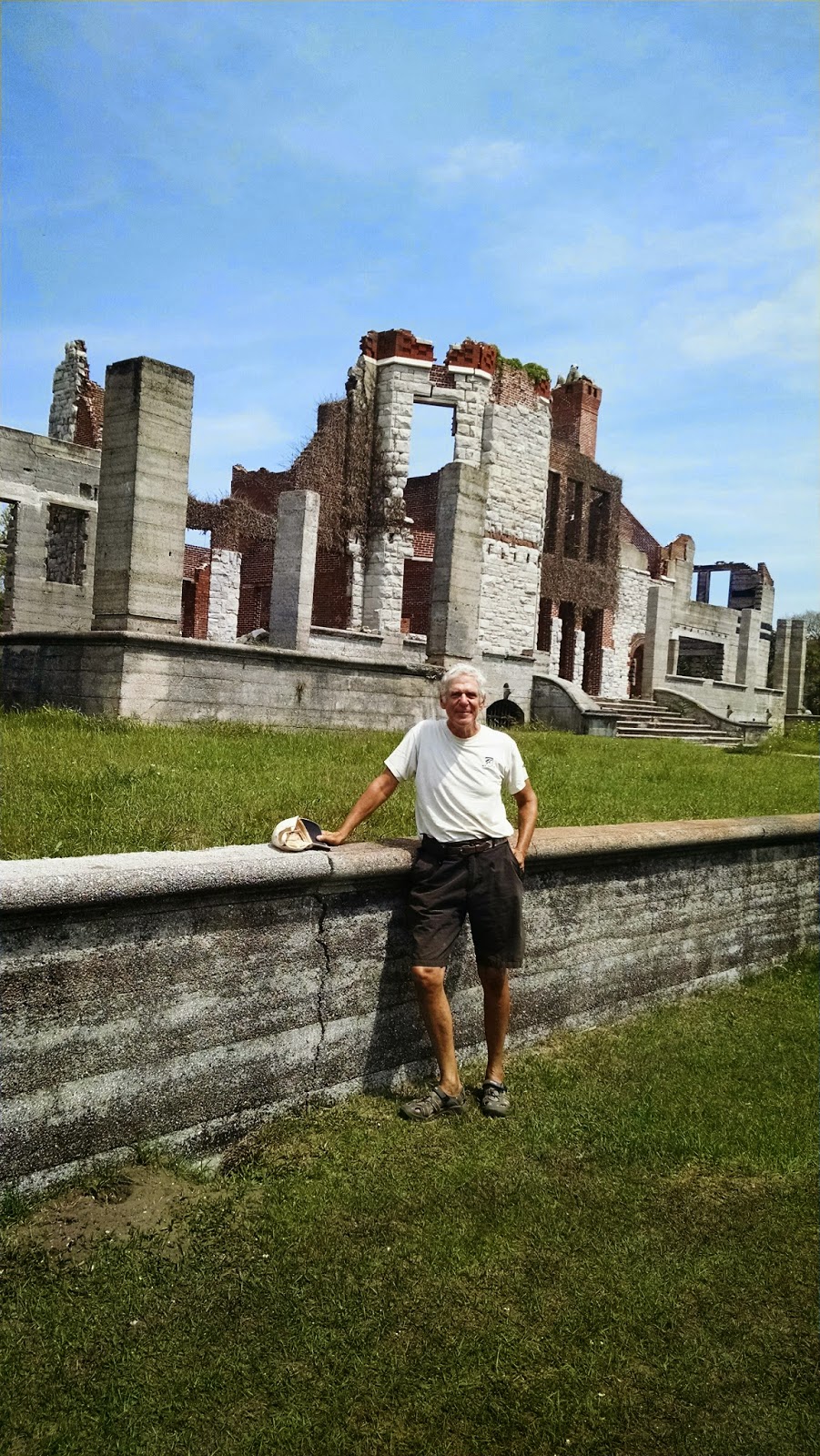
On our day day we were picked up by Bill and Sandy, and served a delicious brunch of baked french toast with ALL the trimmings in their home, with its commanding view of the Neuse. They picked us up at 9 and brought us back at 2:30, so we had a good long time for discussing boats, destinations, books, politics, families, etc.
River Dunes is a relatively new marina, with good wifi and showers. They have an exercise room, pool and sauna. It is very well maintained, only $1.50 per foot and we cashed in the one-time-only Annapolis Boat Show special offer of two nights for the price of one. We liked it here when we visited at about this time of year in 2012 and just as much this time. We hope Bill and Sandy will visit us in NY, perhaps on their way on the loop around eastern Canada aboard m/v Lucille. From NY they would go north on the Hudson, through the Erie Canal, into the Great Lakes, east through the Thousand Islands, down the St. Lawrence River and, after Nova Scotia and Maine, back to North Carolina.

Sunday, April 26, 2015

April 23 - 24 -- Wrightsville Beach to Beaufort, NC and Lay Day There -- 80.5 Miles

Underway from 6:45 until 4:00, outside in the Atlantic. Raised main in the harbor, because we were motoring directly into the wind. Then a brief two minute torrential downpour, a right into the inlet and another right outside put us on course for Beaufort. A straight shot at about 60 degrees for 69.1 miles across a good part of Onslow Bay, which is an 80 mile crescent from Southport to Cape Lookout. Out came the genoa and we were doing fine, on a port beat. But the wind was veering very slowly to the right, forcing us a bit more and more off course, not that this was dangerous: thousands of miles of the Atlantic were to the right. But then the winds came up strongly. The clinometer measures us while heeling 39 degrees.


The effect is more dramatic than shown of the clinometer.


We "buried the rail", i.e., water was rushing over the side deck on the leeward side.
So we furled the genoa, put a reef in the main and put out the small jib. Normalcy and safety restored. When the wind diminished a bit we were at a slower speed. Our objective was to be on our dock before night fall, so we turned on the engine and motorsailed. At one point we were pushed so far off course that it was time to tack. Then, instead of being pushed to the right of where we wanted to go, we were being pushed toward the left. As the wind continued to veer or "clock around" to the right, we were able to change course to the right, two degrees at a time, until our course over the ground matched the bearing to the Beaufort inlet.
We met two interesting boats in the inlet, a tug going in and a shrimper coming out.

Beaufort Docks is the municipal marina of Beaufort, with a large,friendly and knowledgeable staff. They gave each of us a wooden nickle, good (with a dollar for a tip) for a free glass of wine at the restaurant/bar of the marina. I had the house red both nights because Lene does not drink. Their showers are not fancy or spacious but clean, with lots of hooks, seats and plenty hot water. They provide a quality wifi at the docks. We used their courtesy car to get a propane refill at a fish store. And also, a delicious fresh flounder that the store fileted for us and Lene cooked that night. We also got groceries. and fresh engine oil for the next change. We each got haircuts from Rachel of Enchanted on the Lane. A mechanic came over to try again with the engine's intermittent rattle and did less but charged more than Leo of Jekyll Island -- nothing, except he gave his opinions.
Our other diner was at a restaurant called Queen Anne's Revenge, its food adequate. It was named after Blackbeard's pirate ship, that sank just outside the inlet through which we had entered.
The North Carolina Maritime Museum had a good exhibit on the recovery of the remnants of that ship along with pirate life generally -- free admission.
There is also a lot there about commercial fishing and outboard engines, but the best part of this museum was about what they called "indigenous boats." These are boats built of locally available wood and designed to do the work needed by the local population and the water conditions they are likely to face. It started with dugout canoes with the best explanation I have heard on how they are created and ended with the sharpies, a type of flat bottomed fishing boat first built in New England but modified and popular in NC waters. They had several full size boats and models in the display. Worth a lot more time than the two hours I had for it.
I also had taken a stroll through the historic town, three blocks by ten blocks in size along the waterfront. Strip shopping malls and other attractions and probably some lovely suburbs are outside of this historic area. Front street is at the waterfront, its business side full of restaurants and shops and, across the small park area to the right, the marina's docks. The kitties did not enjoy it here as much as they had hoped to because a man on our neighboring boat is allergic to cats and was not pleased when he discovered Alfie exploring his cabin. They had to remain aboard.


Old placarded homes, are on the other streets.


The Allen Davis house of 1774, picture above was used by General Burnside in the Civil War but it did not say which side he fought for.


A historic triumph for this rural town was when the Railroad was built here, allowing inland produce to be shipped to market. The Depot remains beside where the tracks used to run
and is now a civic meeting place with a museum including this recreation of the RR office. Both the Railroad office and our barber reminded me of my maternal grandfather who was a barber when young and retired from the railroad office when he got older.
As sections of the Atlantic coast of Florida have been nicknamed the gold, treasure and space coasts, Beaufort and several surrounding towns now call themselves the Crystal Coast. Someone told me this was because the Atlantic water is so crystal clear.
In 2012 we anchored out off the docks here and did not go ashore. We made up for that oversight this time. From here on until Norfolk we will be inside.

Wednesday, April 22, 2015

April 21 - 22 -- Charleston SC to Wrightsville Beach NC -- 155.7 Miles

We left at 10 as planned, but I screwed up reading the tide table so the tide was against us on the way out of Charleston, though weakly. We put up the main in the inner harbor and jibed it several times on the way out, past Fort Sumter where our Civil War began. Actually it began in SC, earlier, with the thinking of Calhoun, on the theory of states' rights to "nullify" federal authority, a doctrine now becoming popular again among the lunatic right in this country.
We turned left as soon as we reached the first buoy after the end of the seawall and put up the genoa as well. This was before noon but the wind was too weak and too far behind us, to move the boat with  any speed, so we motor sailed, mostly motored, until about 1:30. I even had taken down the mainsail. I had not realized how much of the first 109 mile long part of this passage, was more easterly than northerly and so the projected five to ten knots of west wind was behind us. Then came wind, much stronger than projected and a gift to us. I was able to get up half the mainsail, with double reef in it, and continued with the genoa. The wind built behind us and we were screaming along at seven to eight knots with peaks at 8.9. And with the wind about 120 to 150 degrees from our bow, we rolled a lot from side to side, most unpleasant. Lene felt a bit nauseous though she did not lose her food. We had a delicious cold dinner -- no cooking with the rolling. It was warm and sunny by day and reasonably warm at night, with no rain. But during the night we got some slow speeds, less than four knots and even though I did not put up the genoa again until near daybreak, it was this night part, as well as the first few hours, where we lost time
After dinner, at 7:30, we replaced the genoa with the small jib, a safety measure for nightime sailing in big waves, and were still making over seven knots with just the small headsail and double reefed main. We had put on the preventer to prevent accidental jibe of the mainsail, and with the small jib sliding back and forth we took it in and sailed under just double reefed main. The preventer was a good thing because the wind had shifted from off our starboard quarter, to off the port quarter during Lene's watch. We were sailing "by the lee" -- the way you get that accidental jibe. When I got up at one (Lene let me sleep late) we jibed the main and continued on toward the turning point - off the tip of Frying Pan Shoals, which extend many miles out into the Atlantic from the Cape Fear River. We saw very little traffic: Two big freighters passed us at quite respectable distances -- closest point of approach being miles away -- and one sailboat overtook us, headed for Beaufort. I saw his lights and estimate he was 200 yards off our starboard side, moving a fraction of a knot faster than ILENE. Prior to the close passage I had a radio conversation with him to confirm what each of us was going to do.
Once around Frying Pan, at about 4 to 5 am, we turned north to Wrightsville (The Masonboro Inlet) and the wind came up from our port quarter to its beam and even forward of that. This second leg was only 32 miles and wind speed varied considerably during the leg, as, consequently, did boat speed.
It is hard to get good pictures of a night passage so at least I have the long awaited dawn.

Masonboro Inlet is easy, wide, well marked and flanked with seawalls. Once in, it is easy to get to the anchorage area and we dropped at 1:30, only 90 minutes "late" compared to our projected schedule that would have averaged 6.5 knots. Nice homes line the bay side of the barrier island.
We put out a lot of chain because there is lots of room and 20 knots were predicted for this evening. But by 4 pm it was howling at up to 40. We visited Wrightsville and made the reciprocal of this same ocean passage, to Charleston on our way south last fall and hence felt no need to lower and raise the dink to stretch our legs in Wrightsville. Tomorrow: Beaufort NC, about 80 miles and if the forecast comes true, a beam reach  or close reach from the port side, with five to fifteen knots.
I  tried to take a photo of the pod of dolphins playing under and around our bow, taking the Ipad up there, but they are way faster than ILENE at eight knots. I took maybe 50 shots and only one, a video of less than one second, caught a dolphin. These were not the slow graceful swimmers in the ICW but racers amidst the big ocean waves. I couldn't get the video into this post but it is on Facebook. I did manage to neither fall off the boat nor drop the camera.
Ilene is a true member of this crew and a solid citizen on overnight passages. She grumbles a bit and still relies on me, and I have to admit I like the  second part of that. She is even taking an interest in the charts, tides and weather. I couldn't make this trip without her, physically, mentally or emotionally. We have some chores that each of us do most of, but both of us do many of the chores. She said she liked our 25.5 hours together.
On our honeymoon on the old ILENE, in August 2002, we spent a pretty terrible 36 hours in a nor'easter off the coast of Maine  The boat got beat up (torn sail, water inside through the dorades, compass light out) and we got beat up too. After a good night's sleep Lene asked, "Where do we go next?"  I replied "God, I married the right woman!"  And that has become truer with each passing year.

Tuesday, April 21, 2015

April 20 -- Beaufort SC to Charleston SC -- 57.2 Miles

I forgot something that happened in Beaufort, probably because I'd rather not remember. While we were in the theater we heard a loud storm going on outside. Some water came into the boat through the mast boot but that was easily picked up. I learned to dispose of a used American flag with respect. We had retired one at the beginning of this cruise which had been torn to tatters by the wind. But the wind tore our newish flag -- and its flagpole -- off from the boat. I will figure out a more secure way of attaching the next one.
Yes, I know I said we had decided to anchor in the Stono River, just short of Charleston, but our speed was so good today that we made the 3:30 opening of the Wappoo Creek Bridge and never had to deal with the fact that if you don't make the 4:00 opening, you have to wait until 6;30. It seems by dumb luck, we had favorable tide and the deep water of high tide most of the nine hours we were underway from 7 am to 4:00 pm. The favorable tide is proven by our average speed - 6.3 knots.
I have thought of several additional reasons why it is impossible for that hypothetical Ph.D. to figure out a tide algorithm. It depends on where in the river you sail: in the center the tidal flow is different from nearer the sides. It varies during the six plus tide cycle, slow at the beginning and end and fast in the middle. At bends in the river, one side flows faster than the other. And when you add in motor-sailing, as we did all day today, your speed will depend on the wind direction and speed which vary from minute to minute, relative to the boat's course which was a near continuous curve, and on the diligence and skill of the trimmer. Today the wind was generally from near our stern and the small jib self jibed many times, as it is designed to do. I hope to never mention that crazy hypothetical algorithm again.
It was a cool but not cold day, warming up in the afternoon, with hazy sun poking amidst the light clouds. No rain.
We had two small problems near the end. I bumped into the throttle lever while walking past the binnacle, decellerating our RPMs and bringing back the "alignment" problem that we hoped we had fixed. The rattle was back and big time. But coming to neutral and building up the RPMs slowly -- the rattle was gone again. Something is still wrong and needs to be fixed. Shortly after this I think I caught a crab pot float on our rudder. The wheel became very heavy to turn and our speed was considerably slowed. I think that a crab pot was the cause of the problem but we don't really know. I turned the boat several times and slowed her and if it was a crab pot float, it fell off.
One of the crew at work, doing what he does second best (first is eating!)


Here is Charleston from our anchor on the Ashley River. On our two prior visits here we took a dock at an excellent marina on the Cooper River, on the north side of town, which was full tonight. But we had no plans for sight seeing this time and did not lower the dink.

We have also determined, subject to plans D, E and F, etc., tomorrow's (and the next day's) passage: to the Masonboro Inlet and the anchorage of  Wrightsville Beach. At 6.5 knots this will take 24 hours, anchor to anchor. We plan to leave about 10 A.M., with favorable tide flushing us out. Decent wind from the west is predicted.
We have also determined our planning deadline for arrival back in NYC -- June 7. Lene's niece, Barbi, and her son, Trevor who we hung with in Amsterdam last June, are visiting and will arrive on June 10. We would like to get home a few days earlier to get settled and unpacked, and those few days also serve a second purpose: as a buffer in case bad wind prevents the Atlantic overnight up the Jersey coast, as it did when I helped Jim bring his 26 foot "Aria" up in about 1996.

Sunday, April 19, 2015

April 17 - 19 -- Redbird Creek to Beaufort, SC and Two Lay Days There --66.5 Miles

We hauled the anchor at 7:15 to get to Hell Gate about 30 to 60 minutes before high tide at 8:40, measured at a tide station only 2.5 miles from that canal. It was cold and windy -- in the wrong direction -- but we passed through Hell Gate with no less than nine feet of depth -- about six more than would have been there at low tide. We got such an early start and partial favorable tides, that we changed our destination from Bull Creek to Beaufort SC, which had been scheduled as the next day's destination; we got onto a mooring, rather than their dock where we had stayed our last two times here at 5:05 pm.  Generally the tides were running to the sea from high tide near Hell Gate for six hours and then rushed upstream. The course was so circuitous and involved going upstream on some rivers and down on others that it was always a surprise to us when we entered a new segment to find out which way the tide was flowing. With 2500 rpms on the Yanmar our speed varied from 4.8 to 8.4 knots depending on the current. Maybe some Comp Sci Ph.D. could solve the riddle of when is the best time to leave from point A to go to Point B, depending on your boat's speed, unadjusted for tide, and the date in the lunar cycle. But I can't game nature. I mentioned hairpin curves and here is an early part of the passage
from the pliers at the right, through Hell Gate  at the screwdriver tip, upper right, past one hairpin curve above the big washer to just above the wrench jaw at the left. Overall,  the course for this segment was about 30 degrees, or north of northeast.
The portion of the day's passage before we got to and crossed the Savannah River was new to us. It took us past Thunderbolt, the boating capital of Georgia. We had heard so much about this place, so close to Savannah, including that the marina brings you a free Krispy Kreme doughnut in the morning. Here are its boatyard and marina and a big beauty. I wonder how she got in this far from the sea with her mast vastly exceeding 65 feet in height.


We also passed Paris Island and Hilton Head, both of which I mentioned during our voyage south last fall.  We tried to motor sail in the afternoon, when we got to Port Royal Sound and the Beaufort River the last 14 miles, but the wind had died down and our speed brought it to our nose.
Our stay in Beaufort was quiet. Unlike our last two visits here, we took one of the marina's moorings. We used the marina's courtesy car to spend $290 at the Publix on Ladies Island, across the river. We off loaded several days of our garbage, filled our four one gallon water bottles, met with friends, including a pot luck dinner ashore. We had planned only one lay day, but the forecast weather seemed worse on the second lay day and we like it here so we stayed.
We made a date with Carla, co-owner of another Saga 43, "Reverie", as she was driving past this town between Charleston and Brunswick. But she had a friend as a passenger who did not want to stop, so our rendezvous had to be put off until the fall when, hopefully, Carla and John, who we have not yet met in person, will be driving through New York on a day when we will be there.
We spent some time discussing whether to divide the segment from Beaufort to Charleston into two halves, as we did on the trip south, but in the end decided to go almost all the way to Charleston and anchor in the Stono River, just south of the city. This solution avoids two problems. 1. It is hard to find a berth in Charleston due to Race Week. 2.  There is a strong tide under a bridge that is closed for rush hours which we have to pass at the end of another long day, just before Charleston.
We saw a matinee of Noel Coward's "Blithe Spirit", at the USC Beaufort campus theater. We sat next to Louise and Jim, nice folks, who recommended "Narrow Dog to Indian River" by Terry Darlington, which I am recommending to Dick and Elle.
Though in a university setting, the show was put on by the local theater group and funny, a farce: during a seance with a medium a man's wife comes back as a ghost visible only to him and torments his new wife. And only $20 per ticket for good seats.
And having had dinner and breakfast at Low Country Produce, located in the former City Hall, during our trip south, we had lunch there this time. Innovative inexpensive food in a place with cloth napkins  which also retails its food; one sits among display cases and racks.
The dink is hauled and we have to get underway early tomorrow to make the 7 am opening of the Ladies Island Bridge, less than a quarter mile away, or wait until 9:00.

Friday, April 17, 2015

April 15 -16 -- Jekyll to Walburg Creek to Redbird Creek -- 60.6 and 14 Miles, Respectively

We got underway from Jekyll late relative to the tide, at 8:30, due to the need to fuel up. But the first  time we went aground it was solely my fault: Green on the right northbound in the ICW,... I just wasn't thinking. But no biggie; we backed off easily and quickly. The second time it was the fault of the lack of dredging in the ICW: we were in the center of the channel and while we were not stopped, the alarm was ringing and the fathometer said we had only five feet of water so we were dragging the bottom six inches of our keel through eight inches of very soft sediment. But after the first two miles of the day's passage, depth was no longer a problem.
St. Simons Sound, gateway to the commercial city of Brunswick, is quite deep. And the tide flowing out, southeast, was favorable, very favorable, so we were motoring at over nine knots. Once clear of the channel we motor sailed during the morning but once the wind came up (a broad starboard reach) we sailed without motor in the afternoon toward St. Catherine's Sound. A very pleasant sail under warm and sunny skies. Other than two shrimpers who were working St. Simons Inlet, and a sailboat we were catching up to off St. Catherines Sound, we saw no other boats. We even enjoyed good tide after the jibe, going west into St. Catherines Sound, making eight knots with just the main.
We had started with the plan to go to Wahoo Creek in the Sapelo Inlet. (Most inlets around here are named after the rivers that flow out of them and most are named for Saints: John, Mary, Catherine, Simon -- maybe it was from the period when Spain was influential here?) But while out there, we found that St. Catherines was only ten miles further and we had lots of time to get there before dark, so plan B went into effect.  Nearing arrival, we saw rain clouds gathering to the west, ahead. When we set our anchor in Walburg Creek a light rain had begun and while I was attaching the snubber and securing things it got torrential. Nothing to do when the boat was finally secure but take off all clothing -- everything was saturated -- towel off and put on fresh clothing before dinner.
Walburg Creek is bound by marshes on both sides and sparsely inhabited on land or by boat. We had a scare in the middle of the night when the tide had gone out and we showed only eight feet of water, rather than fourteen, and were dangerously close to the south shore. The wind had come up and the tide was flowing. I got Lene up and she started the engine. I pulled up the anchor, Lene moved us maybe 50 yards to a better spot (there was lots of room) we dropped and set it and, after watching, we went back to sleep. Lene, who edits these posts, criticized me for failing to express our sense of terror while picking up and re-anchoring in inky blackness with current flowing fast and wind howling. She is correct.
In the morning the plan had been to sail to Bull Creek, up in Tybee Roads, which is the entrance to the Savannah River, near Hilton Head. The outside route would have been 43.2 miles as compared to 48.9 via the hairpin turns of the ICW. But the wind was from the north at up to 20 knots and especially for the 20 mile plus outside part of the passage Lene was not enamored of beating into that stuff on a cold grey day with rain forecast. And I was not looking forward to it either. There is a saying to the effect that "Gentlemen do not beat." Beating into strong wind in the ocean beats up the boat and the boaters. So Plan B: inside. But blocking the way was Hell Gate. It is a portion of the ICW, a canal, only .6 miles long, connecting the Ogeechee and Vernon Rivers. But with our draft, we cannot get through except at very near high tide. And the tide was already flowing out and we had a couple more hours to go, so: Plan C: Redbird Creek is a totally uninhabited creek through the marshes and only 4 miles from Hell Gate. It was tricky in Redbird when the strong wind was blowing from the north while the tidal current ran the other way. ILENE did not know how to lie on her anchor. The good news is that the anchor held. No one came through by day or night; it was just us and the kitties. And very dark at night, being for from civilization. We arrived in the late morning with plans to leave in mid afternoon, but stayed the night. The views: N, S, E and W; are impressive for their blandness. At low tide one is six feet lower and sees less other than the banks which are closer.


Thursday, April 16, 2015

April 12-14 -- Fernandina to Jekyll Island's Harbor Marina -- 23.9 Miles

Amazing! This is the 365th post to this blog since it began in October, 2010.

We were underway from 8:15 to 2:30.  We went very slowly up the west side and north side of Cumberland Island, across St. Andrews Sound and up Jekyll Creek, on the west side of Jekyll Island. A new stretch of the ICW for us. We went slow because we wanted to arrive when the tide was an hour before high. We passed the huge King's Bay submarine base, but without sighting any of those killing machines. We passed Cumberland Landing,
on the north side of that island, where the packet boat used to land. We also passed the abandoned lighthouse and saw a buoy that has apparently detached from its mooring and washed ashore. The NY Times had a nice article about the men and women of the Coast Guard vessel that services the buoys in the NY area. In the ICW most "aids to navigation" are not buoys, but numbered red triangular and green square signs posted on pilings -- cheaper to maintain.
But this passage, with a few quite shallow patches, was deep water, 40 to 50 feet, deep enough for nuclear subs, so buoys are necessary.
This Marina is a well loved one, essentially a long dock along the east side of the creek to which all the transient boats are tied, this from its free postcard.

Here is ILENE under the live oak tree from the shower house, laundry and restaurant. Her mast, with its distinctive double forestay is in the center.
My first chore was to change ILENE's engine oil and filter. The marina takes waste oil for $2 per gallon, and I paid $2.50. We have a good pump that sucks waste oil out of the engine through the dip stick hole. You have to run the engine to get the oil hot before sucking it out but this was not a problem in that we had been running since early in the morning. But I realized that when you think you have gotten all the old oil out you have to wait to let more of it drip down to the bottom so you can suck out more of it. This time I pumped one pump to many and some oil gushed out from the bottom of the canister onto the cardboard box that I had set under it to catch spills. I'm hoping I did not ruin this tool and will be able to fix it. I was also able to twist off the old oil filter without dropping it and spilling its dirty contents under the engine. Patience, and resting and drying hands just before it came off was the key. Lene helped out at the stage when you pour the dirty oil from the canister of the pump into the recently emptied oil cans for disposal. She steadied the receptacle and the funnel while I poured. No mess! Then, using a tiny bit of laundry detergent and a stiff brush, I got rid of 99% of the remaining one percent of the pelican poop from the blue canvas.
 The Marina is extremely friendly and provides good, movie watching quality, wifi; Lene has watched a lot of TV shows. They also have bicycles and a golf cart, which we used for the limit of 90 minutes per usage, for shopping at the IGA.
It is a very small store with limited selection and high prices on the east (Atlantic) side of the island, which is being developed with homes and hotels. The one drawback is insects, which bite, especially Lene. Rain has been predicted for the last week, including very high probability several of the days, but it did not come. During this passage the grey lowering skies suggested rain but it did not come until about an hour after our arrival, and lasted for about eight hours.
Because we were spending three nights and two days here, I asked the marina staff for the names of people who wash bottoms, change oil of outboards and align propeller shafts. Leo Ross, 912-266-1323, looked at the alignment, first. "Well", he said, "with the problem being intermittent and only at certain speeds, it might not be an alignment problem at all. Let's take a look."  I had cleared out the aft compartment so everything was ready for him. "What's this? A motor mount bolt!" he quickly noted, picking it up from the bilge. It seems that the engine was held on its shock absorbing mounts by only three of the four bolts and those three were loose too. And the flange at the forward end of the propeller shaft, which is held in place on the propeller by two set screws, was also loose! After everything was nice and tight, I ran the engine at pretty high speeds in forward and reverse while tied to the dock and so far it looks good, very good indeed. But the acid test will be trying this while underway.
As to the outboard, it needed both its engine oil, which I had, and its lube oil, which I did not have, to be replaced after its 20 hour break in period. And the latter requires a special tool to force the new oil in from the bottom hole until it flows out of the top hole. I will get that tool for next time. Leo went to Westmarine on his break and bought the lube oil. He let me help him and taught me how to do this, including whacking the screwdriver with a hammer to shake lose the tight seal.
Leo looks like a refugee from that Dynasty Duck program but he is a set man, a good teacher, knowledgeable and charges a very fair amount A diver came and scrubbed the bottom and reported that my zincs have 75 to 80 percent left but that the wheel that, when not clogged by seaweed tells us how fast the boat is moving through the water (as compared to over the ground), is broken.
With all of the repair activities we did get time to use the pool and hot club, or do the sightseeing I would have liked. They have a free museum which also offers a $16 guided tour train ride through the historic old town district on the island's western side, which the Macys and Goodyears and other people of wealth set up in the 1890s. A reason to come back! Our last evening we did have a pretty good meal at the annex of the historic dowager but quite busy Jekyll Island Club Hotel, where the rich hob nobbed -- and still do. The Club sent over a van to pick us up and bring us back to the Marina.

Saturday, April 11, 2015

April 9-11 -- St. Augustine to Cumberland Island, Lay Day There and then to Fernandina-- 58.7 Miles and 5.3 Miles

We dropped the mooring at 7:15 to make the 7:30 opening of the Bridge of Lions. We made our way to the inlet using the charted buoys. But from there out to deep water, the buoys are not marked on the chart because they are frequently moved as the waves push the sand around. The marina provided us with a very helpful aerial photograph with the buoys shown. It would have been more helpful for readers had I been able to get this rotated. You can see the white beaches through which we exited and then it's simple: Just stay between the reds on your left and greens on your right until "STA" for St.Augustine, the red and white buoy at the open end. Except the buoys are a lot smaller than the dots in the photo and appeared as black dots in the rising sun. We never saw less than 17 feet of water.
And the seas were flat calm, making it easier. Even though when we got in the ocean we put up full sails, we had to motor. Flat seas made a turtle near us visible, however, as well as numerous dolphins.

We lost half an hour when the engine stopped. After tinkering with the filters and switching to the other fuel tank and hand pumping fuel with the hidden lever, she started right up again. During this time the sails were doing little good, 1.8 knots over the ground. A few miles later I noticed that the interlocking Allen head bolts that hold the eye splice at the bitter end of the main sheet in place in a block were missing. Luckily I found the two parts on the deck and locking the boom in place with a different line, I reinserted them onto each other through the splice and used blue Locktite so they will hopefully not fall apart by themselves again.
Around noon the wind came up on our starboard quarter, strongly enough to move the boat at a bit more than five knots. It was such a pleasure to sail, without the noise, that we shut down the engine even though we were making only five knots, a lot less than the 6.5 we had planned for.  These big guys were anchored in our path, about three miles off the mouth of the St. Johns River leading to Jacksonville.
At about 4:30 we gybed for the left turn into the St. Marys River and felt the effect of three knots of adverse current, making only 2.8 over the bottom until we augmented with the engine again. Another gybe and we were headed north up Cumberland Sound where we anchored in 15 feet of water with 60 feet of snubbed chain at 6:30; a long day. We were near s/v Seeker
and Earl and Kathy invited us over for a delicious fun dinner as soon as I got the snubber on and the dink lowered. He is a psychologist who taught groups of corporate executives. They are newly retired and planned to haul Seeker until the fall at nearby St. Marys, where s/v Pandora was earlier this year, They have interesting summer plans including a motorcycle ride from NC to Alaska and back.
Next day I put cat proof screening in the four starboard side opening ports using proper fitting spline that we had obtained in Cocoa. The tops of ILENE's interior cabinetry give our felines access to these screens which they had clawed.
In the afternoon we went ashore and toured the ice house museum and the ruins of Dungeness, the largest (37,000 square feet) of the Carnegie family mansions on Cumberland island. Lene at front; Roger at rear entrance.


We also visited the beach.

The island is 13 miles long and its very clean wide lovely beach is almost unused by humans. Behind Lene is the view to the south and behind me, the north.


In November we saw a few of the horses, but at a distance. Today we saw many and they came close.
Three in the meadow
Three on the trail from the beach, walking past us.
One of the three passing us.
Three more on the beach, one of whom is interested in making more horses.
There is a no-touching rule honored by the humans and the equines. I
keep thinking how much my youngest daughter would love this place though she would not like the law prohibiting the Park Service from feeding, sheltering, grooming or providing veterinary services to the horses. They fend for themselves and are rather small compared to the hunters and jumpers she works with..
Back on ILENE, we prepared for the predicted thunderstorm by letting out twenty more feet of scope. There was no one within several hundred yards of us. We saw the thunderstorm both on radar pictures and in reality, and heard it, moving north, just west of us. No rain and no wind for us.
Our next stop was supposed to be -- and will be -- Jekyll Island, but they had no room for us the first night so we backtracked, south, back into Florida, and took a mooring off Fernandina. Lene wanted to go to the farmers market, where this impromptu group was jamming.
I took this photo just after the two fiddling ladies had left. I walked about a mile further and got two oil filters, one to install at Jekyll and a spare. I also picked up To Kill A Mockingbird, my book group's selection for the May meeting, and a delicious Pecan roll to enjoy with the dinner at the end of Passover.

Friday, April 10, 2015

April 6-8 -- Three Lay Days in St. Augustine -- Zero Miles

Laundry, cleaning and shopping, the usual, except for the shopping which we did by dink to a Publix less than half a mile from a dinghy dock which was about 2.5 miles north of our mooring and on the other side of the shoal infested harbor. We took Lene's i-Navx with us and ended at a boat ramp where Arnis met us with his truck and trailer, took our dink and gave us and our five bags of groceries a ride back to the marina. Two days later he picked us up on the street in front of the marina, drove us back to the boat ramp and launched the dink so we could drive her home to the marina and later to our boat. Hopefully, the gash is history. He said he put a patch on the inside (how the heck is that done) and then a larger one on the outside in addition.

But life is more than chores and repairs. We visited the Villa Zorayda, built by a wealthy Boston man in the 1880s to resemble the Alhambra palace in Grenada Spain, where he had traveled and fallen in love with things Moorish. Of course it is much smaller than the original but its rooms have the same names including a two story central atrium, like Viscaya in Coconut Grove, a harem room with an overhanging window through which inhabitants could look out without being viewed. The house was stuffed with furnishings from throughout Europe and the Middle East, including a "cat rug" in which a mummy was found buried in a pyramid. The house later passed into the hands of a Mr. Mussalem, a respected dealer in antique Oriental rugs and later became a hotel, speakeasy and gambling club. I just loved the floor, composed of square tiles that are each identical but arranged to form two patterns.

I walked to the Lighthouse and back, about four miles round trip. But I could not climb the  219 steps to its light room which was closed for painting. So we were given a guided tour by Don, a retiree who seemed to love his subject. Much of his talk had to do with the work done there and the processes of the preservation of parts of sunken ships, as was done the The Vasa in Stockholm (Blog June 2014) and about a wooden boat building project.
We toured the home that the two lighthouse keeper families and their assistant shared and I thought of the similarities of the US and Scottish lighthouse services. The lighthouse is on Anastasia Island and I checked out the St. Augustine YC, on its eastern side, behind the barrier island, while there.

I visited two historic houses, first the Pena-Peck house, built as a Spanish style open home around a courtyard with shutters but no windows behind them for the Spanish Tax Collector, Senor Pena. After a second story was built in the English style, it became the home and office of Dr. Peck of Whitestone, New York and his family. His decendents lived there until 1931 when the last died childless and the house was given to the city. My docent there was a Ms. Policer,
who had moved back to this area after her husband retired from his work in California. She mentioned that Dr. Peck had lived in the Ximenos-Fatios House, a few blocks away (everything is only a few blocks away in the center of this historic town). I had planned that as my next stop and learned that the house had been one of several boarding houses that competed with hotels in the mid nineteenth century. They were run by women and served nine course dinners as well as multi course lunches and breakfasts. The two names represent the names of the first and last owners during the period that was of interest to the preservationists and in reading the placards I learned that one Menorcan (I would have said Minorcan) woman whose surname was Policer, had married a man who had built or owned this house early in its history. So maybe, my docent at the first house was of Menorcan descent and has roots in St. Augustine that go way back, which she did not mention. Another thing: tourists did not arrive by railroad, car or boat (or airplane); they took a steamer up the St. Johns River past Jacksonville and then by stagecoach, east from that river to St. Augustine.

One attraction that I did not visit was El Galleon, from Spain, which will be here until june and plans to visit Philadelphia next. To get under the Bridge of Lions, she had to trim her spars fore and aft and squeeze through with inches to spare.

Anchor is "catted"


We had two good restaurant meals, the first at Columbia,
which we had visited in 2012, and the second at Collage, a newer place which was one of the few "fine dining" experiences we have treated ourselves to on this trip. Excellent service by well trained, well dressed, efficient, lovely, young ladies and interesting imaginative food. In New York such a dinner would have cost $100 per person; here it was half that. In hindsight the two meals share one thing in common: local spicy smoky red peppers. At Columbia they were stuffed with chorizo and spanish ham and baked under an almond sauce and at Collage they were pureed with carrot in a soup.
And we had a pumpkin/mango pancake breakfast

aboard ILENE with Earl and Kathy of s/v Seeker, friends of Dean and Susan who introduced us to each other in St. Augustine on the way south. One of my favorite feelings is the joy I get when I introduce friend A to friend B and they hit it off. Thanks, Dean.

St Augustine still has several attractions that, even after three extended visits here, we have not seen.
Sunset from our mooring.