"There is nothing more pleasant than cruising on a boat with the whole family."
Letter from Empress Catherine the Great

Friday, August 11, 2023

August 8 & 9 — Days 32 & 33 — Grimross Island to Douglass Harbor in Grand Lake to Evandale. — 14 NM

Two more  non sailing, all motoring days. Our fifth and sixth in a row. It’s partly lack of wind but even with wind it is often expected when River cruising. The interesting part of the two passages was the Jemseg River, between the Saint John River and Grand Lake —  and it is big! The Jemseg runs at an acute angle off the Saint John. It reminded me of the Dismal Swamp route of the Intra Coastal Waterway (through North Carolina), but no “deadheads” (submerged tree trunks) to contend with here. Also, because it is wider, we did not have to contend with our masthead instruments getting caught on the overhanging tree branches.


Once through the Jemseg, and out into the Lake, the first few miles is a very well buoyed (red and green every 700 feet) channel until the lake is deep enough that folks can go wherever they want. Another reminder of our ICW because for many miles it runs through water that is a mile wide, but only a few feet deep, except in narrow, dredged, well marked channels. Finally it reminded me of the ICW in the low country areas with water grass and lilies at the sides.

Eight  miles of  each day’s passage were coming and going in the Jemseg and the channel out into the Lake. The water was as shallow as 12 feet deep, at spots, more than enough and more than in most of Eastchester Bay, but still, these are NOT our home waters.

Our first destination was Douglas Harbor on the north shore of the lake. Is is a favorite destination among boaters here with many boats moored in its eastern part, called “The Bedroom”.


There are beaches nearby, trails, a restaurant, etc. The problem was that the weather was not cooperating. We got on a choice mooring operated by the Club, near the dock, which would have been ideal.

But shortly after our arrival the rain came, and it stayed, sometimes heavy and other times light, until 10 am the next day. So while we visited Douglas Harbor, we did not experience its pleasures. We saw no one aboard, going to or coming from any of the many other moored boats. Disappointing.exiting the Harbor, into the Lake, you can see it’s still gloomy.

A mistake when exiting: I cut to close to the shoreline. ILENE’s depth sounder alarm honks at seven feet, 14 inches before the crunch. It did not, because when I glanced at the indicator and saw eight feet I swerved away from the shore. Another harmless mistake I failed to report from a few days ago. I pressed AUTO and left the helm to attend to some other issue. Suddenly alerted to the boat turning sharply I rushed back and put us back on course. It was not Auto’s fault that time. I had pressed a button but oops, not AUTO. 

We were underway for the second passage at 10:40 and arrived at the Evandale Resort at 3:55.


Evandale has docks and only one mooring, which we had reserved. So no question which mooring was ours.

Letting down the dinghy I learned that I had failed to pull the drain plug of the dink when hauling it at Grimross. It was half full of heavy rain water from the night’s rain which had also gotten into the sealed plastic bags of garbage we had stored there. I pulled the plug, let it drain and washed it before reinserting the plug and lowering it. 

The Hotel is right next to a drag ferry launch site. The ferry, seen here at the far shore, drags itself back and forth along its cable, seen here buried on the near shore.


These ferries seem to be in near constant motion. It does not take long for two or three motor vehicles to drive off, to be replaced with others going the other way. And then another crossing. I investigated: it is a relatively low cost infrastructure, compared to building 70 foot high bridges, operates 24/7 and is toll free, like the Staten Island Ferry.

The hotel has a snack bar, a small store, good showers, two washers and two dryers and a very friendly staff. We did laundry, took showers and had dinner at the Inn. Back in the 19th century, the river was a passenger route and the steamboats made a stop at Evandale. 


Along the shore we saw cows:


Tuesday, August 8, 2023

Aug 7 — Day 31 — Frederickston to the Upstream Grimross Island Anchorage — 21 NM

 While at Frederickston we decided to go to Douglas Harbor on Grande Lake, a short detour. But it seemed too far for one passage. So where to stay along the River? With good weather today,  but not tomorrow, it was better to go further today.We passed Oromocto first, and we liked it, but it was not far enough. Next came Middle Ground, an eye shaped island where RKYC had stayed during its cruise,  but also too near. Ox Island was third, and “Pyerates Treasure”, who we had met in Oromocto, had graciously offered us the use of their mooring there. But we pressed on,  motoring with the downstream current the whole way (though I did twice fly the small jib, briefly, but to no avail because the light wind that was available curved with the river to stay on our nose). 

This screen shot illustrates the dotted pink line (solid red on the paper charts), that have been added to show the correct route so boaters will be less likely to get lost. This one passes on the correct side of red buoy “H28, but would take users over a patch of 6’6” water where I’d prefer not to be. Darker blue water is shallower and the shot shows two solid pink lines on the left, representing our track upstream, toward the left, and down. Though the water in the river is higher than normal, I took care to stay in the light blue part of the River, however skinny that piece of water was. 


Then we came to Grimross Island, very close to Gageville. The bulk of the river passes on the west side of Grimross,  but a bit of water also passes its east side, which is wide, but mostly shallow for most of its length - less than five feet deep. At each end, however, the chart showed there was deep enough water for anchoring.  We chose the upstream end where we anchored in 12.5 feet of water with 60 feet of snubbed chain. We were and remained the only boat in the anchorage with more than 450 feet of water to either shore. It is a pretty nice spot with a view of the bridge we had just passed under.

The blue dot toward the top of  the satellite view of  Gatesville shown in the last post is our location on. Grimross Island was not mentioned in the very thorough Cruising Guide; this worried my mate. There was one drawback: close proximity to Route 2, the Trans Canadian Highway, which passes nearby. But we live half a block from Broadway in NYC so street noise is common for us. 

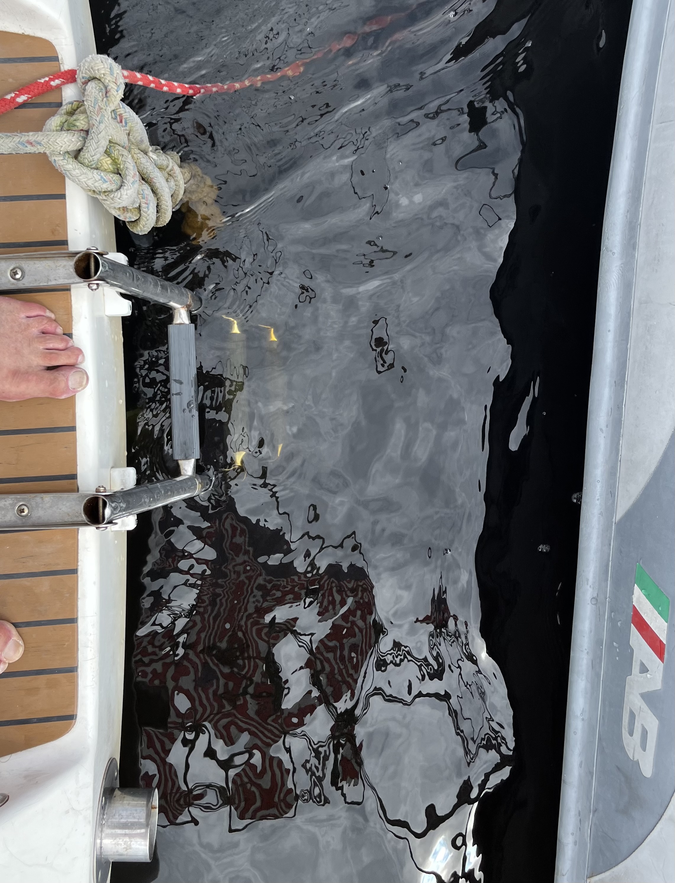
We did not go ashore, saw no dinghy dock and while a beach landing was possible, we might have been trespassing.  But I lowered the dink to try out the alleged fresh warm River water. Well not warm but comfortably refreshing like an unheated pool at home. The taste test (I did not swallow) showed no hint of salt. The water is quite clear but has a tan tint as shown by comparing the top rung of the swim ladder, above water, with those below water. 


I used to be a strong swimmer, distance not speed or form. I have gone into every body of water I could get to, including, last June, Arctic water in the pool of a cruise ship. This was my first New Brunswick water though.While in the water I cleaned the dink and ILENE’s rudder.
The  main sheet, through repeated tightening and easing had developed a twist that seemed to stiffen it and interfere with optimum performance. While on anchor we reverse twisted it. Time will tell whether this “fix” will work.

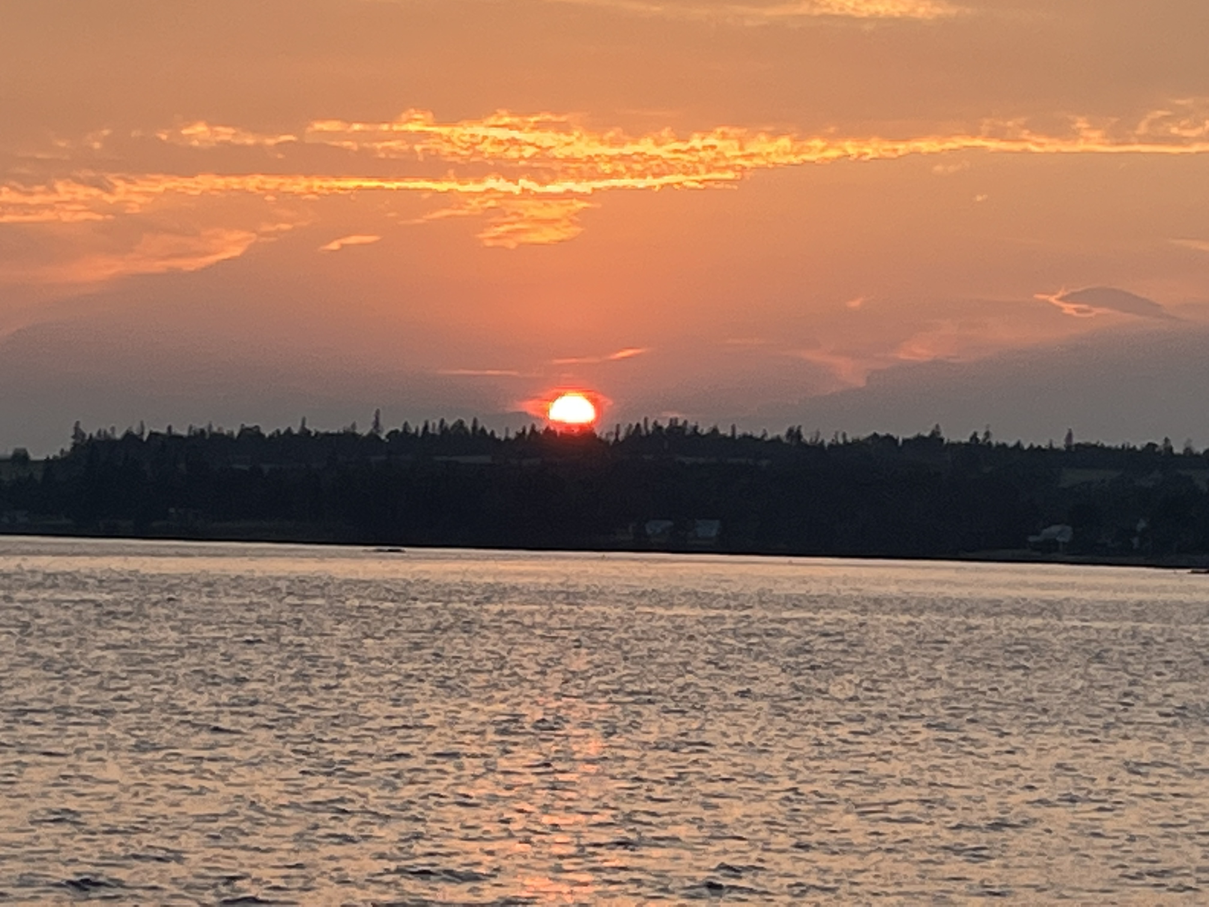
Whenever Lene expresses doubt about whether cruising is fun (and the weather this trip has given her cause for such complaints) I show her pictures like these as reminders of the joys of cruising.


A beautiful simple Al fresco dinner of delicious boat cooked food in our expansive cockpit dining room followed by a good calm night of sleep. 

Monday, August 7, 2023

Aug 4, 5 & 6— Days 27, 28 & 29 — Jenkins Cove to Gagetown, to Oromocto and to Fredericton — 20 & 17 NM

 We motored at five knots out of the sheltered serenity of Jenkins Cove


the three miles to and through the well marked passage from the nine mile long Belleisle Bay

between bigger Hog Island and smaller Pig Island, both low marsh islands. Until we got to that passage, the wind was directly in our faces at 20 knots for apparent wind of 25. Immediately, once back in the river, the wind came and remained very close to our transom at 15 knots apparent and we used the small jib without engine, again making various speeds, but probably averaging four knots. The wind was stronger than the day before, but we still used the engine, twice. Once was on a short  zig into waters where the wind was cut off by the hills until the zag, during which we made 1.2 knots and took lunch, before motoring. The other time was after speaking to a drag ferry Captain. She asked me to hurry across her cable. Another beautiful sunny day. 

The next two passages were on windless days so all motoring. We passed more beautiful riverside scenery. More hilly to port.


And more marshy to starboard; but the marshiness was only apparent—  cattle were grazing near the edge. 


Gagetown is a tiny town (I’ve marked with a horizontal red line) in narrow Gage Creek (the thin vertical black line at the side of the town)  on the straight side of Gage Island (that I have marked with a vertical red line).  A Marina, specifically a dock parallel to the creek, near its hill-backed mainland side also offered a row of about half a dozen moorings along the other side of the creek. The River’s main stream, wider, deeper and marked on the charts with a red solid line  (indicating it is the preferred and safer route, runs in a “C” shaped bend, the long way around Gage Island. It starts in the lower right in this view and after curving around Gage Island, continues up in the upper left corner. (Gage was the British general who defeated a French one here long before our revolutionary war. (Ignore the blue dot in the upper part of this picture, for now.

Communication with the marina proved difficult; when we finally could not determine which was our reserved mooring we motored near the fuel dock, and yelled to the attendant who said “Take the green one.” We did but it’s bridle looked puny as well as too long. When the wind blew us toward the marshy side of this creek, our stern was within 10 feet of the marsh grass. So I  cleated the bridle shorter and added one of our dock lines to double it up. Going ashore we asked the dock attendant why he had not answered the VHF calls. “That’s reserved for only emergencies” was his answer! I also asked him and others about tides, wanting to know is they would be more favorable in the  morning or afternoon next day. “I don’t know”. Well I figured a couple of knots do not mean much to power boaters. But later I learned that tidal flow is indeed arbitrary, based on random unannounced releases of dammed water upstream. I like this bucolic picture of ILENE.

We found a bar and grill, a restaurant, an ice cream cone stand, a craft shop, a post office, a gas station, and two pottery places. The restaurant looked nice, but the food was rather mediocre. We had thought of staying another day in Gagetown, because of “all-day rain” forecast the next day, But it looked like the rain would be light in terms of its volume and without wind it would not be a problem. We cast off early in the morning in the rain, which later dried up.

Oromocto is the site of Canada’s largest military base and almost everyone there is or was in the army, related to such a person or working in a job serving the military. The club is a very long dock with boats tied up on both sides in a creek off the river. About seven folks were on hand to catch our lines and help us tie up. We had a fast food lunch nearby. They call them “Grande Big Macs” here, not because they are bigger but because Grande means big in French. Lene indulged her lust for shopping in a supermarket, drug store, pet store and Canada Tire Store. With lots of fresh (but not potable) water, I got ILENE’s topsides cleaner than they have been all year. Under large yellow tents are picnic tables and free use of propane fired grills where we ate our salads.

But the best part of our Oromocto experience was the folks we met there. Lucas, retired from the military on disability who had lost his wife recently came over from his power boat behind us, on the right. I taught him as much as I could about sailing.

 I noticed that as in the states many boats are named for words ending in “cy” such as Lunacy but spelled “sea”, French speaking people use “o” endings, such as in “Bistro” but spelled “eau” meaning water. Jason and Norma and their twin Tenth graders, two cats and a dog were vacationing on their 33 foot Beneteau, “Halcyon”. They toured our boat and we theirs. This was the stop after the end of the RKYC’s eight day Club Cruise; it is up to each Captain to plan his or her own itinerary back to St. John. 

Then the short hop to Frederickton where we are on a mooring set of the town side of the river, but below the two bridges. You can barely see the second one, low, below the first. The low bridge is the limit of navigation for sailboats on the St. John River. So from now on, with digressions, we are on our way home. The town is around a bend to the left, just past the low bridge. Like Albany in NY and Trenton in NJ, Frederickton, though smaller than St. John, is the Province’s capital.

The Frederickston YC has two homes, one in town and the other, which we hope to visit soon at Douglass Harbor in Grand lake. Mike, Rear Commodore, came out to greet us, charged the princely sum of $10,  Canadian, ($7.50 at home) for our mooring, gave us a key so we could get back in and drove us in to the city. But on Sunday, most things were closed so after lunch in a restaurant we took in the Barbie movie. Lene loves Greta Gerwig and though not a doll player as a child, was eager to see the movie. I had low expectations for it and it started slowly with fantasy, but gradually it won me over. It was a full throated attack on paternalism, over-corporatization and toxic masculinity and promoted all people of every gender, race, etc. equally. 
The YC here in town has a mooring field with many moorings, a small dock, a large yard for storage, a gazebo and a portapotty. I think that’s what most of its boats are at Douglas Harbor.

With Monday a Provincial Holiday, things were likely to be closed so I hauled the dink and we made plans to head down river tomorrow. Frederickston was a destination, because it was there— like Everest. Frederickston is approximately the same latitude as St. Peter’s in Nova Scotia. We have put 608 NM under ILENE’s keel and are 635 road miles or 528 air miles from NYC. We have been gone 31 days so far — 27 passages and four lay days — with an average of 22.5 NM per passage. We will be back in about 35 days.

Thanks for reading.

Friday, August 4, 2023

Aug 3 — Day 26 — RKYC to Jenkins Cove — 27 NM


 Fueled and watered ILENE at the start, with the Club’s fuel dock not opening until 11. Note flags of both nations plus the HYC burgee.
We did not know what to expect in the clear and clean but brownish waters of the St. John River system. How narrow, how twisty? So we set the sail that is easiest to use, the self tacking small jib, and used it almost the whole way - without the diesel, making the 27 miles in five delightful sunny hours We did have the wind pushing us up the river, changing directions in the river’s groove, and apparently we had tidal current helping us as well. We made speed of 3.8 to 6.2 knots depending on changes of wind speed (15-20), how hot off our tail it came and the river’s current,  which got stronger in narrower spots and depending on the river’s bends. The river is beautiful, broad, not deep, with a few islands in it. Much less industrial and commercial than the Hudson, with recreational housing, campsites, beaches and moorings near its shores. Not much traffic, mostly power boats. The hills are much lower than those lining most of the Hudson.
An interesting feature, noted on the charts, are the cable ferries. These bring people from one side to the other and are drawn across by cables, with large bow and stern ramps that they lower onto the beach. What about those cables? I called via channel 13 and the operator, who was at one end, said he would wait and that I should just stay in the middle.


I had selected two destinations, three miles apart, both off the river, in What was perhaps once a tributary and is now called Belle Island Bay. One is Jenkins Cove and the other Kingston Creek. Because we will be passing this area on the way back down river, we will probably end up in the other on the return trip. Jenkins is about three miles further in but better sheltered in N or S winds like the 20 knot ones from the south, so we selected it. And our anchor in 15 feet of water (no tidal hight to speak of in the river) with 60 feet of snubbed chain, put us comfortably distant from a large motor boat from NC and a trawler from Newport RI, which has a cat aboard.  Next stop: Gagetown.


Thursday, August 3, 2023

August 1 & 2 — Days 24 & 25 — Chance Harbor to the Royal Kennebecassis YC after passing over the Reversing Falls — 27 NM

 Lene and I, with her two brothers, had viewed the Reversing Falls when they were at near full ebb flow. This was when the cruise ship we had taken from NY had visited St. John and the date is clear in my mind because we were watching with horror the destruction in New Orleans wrought by Hurricane Katrina. The power of the churning ebbing white water over the falls was an awesome sight.


The Guide Book, it’s chartlet shown here, and everyone we talked with said it is easy as long as you time it perfectly to get to the falls at slack tide — the short interval between when the waters stop rushing one way and begin rushing the other. So timing was the key and anxious me would rather be too early and have to wait a while than be to late and have to wait six hours.  Crossing the falls other than at slack would be impossible against the tide, which is moving faster that the fastest speed our boat can go. Whether with or against the flow would involve loss of the ability to steer and a high likelihood of being swept onto the rocks that line the shores. The amount of time needed to get to the falls on time is purely a factor of the distance to the falls and the speed of travel. We called Fundy Traffic on VFH channel 12 to confirm and planned to get there at 2:15 with a wait, circling, until 2:31. (This is two hours and twenty five minutes after high tide at nearby St. John. I’m not aware of why two places so close together geographically could have tide events so far apart in time, but it is true.

We had planned to leave at 10:45 but I left at ten with Everett’s help,  and there was no wind so we were motoring. But at idle speed, with tidal flow, we were making more than five knots over the ground — more than the four planned to get to the falls on time. So we sailed, with just the small jib, to slow down, and did do, to 3.5 knots, until the wind got stronger and we were going too fast again. So some zig-zags, off course, ate up the time. I even intentionally untuned the one sail we were using to slow us. Out in the Bay of Fundy, there were several large merchant ships on anchor

We kept sailing most of the way to the falls, furling the sail and. turning on the engine about a mile before. We entered the harbor approach, passed the City of St. John to starboard (looking out) and the container ship loading dock to port.


Then under the big blue bridge, partly seen on the right side behind the container ship, a left and a right and we were there. These photos were taken from land on the lay day. No photos in the falls, my concentration was elsewhere. We saw just ripples and a boat had gone before, so we went through about five minutes early, and easily, though we saw large and small whirlpools in the water. All the planning however imperfect, had turned the anxiety into wasted emotion. 

Five miles later we were on our mooring at the RKYC. It was founded in 1894 and has among all classes of membership, more than 400 members, about half with boats and most all of them kept at their docks. We are on one of their few guest moorings. Their dock-centered focus means no launch service, but a very roomy dinghy dock. A lovely modern bar and social area, but they serve food only every other Thursday night. I wonder why, given how many cars in the parking lot. They have Committees but their Trustees, by and large, do not chair the committees. 

The first thing I saw was another Saga 43, “Ishmael I”, hailing port Toronto, but we were unable to connect with its owners. Ashore, asking where the supermarket was, a PC offered to drive us there. We cabbed back. Blogging in the evening. A cold night, perhaps reaching fifty degrees. I finally got a long overdue haircut.

And I got finally got the river charts that I had craved, at the chandlery across the street from the YC. We took public transit into the heart of town; you call and a small van comes and takes you to where a larger bus waits and takes people into the city. One thing about cruising to anchorages is that on nights we stay aboard, we get in very few steps as recorded by our cell phones, though Lene has figured out how to do the stretching type exercises aboard, squats, push-ups, etc. But lay days are walking days and we put in 10,500 steps.

We visited Container Village, a new waterfront commercial venture built entirely from shipping containers selling foods and gifts. It is supposed to be a feature; but we are from NY.

We discovered a pamphlet describing three walking tours of the city, and took two of them — the Loyalist and the Victorian tours.


They took us to the local sites and told a bit of the history of the city, which, like San Francisco and Nantucket, was half destroyed by a fire, St. John’s  in 1877. 

Dinner at East Coast Bistro, a fine dining experience, the place owned and run almost exclusively by women. Then a cab back to the Club, because public transit shuts down at 6:30 and plotting of riverine courses and distances to points upstream.

Wednesday, August 2, 2023

July 30 & 31 — Days 22 & 23 — St. Andrew’s to Scotch Bay off the Letang River to Chance Harbor — 15 and 26 NM

 Our first route took us through Letete Passage, from Passamaquoddy Bay to the Bay of Fundy. As is often the case up here, tide was determinative, or at least influential. The tide runs faster than normal in the Passage (due to the huge volume of water associated with 15 or 20 foot tidal heights. The Cruising Guide warned against being there when the tide is running fast - the middle two of the six hour tide cycle. We planned to leave at 10, but the stiffness (otherwise desirable) of ILENE’s  new mainsail made it difficult to put a reef in the main at the tack, so we got underway at 10:30, half an hour late. My mate was a bundle of nerves over this but in the event, we has a gentle favorable tide, and with a Route of waypoints I had put in, it was like following the breadcrumbs, easy.  Then it was easy sailing at four knots under only the reefed main, a pleasure, even with adverse tide. We had only 14 miles to go, total, and half of them were done after we exited the Passage. 

The difficulty arose in going through the gap between Hills Is. to the NE and Letang Head on the mainland. It reminded me of the wide enough gap heading for St. John’s from the BVIs. We saw the big ferry to Grand Manan coming out but then confronted trying to tack against a strong current with only a reefed main and wind cut off by headlands. Back and forth at very acute angles of COG. So we gave up and let Mr. Diesel do the job. 

The forecast called for SW winds at night and the Letang River runs up toward the NE so we sought a better alternative. To port, as we were passing Scotch Bay, the a river starting at the bottom and bending to the right past the top,  it looked to present shelter from SW winds under its headlands and depths of nine to ten feet.


The good, detailed Cruising Guide does not mention Scotch Bay, however, which was a cause for concern. I elected to go in, about a mile short of where we had planned to go (and again, one less mile when exiting next day.
We anchored in 25 feet of water with 90 feet of snubbed chain out near where I put the red smudge. At low we were in 12 feet. Several submerged reefs noted on the chart but not marked by buoys, that we avoided showed their ugly heads at low, like this one at the left end of the fish weir shown here.

No internet here. There were two houses overlooking this huge bay and we are the only boat.

But a highway runs nearby so the sound of “civilization” was not far away when the wind piped down, though the internet was totally unavailable.
 This was a day of isolation. 

In the afternoon Lene picked out which places we will want to visit in the St. John River. I also realized how hard it will be to navigate without paper charts through rivers that are not familiar. The electronic charts show the waters but not the names of the anchorages we seek. But I have figured out how to get to our first stop in the river and the marina there says it sells river charts. I also rewhipped the ends of two lines that had lost their protective caps and darned one of the fraying holes in the dodger’s forward edge. The other such hole will be more difficult.

Morning in Scotch Bay was crisp, cool and CALM as a mirror in prior photo. We got underway at 7:10 in the hope of catching favorable tides flowing toward St. John. This pretty as a postcard fishing boat came out through that cut with us.


We did not put up any sails at all.  Five hours later, entering Chance Harbor we were undecided where to anchor and ended up behind the seawall near a dock with  fishing boats tied breasted out in pairs along the dock. The cruising guide said we could tie up to such boats but without a personal invitation to do so and fearing we might have an early morning problem when they set out to sea, we anchored nearby. I had lowered the dink to go ashore to perhaps find someone to talk with when a car drove out on the dock and I had a yelled conversation with a stranger. Fishing season is closed until November he told me and we were safe where we were, or could tie up to a fishing boat. He offered to take us for a ride for groceries but we needed none. We rigged fenders and lines, hauled the anchor and selected to tie up to the fishing boat with the easiest access in terms of equal height to our decks. The only problem with the tie up was the absence of cleats on the fishing boat to tie unto. She had loops and eventually we got tied up and then kept the adventurous felines from jumping ship.

Crossing the broad aft decks of both our neighbors, took a walk around to the other side of the harbor. There we met Bevin and Joe and their five kids. They invited us to cross their property to the beach and we invited them for a tour of ILENE.


 Back at the boat Everett and his wife Kim came by. I offered them a beer which he took. Luckily she declined, because I learned that we had only that one I gave away left. He accepted my invitation to tour ILENE and I toured a fishing boat and learned a lot about the various different uses to which they are put for scallops, lobsters, and halibut. This one is temporarily rigged for dragging for scallops.

Each of the first eight boats is owned by a cousin of his family. A pleasant social afternoon. Everett said he would be here tomorrow morning to help cast off our lines when we back away from the boats.

Bevin and her oldest daughter, Charlotte (going into eighth grade) came by and enjoyed a tour.  

Thus, accidentally, by chance, Chance Harbor was the most social place we have been.

A change as to the destination in the St. John River at the end of tomorrow’s big adventure over the falls. I had selected the St. John YC at Ketepec on the west side of the river rather than the Royal Kennebecasis YC on the east side. A poor choice because, as Ketepec explained, A) they no longer sell the river charts I crave but RKYC has a next door chandlery that does, B) they have only dockage no moorings or anchorage and C) their bay has silted in a bit making it shallow for our 5’ 10” draft. Especially with it being near full moon, the tidal depth could have been a problem for us.


Tuesday, August 1, 2023

July 28 & 29 — Days 21 & 22 — Deep Bay, Eastport to St. Andrew’s, CANADA & Lay Day There 14NM


The quietest, gentlest member of our foursome.

A windstorm with rain during the night but the mastboot did not admit water. 

In the morning I had planned to go obtain the  nautical charts published by the Canadian Hydrographic Office that describe the remaining waters of Canada  that we plan to cruise on this summer. Our chart book, about 85 pages,  describe from Block Island to the Canadian  Border and cover St. Andrews, but not beyond. We do have electronic charts, two different systems, for the days ahead, but I have always taken comfort from paper charts.


Our normal supplier, who sold me the charts we used in Nova Scotia, Landfall Navigation of Stamford CT, advised that they need lead time to print charts and with my mate’s ambivalence about whether we would go this far (her “one day at a time” plan), I had deferred purchasing the charts until Eastport, which is on the Canadian border. The cruising guide said that the hardware store there sold them. But back in NYC, when I called to confirm, the answer was “no longer, but try X”.  X said, “Sure we have lots of Canadian Charts.”  Two days ago I called X again with the numbers of the charts I wanted and was told  “Don’t worry, we will set them aside for you. When I called told them that I was coming by to pick them up, they asked, “Which numbers, again? “ and then reported that they did not have them!


I was angry.  I am being involuntarily thrust into the digital age and have brushed up my chart plotters “routing” feature while in St. Andrew’s and have way painted routes (series of red dots at waypoints connected by black lines) through unfamiliar waters to our next four stops. I don’t follow the routes precisely, but it is good to know, when getting near a place to change course, whether is is to port or starboard and how much of a turn.


The morning in Eastport also saw a two person cleaning team attack the dirt in ILENE’s interior. One small carpet had been soiled and I took it to the dock with scrub brush and soap, only to be confronted by the no running water problem. But I noticed a puddle of rainwater from the night rain. It worked. 


The route to St. Andrews began with  a counterclockwise trip around most of Eastport, and the crossing of the huge Passamaquoddy Bay to the entrance to the St. Croix River. That river is the boundary between Maine and New Brunswick, much as the Rio Grande divides Texas and Mexico.


We left our Deep Cove mooring at 1:10 pm, both because there was no wind before then and because the tides became favorable later. I had called Canadian Customs and Immigration in the morning to let them know we were coming but they said we should not call until we were “on our mooring” in St. Andrews. What I forgot was the time zone change. So we arrived after a bit more than 2.5 hours, at 3:50 PM Eastern Time. But this was 4:50 Atlantic Time, just ten minutes before Customs and Immigration closes for the weekend! We had some anxious moments when the recording kept telling us to wait — “on pain of losing your place in the queue”, for half an hour. It was well after five and we were about to give up hope of getting ashore this weekend when a lady answered, asked us our names and birth dates, ILENE’s boat registration number,  whether we had cannabis,etc. aboard, how long we planned to remain in Canada and the purpose of our visit. Then she gave us our ten digit Clearance Number and said “You’re cleared”. She did not ask for our passport numbers, the dates and places of their issuance or about our cats. We have their papers but I had expected to be asked. 


We dinked ashore, visited the supermarket, had a dinner at the Kennedy House, built in 1881 (second consecutive night with mussels, a visit to the SAYC, showers, and back to ILENE. THE club was closed and consisted of a 35 by 20 foot one story one roomstructure at the water’s edge, with no docks or access to the water from the premises.


Next day we got a late start due to jet lag perhaps, did laundry, had an elegant lunch at the 1889 Algonquin Hotel,


now a Marriott, very Scottish, the help all are wearing quilts. With a mussel in the chowder, this marked the third consecutive day that I, who always thought I did not like them, enjoyed mussels. Then a tour of the Kingsbrae Gardens, with 26 separate gardens, each with a different theme such as this, the most formal garden,


children’s, butterflies, bees, memory, etc., many featuring wildflowers. Thanks to Jamie for suggesting this attraction.
Sadly no time for the museum, the library or any other notable attractions. 

Was St. Andrew the Parton Saint of Scotland? The town is also very British with its grid of five by eleven blocks, and it was a “loyalist” town. The mooring field is protected by Navy Island and most of it is very shallow, requiring a huge pier that extends out into it, upon which sits the office of the “Wharfinger” (think harbor master) and two very clean and well run shower rooms.  Promoting tourism, the  second night is less expensive than the first.