We planned three nights in three "new" harbors on or near Swan Island: Opechee Anchorage, Mackerel Cove and Buckle Harbor but ended with two new ones and an old friend.
Thick fog delayed our start from Bass, and fortunately so. At 10:30, Phyllis, the proprietress of Acadia Sails, called. The Stack
pack repair was ready already and she delivered. So we took ILENE back onto the dock and got the sail
We headed west across lower Blue Hill Bay for Opechee Anchorage
formed by four unpopulated islands: Opechee, Black, Eagle and Sheep.


A funny thing happened on our way here. I put in as the
waypoint a similar looking cove but oops! it was on the wrong side of Sheep Island, about
half a mile north of here! A few miles out I asked Lene to check the cruising guide
and later to check her iPad chart and she pointed out that we were headed for the
wrong place! So it was my beloved one, much maligned for her lack of any geographical sense, who successfully navigated us to this spot.
The anchorage is 15 feet deep at
low tide (25 at high) and well protected from waves but open to the
winds though hardly any were expected that night. This corner looks open to the seas, but ledges break any waves coming through from the SW.

I am always amused by coincidences like these: While anchored at Opechee Island, Maine, I read the page in my book group's 900 page summer book, Shadow Country, by Peter Matthiesen which refers to Ochopee, Florida.
Sunset over Opechee and Sheep:
 Next day it was less than three miles, motoring south to Mackerel Cove on the northeast side of Swan Island. In the morning, in calm conditions, before this little passage, I put in the remaining battens
and the reefing lines. But I made several mistakes so
while all are in, the reefing lines are not in right yet – as I accidentally led them, the zipper
cannot be closed! And then the wind came up so further work again had to be deferred.
Next day it was less than three miles, motoring south to Mackerel Cove on the northeast side of Swan Island. In the morning, in calm conditions, before this little passage, I put in the remaining battens
and the reefing lines. But I made several mistakes so
while all are in, the reefing lines are not in right yet – as I accidentally led them, the zipper
cannot be closed! And then the wind came up so further work again had to be deferred.
Mackerel is a big bay and where the ferry from Bass Harbor stops. We made this our
second of three nights in the Swan region because it had a market and a dinghy dock. No landing at Opechee or in Buckle Harbor, our next stop. But with up to 15 knots predicted from the SW that evening, we anchored almost a mile from the
landing in a more sheltered SW corner of this bay in 15 feet, and were later joined by only one other boat.
 Lene phoned the store and the restaurant on
this island and for the first time we regretted that our excellent Fifth Edition, 2008
Cruising Guide to the Maine Coast, by Taft and Rindlaub, was not the Sixth Edition. The only businesses on this rather large island had closed. So as we did yesterday at Opechee, we stayed aboard. We also use the Maptech Embassy Cruising Guide to The New England Coast, but it covers from Block Island to Canada, has advertisements, and focuses on spots with commercial businesses not the Opechee Anchorage type places. And Taft and Rindlaub rate each place from one to five on two scales: safety and security of the anchorage and beauty and interest of the place. They do not replicate NOAA charts but have little hand drawn chartlets, showing the best path in and with a scale of distance. Each book has its purpose and use but I love Taft and Rindlaub!
Lene phoned the store and the restaurant on
this island and for the first time we regretted that our excellent Fifth Edition, 2008
Cruising Guide to the Maine Coast, by Taft and Rindlaub, was not the Sixth Edition. The only businesses on this rather large island had closed. So as we did yesterday at Opechee, we stayed aboard. We also use the Maptech Embassy Cruising Guide to The New England Coast, but it covers from Block Island to Canada, has advertisements, and focuses on spots with commercial businesses not the Opechee Anchorage type places. And Taft and Rindlaub rate each place from one to five on two scales: safety and security of the anchorage and beauty and interest of the place. They do not replicate NOAA charts but have little hand drawn chartlets, showing the best path in and with a scale of distance. Each book has its purpose and use but I love Taft and Rindlaub!

Our third Swan Island day was to be in Buckle Harbor, about two miles distance from Mackerel Cove, and formed by Buckle Island's proximity to Swan Island; our third consecutive "new" harbor. But without restaurant or store, we were running out of fresh fruits and veggies and Lene proposed Frenchboro on Long Island, where had been about two weeks ago. I finally ran the reefing lines correctly in the still air of the morning before we got underway. Part of the eight mile passage was quite foggy but with favorable tide part way we maintained a sharp lookout and only used the fog horn twice, when we heard the engines of nearby boats that we could not see. We used the main sail (apparent wind varied from zero to 14 on various close reaches as we beat south) and the engine, refraining from using the genoa, sacrificing speed to improve visibility. As we arrived, visibility improved in the harbor.
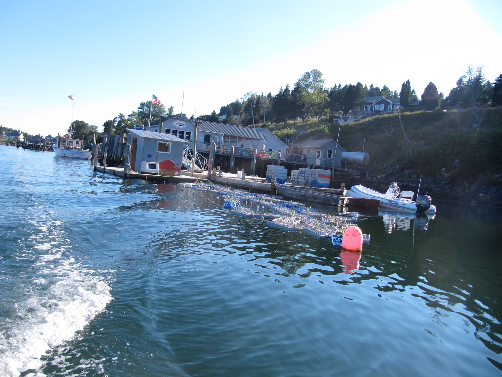
 Taking a free mooring, we had lunch at the Lunt and Lunt deli
 and quite a lunch it was: 1.5 pound steamed lobsters, corn on the cob, cole slaw and for me, blueberry pie that was still warm. Once again Lene said "Best lobster ever." She is becoming quite a fan of these crustaceans. We saw the lads loading them from their boat into the "pound" (90 pounds of them to a box)
 and the cook walked down there and got a pair for us. That's fresh! $14.95.
Here is the "pound" where the boxes wait.
 Lunts are big on Long Island; they operate the store and populate the cemetery. I had read the other day in a free Maine History magazine about a Lunt from Maine who enlisted in the Union Army and was shot as a traitor in 1862 for working for the confederacy. No relation to the Frenchboro Lunts, we were told.
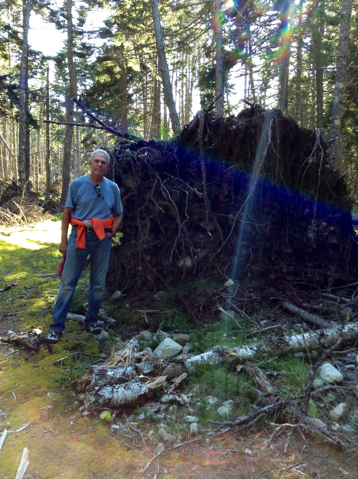
After lunch, and a few hours in the museum for the blog, we a hike along moss covered trail

 before a home cooked dinner.
Lene liked the look of the underside of this dead tree:

We could not do the entire trail, which would have involved the oceanside rocks leading past this private vacation home, the entrance of which we passed at the beginning of our hike because Lene's hip was acting up. She is a game girl!
 The hike was to the Northeast point as shown on this billboard. The harbor is the niche in from the north on the left side. Like St. Vincent's in the Caribbean, the road does not go all the way around the island. Next, ILENE on the mooring at Frenchboro with the mountains of Mt. Desert island in the background.
 This hike is the path less travelled as evidenced by the thick moss growing on the trail;no grass, much less moss grows on paths in urban parklands. Here is I

NOTE: Blog readership for July, subtracting out that inexplicable two day 4300 page-view blip, was 2234 page views, greatly exceeding the prior high of about 1500, despite competition from Lene's daily emails! THANKS, readers.


Here is the "pound" where the boxes wait.
After lunch, and a few hours in the museum for the blog, we a hike along moss covered trail


Lene liked the look of the underside of this dead tree:
We could not do the entire trail, which would have involved the oceanside rocks leading past this private vacation home, the entrance of which we passed at the beginning of our hike because Lene's hip was acting up. She is a game girl!


NOTE: Blog readership for July, subtracting out that inexplicable two day 4300 page-view blip, was 2234 page views, greatly exceeding the prior high of about 1500, despite competition from Lene's daily emails! THANKS, readers.
No comments:
Post a Comment